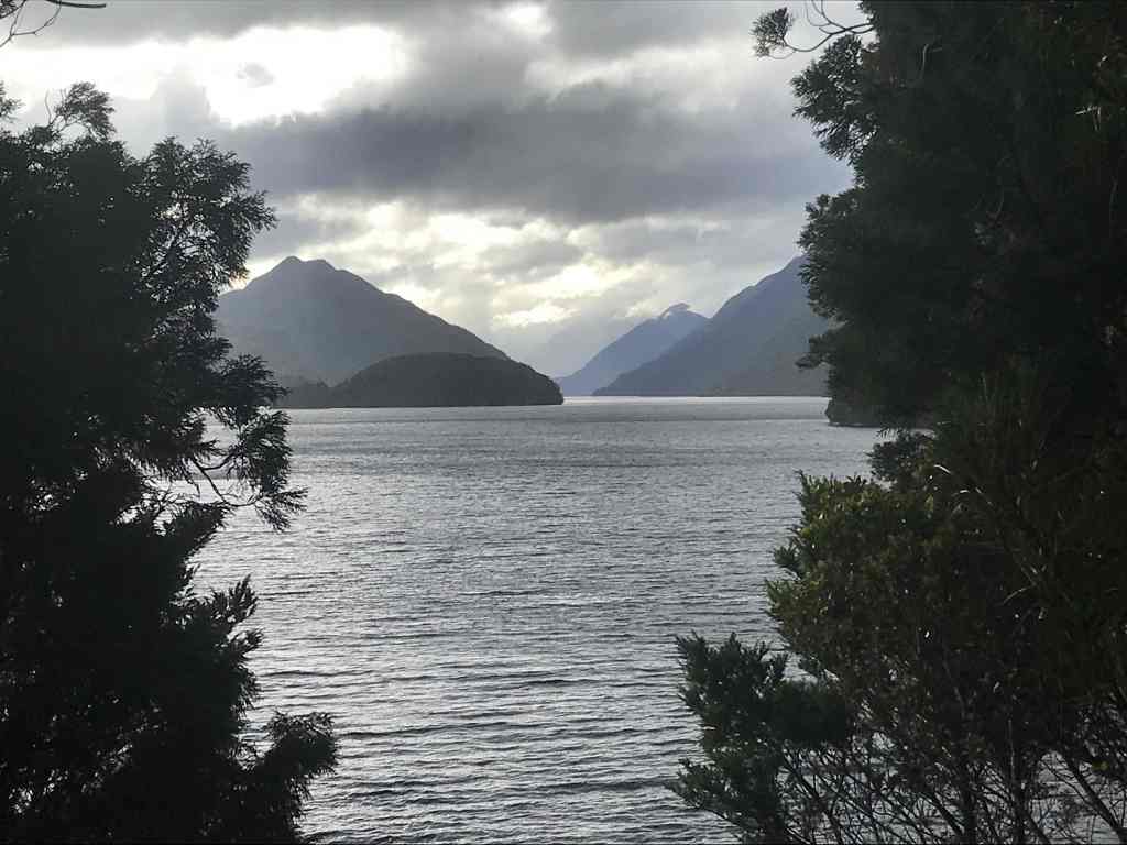
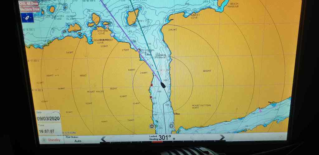
Beach Harbour, Breaksea Sound, Fiordland
Monday 9 March 2020
CAPTAIN COOK, Second Voyage, March 1773
Cook’s Journal, Dusky Sound: “The almost continual rains may be reckoned another evil attending this bay, though, perhaps, this may only happen at this season of the year; nevertheless, the situation of the country, the vast height, and nearness of the mountains, seem to subject it to much rain at all times.”
“The most mischievous animals here are the small, black sand-flies, which are numerous, and so troublesome, that they exceed everything of the kind I have ever met with; wherever they bite they cause a swelling, and such an intolerable itching, that it is not possible to refrain from scratching, which at last brings on ulcers like the small-pox.”
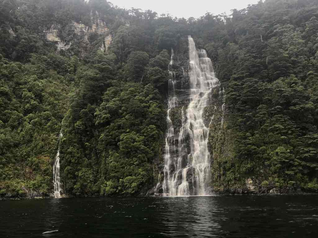
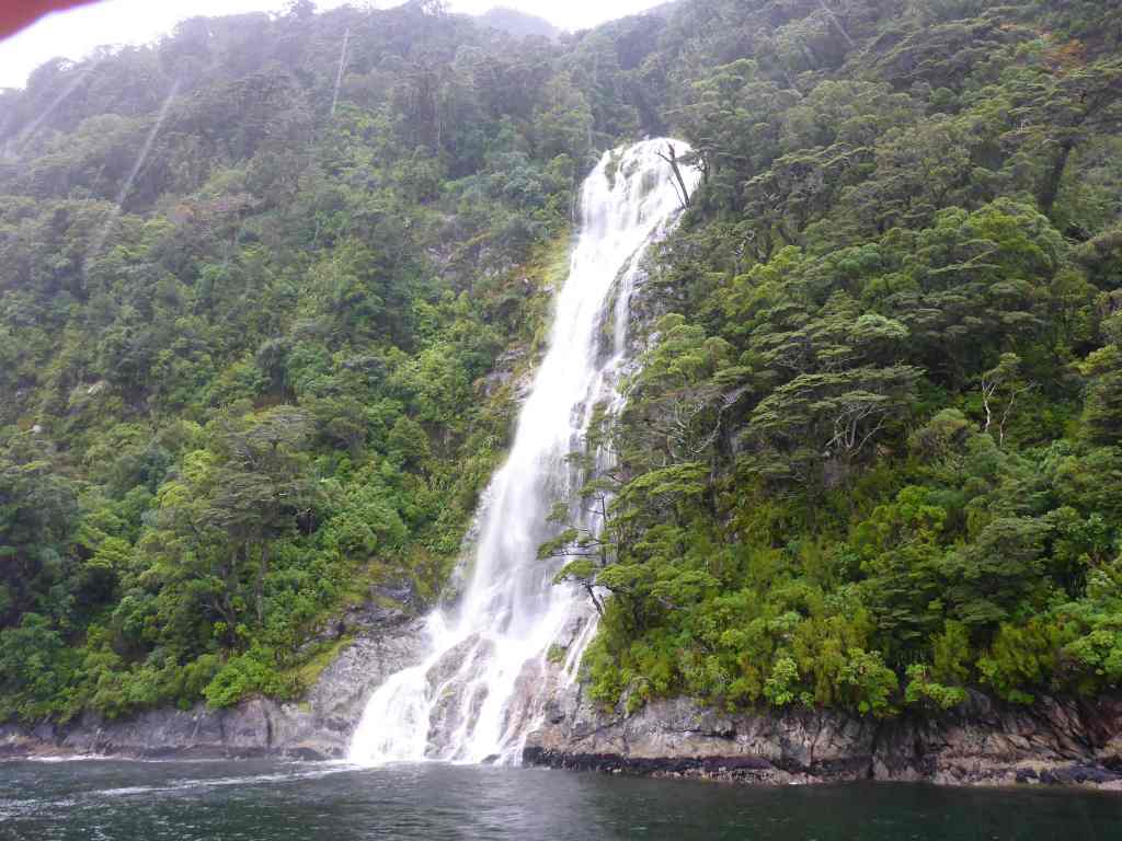
Our friends in Blenheim (NZ), Simon and Jenny Hardgrave, when they learnt we were going to Fiordland, insisted … “You’ve got to have rain. Rain makes waterfalls, and they fall off the cliffs and mountains and make it a truly spectacular experience”
Well, I can safely report, they were right.
My “wish list” in the weather department, of course, usually extends to a “fair breeze and smooth seas”. And the devastating impact of too much rain over the past month, will see many communities in these parts, (including Milford Sound to our north), making repairs for months, maybe a year or more.
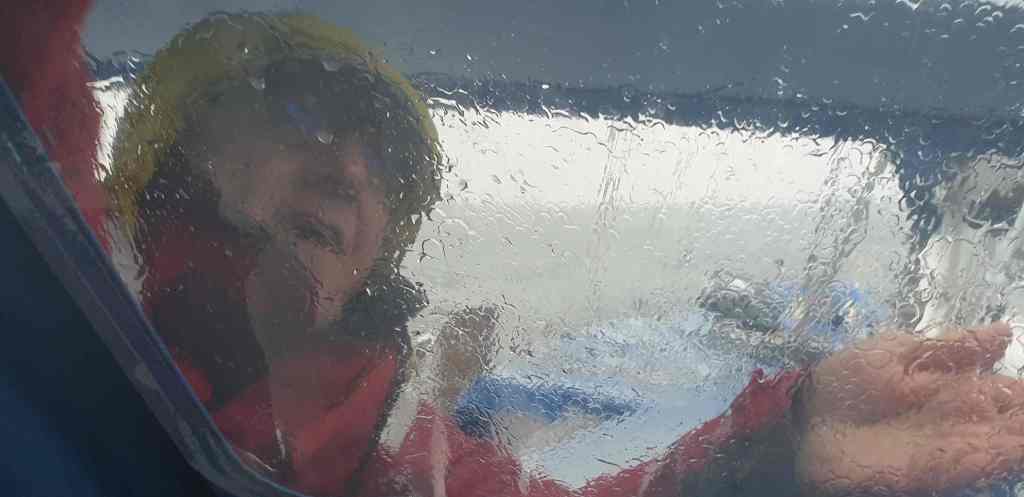
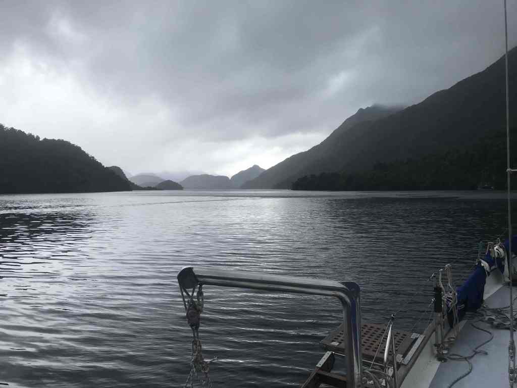
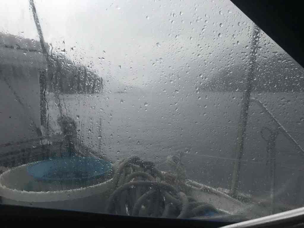
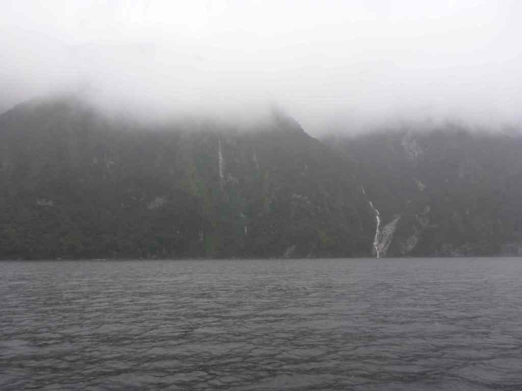
But, as in Cook’s time, this place is a rain magnet and so we shouldn’t have been surprised that after a few days of warm sunshine and blue skies, the clouds rolled in and decided to stay; dropping a continual blanket of rain for at least the past 24 hours.
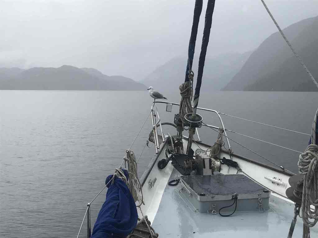
The result has been swollen streams, bursting high-altitude lakes and falling water. All over the place … down steep valleys, over rock ledges, close to shore and high up near the peaks … pouring into the fiords as we drive along.
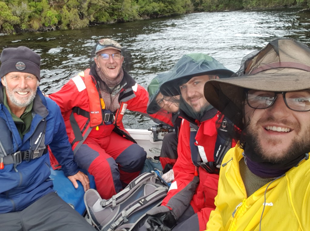
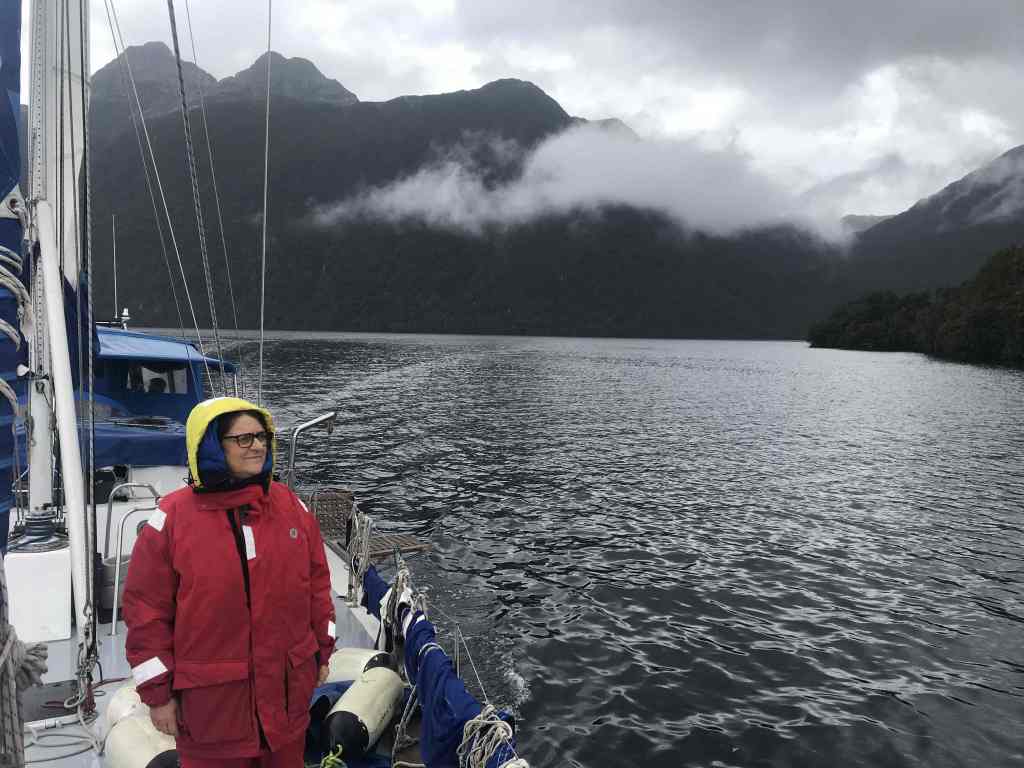
I’d like to say we “sailed”, but it seems no matter which direction the inlets and water-ways are orientated, the wind is just funnelled down, and either remains on the bow, is extremely fluky, or races down valleys and gaps on our sides to create “bullets” that can quickly tilt you over … spilling your carefully balanced coffee cup; at the very least.
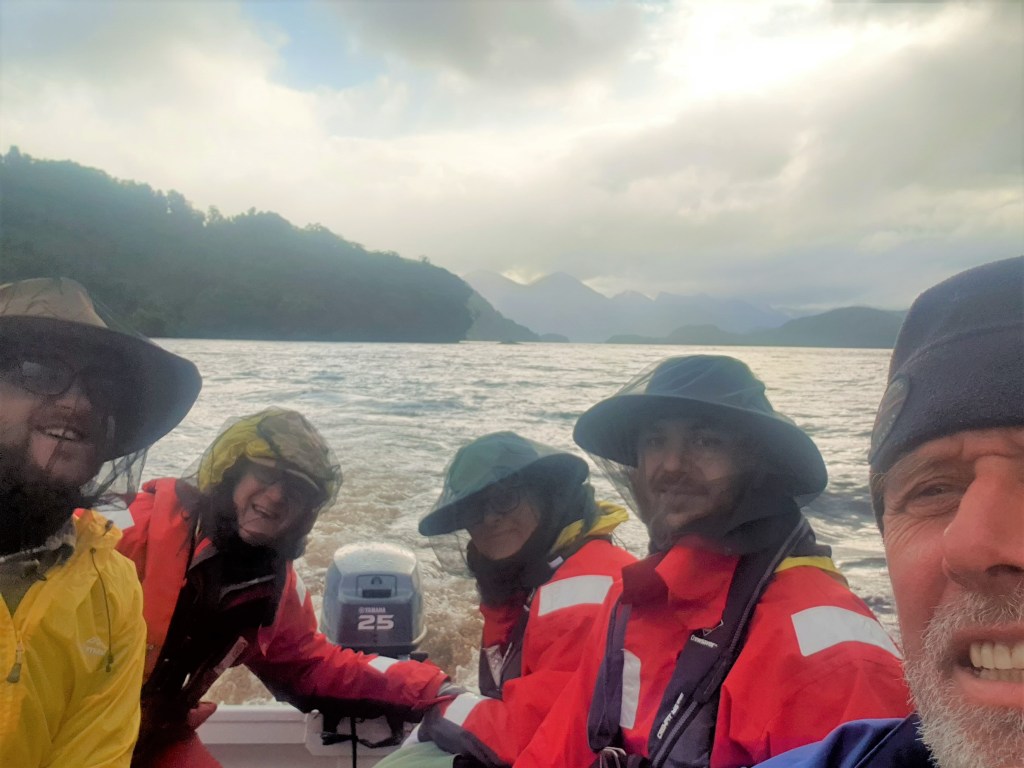
For example, while making our way up Cook Passage around midday, we experienced a full-on 25-30 knot, howling gale, with raised spray and whitecaps, all accompanied by driving rain and minimal visibility. Then, less than 30 minutes later the sun came out, it was dead calm and we even saw a small patch of blue sky; then before long the low cloud returned and it started raining again.
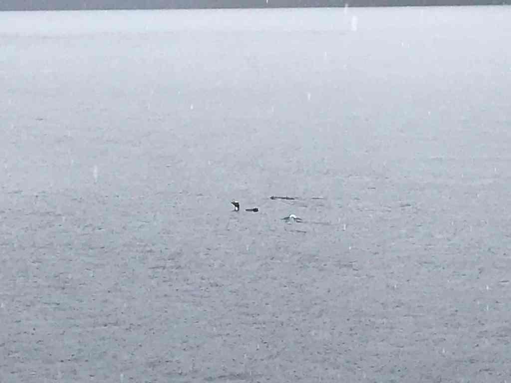
It was in this unusual calm patch that we saw what looked like three sticks in the water ahead. “They’re penguins!” someone called out. And sure enough, they were penguins, but not the Little Blue critters we’ve all seen at some time or other. These were bigger penguins, which didn’t just dive and disappear … only to pop their heads up a few hundred metres away. These had yellow stripes on their heads and swam like the ones you see in Antarctica, diving in and out of the water as they raced along; more like a seal.
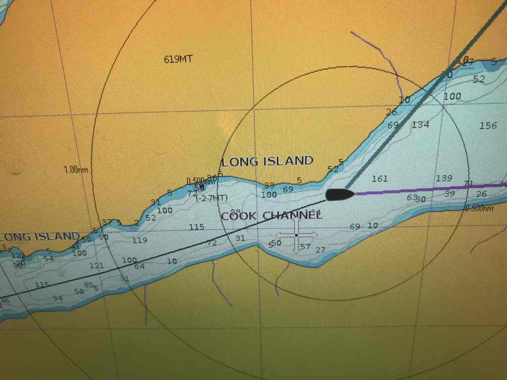
We initially thought they were the Yellow-Eyed Penguin, but later research led us to think they were the very rare, Fiordland Crested Penguin. We can only hope that along with being rare, they are also very resilient little critters, because they might have thought we were a big orca, or a whale, as we pursued them in hope of a better photograph. So, if you study our Yacht Tracker, trail, in Cook Passage from yesterday, that explains why it probably shows us travelling in a big circle … it wasn’t our fault … it was the penguins for not floating still, in the one place.
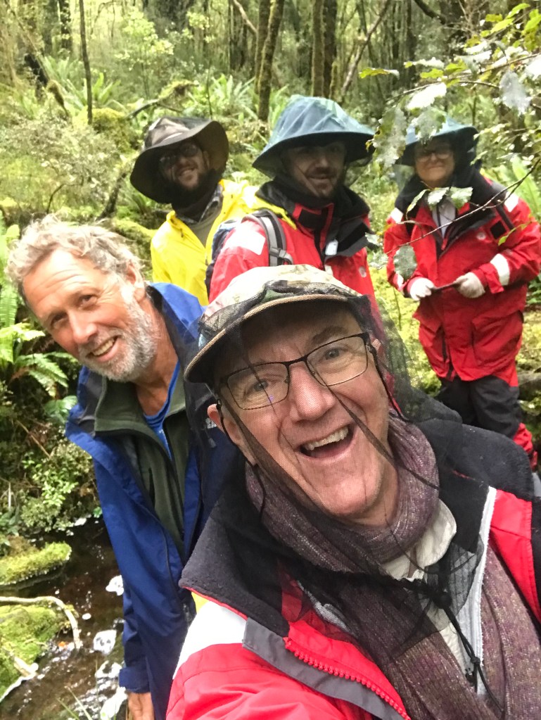
Whilst we did manage to select a sheltered corner of Pickersgill Harbour in which to anchor last night, the combination of strong gusty winds, tidal movements, and having a stern-line tied to a tree onshore, (to reduce our swing) left us a little more alert than normal throughout the night.
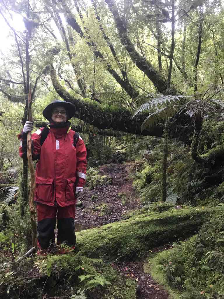
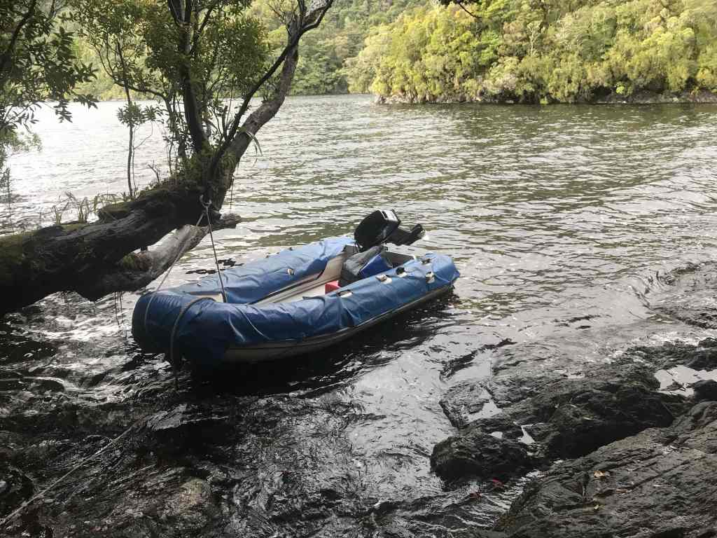
Come morning, though, we were ready to do some exploring ashore and so around 9:30am, during a brief break in the rain, we took the dinghy in past Astronomer Point to soak up more of the Pickersgill Harbour “vibe”. There was a brass plaque on the rocks just above high-water mark, plus a boardwalk, that encircles the very small promontory. It was a short climb to the metal “Trig Point” at the top of the hill, and it didn’t take much to imagine the industry and hive of activity that would have consumed this small piece of land, all those years ago.
As Captain Cook wrote in 1773, “Thus situated, we began to clear places in the woods in order to set up the astronomer’s observatory, the forge to repair our iron work, tents for the sail-makers, and coopers to repair the sails and casks in; to land our empty casks, to fill water, and to cut down wood for fuel; all of which were absolutely necessary occupations”.

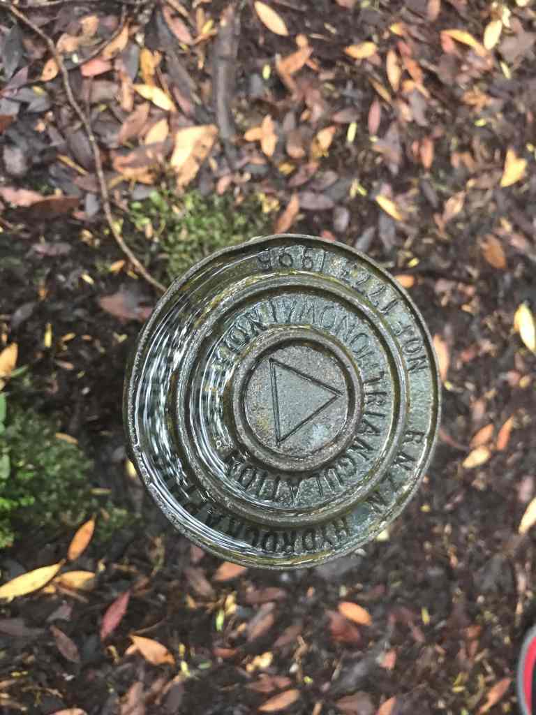
On this voyage Cook was testing the accuracy of Larcum Kendall’s copy of John Harrison’s chronometer H4. As a consequence of the observations made by William Wales at this point New Zealand became the most accurately located place on the globe at that time.
In the autumn of 1773 Captain Cook sailed the Resolution into Tamatea/Dusky Sound and anchored in Pickersgill Harbour. After an arduous voyage through the Antarctic his crew needed rest and the ship required repairs.
About an acre of forest on Astronomer’s Point was cleared by Cook’s men. The stopover was used for re-provisioning and overhauling of the Resolution. A forge was set up for iron work, tents for sail makers and a workshop for the cooper. Cook set up a brewery using rimu and manuka leaves. It was hoped the resulting beer would aid in the prevention of scurvy amongst the crew.
While in Tamatea/Dusky Sound, a host of scientific data was collected including observations of the local flora and fauna. Cook produced the first, highly accurate chart of Tamatea/Dusky Sound.
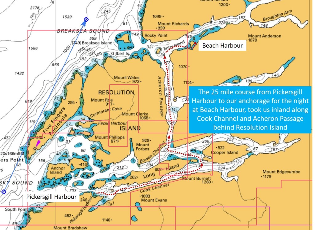
After a five week stay, with the Resolution repaired and the crew restored, they set sail on 29 April 1773 and left via the Acheron Passage and Breaksea Sound. https://www.doc.govt.nz/parks-and-recreation/places-to-go/fiordland/places/fiordland-national-park/heritage-sites/astronomers-point/

RESOLUTION FOR RICHARD HENRY
In May 1891, the government temporarily gazetted Resolution Island, in Dusky Sound, as the country’s first reserve for the preservation of native flora and fauna. Rugged and remote it certainly was, but there was some doubt as to whether it was far enough from the mainland to protect it from swimming predators. Was rival island Little Barrier a better choice? Only after persistent lobbying from Otago over the next two years did the government finally vote funds for a curator who would stock Resolution with birds and look after them. It was Richard Henry’s dream job.
And what must go down as New Zealand’s original and very first “micro-brewery” … Cook goes on to write … “We also began to brew beer from the branches or leaves of a tree, which much resembles the American black spruce. … mixed with inspissated juice of wort and molasses, it would make a very wholesome beer, and supply the want of vegetables, which this place did not afford; and the event proved that I was not mistaken.”
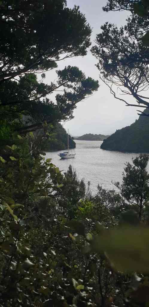
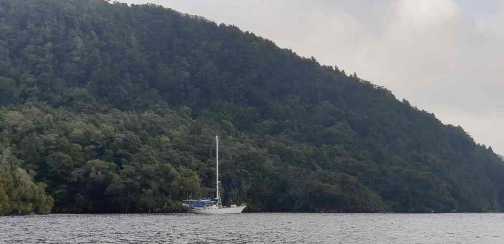
After five hours of travel through these high-sided waterways, stopping here and there to get close to the larger tumbling cascades – where the depth of water was often around 200 metres, little more than 50 metres from shore – we entered Beach Harbour in Breaksea Sound, with a view to dropping the anchor. A brief chat with the skipper of a large motor launch tied up to a mooring, however, revealed that there was a ban on anchoring in this particular bay because of a campaign to limit the spread of particular type of sea weed.
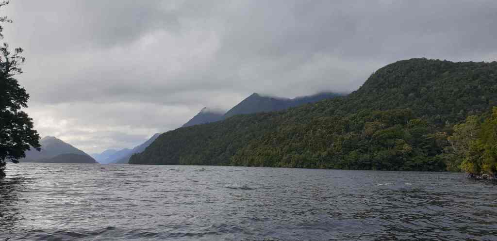
No shortage of water
“But you can pick up that large mooring in the distance if you like, and if the owner of that mooring comes – which he probably won’t – then you can move to that other mooring with the red float. Failing that, feel free to raft up to my boat”, explained the skipper
So off we toddled to attach our line to a permanent mooring – much easier than anchoring! What could possibly go wrong?!
Of course, an hour later the big charter boat (small ship), that “probably won’t turn up” … DID turn up, but rather than ask us to move on, they instead picked up the “other” mooring … so all ended happily.
All this happened while the skipper of the first motor launch, which turned out to also be a charter vessel, came over to say hello in his dinghy – while the rain kept pouring down. “Here, would you like a couple of rock lobster?” he asked, as he tied up alongside.
We thanked him profusely and as the rain poured down, he stood there in his dinghy wearing shorts, thongs (sorry, jandals) and a simple wet weather jacket explaining how he’d dropped a couple of shooters off in the forest and needed to pick them up soon, and how he doesn’t’ really like crayfish but his customers keep wanting to catch them, plus which bays we should consider dropping in at further north.
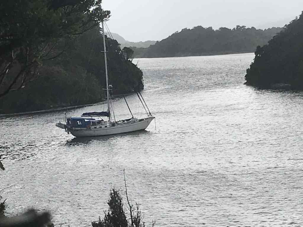
This was the third small charter boat we’d come across in the last few days, with customers/guests coming and going via helicopter, with every sort of individually planned experience built in … from shooting, diving and bush walking to fishing, sight seeing and photography … whatever takes your fancy, all within this amazing part of the world. Certainly, a different sort of “cruise ship” experience to the norm, and well worth considering if you want to get away from it all with maybe 8-10 of your friends.
As we set our sights on making Milford Sound by Thursday, for Linda, Matt and James’s departure on Saturday, it’s now important for us to cover some distance heading north. This means, maybe tomorrow night (Tuesday) anchored in Doubtful Sound and Wednesday night anchored in Bligh Sound, leaving Thursday and Friday in Milford Sound; certainly the most well-known, and steepest fiord of them all.
The weather forecast looks good for heading north, with the wind expected to come in from the south tomorrow; talk about good timing!?
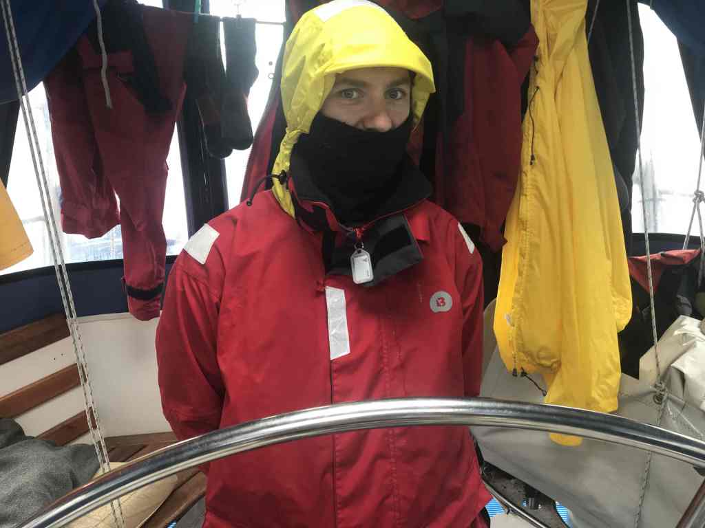
Right now, we’ve completed the task of lifting the big dinghy back onto the deck (for our journey back out to sea tomorrow) and the saloon is full of wet wet-weather gear hanging out to dry.
Smooth seas, fair breeze and rain equals waterfalls
Rob Latimer
PS I’m still looking for extra crew to assist with the 8-day voyage, from Milford Sound to Wellington, starting on 14 March. If you or a friend want to join us, please sing out ASAP. Email me on the satphone at … msm1@clientsatmail.com.au and latimerfamily4@gmail.com but remember, no file attachments)
