Jackson Bay, West Coast NZ
Monday 16 March 2020
Up at 4:00, away by 5:00…
In fact, we actually got away at 4:45am. a Personal Best to be sure. No anchor of course, so it was a simple act of letting go our mooring line; that had held us safe and secure these past four days here in Milford Sound’s Deepwater Basin.
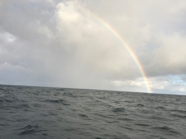
The rain and wind that had continued most of the night, was now past, and in its place was a bright half-moon, shining from a calm, half-clear sky. The only noise being the sound of the new waterfall that had started up off the cliff close by.
Leaving “port” in the dark, just like arriving, has it’s added obvious risks. There are usually more hard objects to potentially run into – than being 25 miles off-shore – and NOT being able to easily see them, presents a challenge.
With high tide at 5:00am – the very time of our departure – the senses were heightened even more, because to run aground now would mean little chance of further in-coming tide to help “float” us off.
Not that we were planning on hitting anything, or running aground, but the possibility was always there … in the back of your mind.
John assumed his now usual, position at the wheel, while I used the search light and adjusted and checked the chart plotter. The chart plotter not only shows where you are headed, but it also leaves a trail, in the form of a black line, of where you’ve been. This is particularly useful when retracing your path OUT of a place. The only problem we found here, was that because of the high cliffs and terrain, there seemed to be a significant “lag” in the GPS position-locator and the display on the screen. Not usually a problem when you’re out at sea, but when the channel is only 100 metres wide and it’s really important to stay the correct side of Red-and-Green-painted navigational markers, there’s no substitute for a pair of eyes, a good torch and a loud voice.
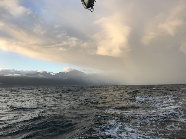
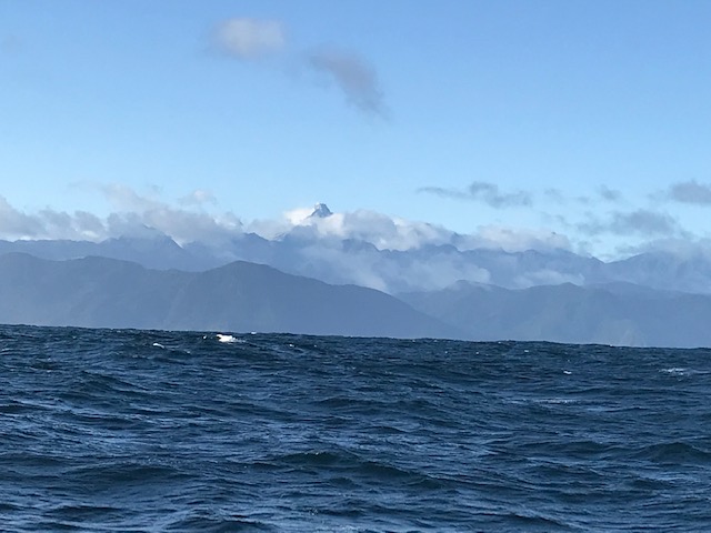
So it was with a sense of relief that we found our way into clear water and out into Milford Sound, where the moon reflected off the many new waterfalls cascading from the cliffs either side of us, as we made our way out to sea.
The beginnings of daylight emerged as we made our way out into the Tasman Sea and began to feel again the south west swell coming in off our port side.
Whilst we are keen to reach Mana (Porirua Harbour, near Wellington) around 430 miles away, as soon as possible, we couldn’t resist the opportunity of dropping into sheltered Jackson Bay for the night – just 60 miles up the coast. To rest and prepare fully, for the next 2-3 days and nights of constant travel. With just the two of us aboard, the trick will be to maintain our alertness and energy levels. Fortunately, the weather forecast still looks good for the next few days
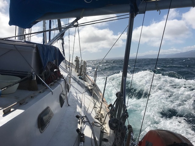
Finally, the much promised and anticipated SW wind came in at around 15-20 knots, which strengthened to 25knots later in the day, allowing us to turn off the motor completely, while still making around 7 knots.
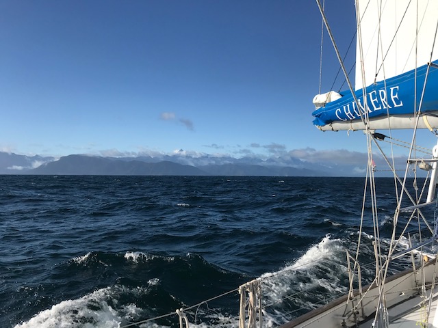
Our travels were now leading us north, away from Fiordland and along a stretch of coast known as the “West Coast”. Named, to be sure, in far less imaginative time, when things and objects were named and described in practical, no-nonsense ways. “South Island” … “North Island” … “West Coast” … names you could set your watch by. Then, every now and then you get names that mix it up a bit. That speak to a deeper message, conveying something of the emotion and experience of the time … such as … “Anxiety Point” … “Preservation Inlet” and “Doubtful Sound”. In a sense, conveying the notion that despite the years, nothing has really changed.
In place of the amazing Fiordland off to our right, we are now being spoilt by views of the Southern Alps, which make what we’d been seeing to date look like mere hills. It started with a glimpse of towering Mt Aspiring, which at 3,029 metres is New Zealand’s answer to the Switzerland’s Matterhorn. Then, way in the distance we were tempted by glimpses of more snow-capped peaks, all shimmering in the morning sun. But they would have to wait.
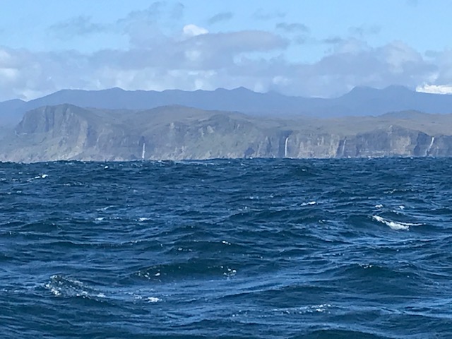
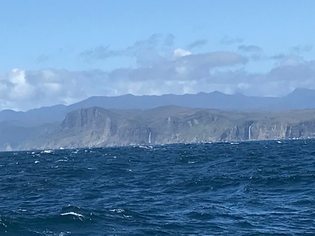
After around 10 hours sailing we were beginning to close in on Jackson Bay, but first it was necessary to round Cascade Point. Our eyes now confirmed what the chart showed – a simple line of cliffs and headlands, with land rising behind into forest-covered mountains (in Australia) … hills, here in New Zealand.
But with a name like “Cascade Point”, what else do you think you might find, apart from cliffs and mountains … that’s right, waterfalls. Not one, but FOUR. All pouring over the top of the cliffs, maybe 50-100 metres high, fed from separate streams. Presumably, as the chart shows, the Hacket, Hope, Gorge and Cascade rivers, which in turn flowed down from the McKenzie Range and the Hope Blue River Range further inland; just stunning!
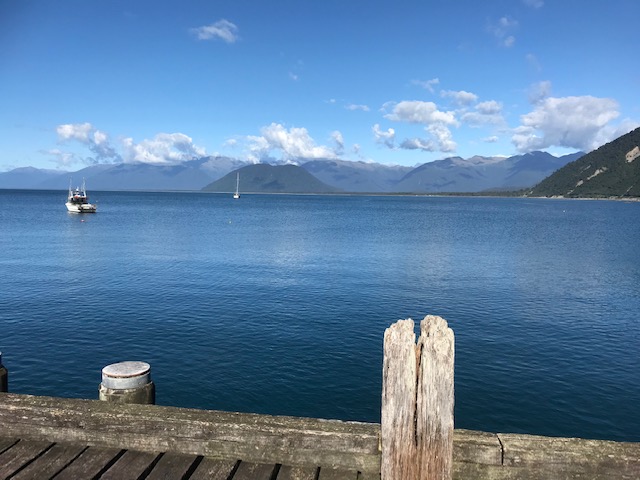
At 4:0pm we made our way into the sublime, still, lonely waters of Jackson Bay, pulled down the sails and dropped our anchor. In what Captain Jack Aubrey, (of Patrick O’Brian’s) Master and Commander fame, would have described as,
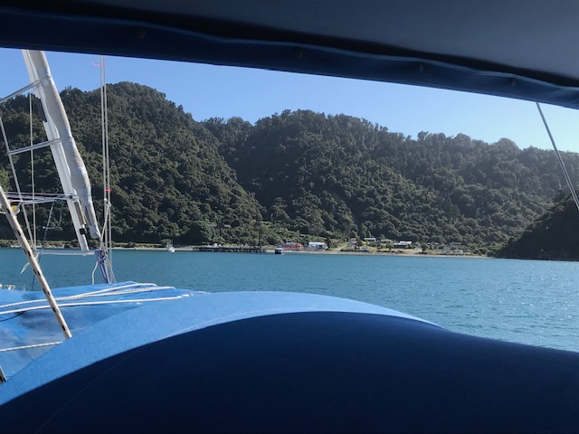
“… a damn good Christian anchorage, in 7 metres on sand. Splendid!!”
The warm sun had us quickly taking off layers … at least until we got ashore and encountered once more, the persistent, pesky and painful sand flies. These Jackson Bay guys seemed hungry, and were determined to get from us what they could, there not being a lot else on offer in these parts – apart from the occasional tourists in motor homes keen to reach, literally, the end of the road. But I don’t think they got out of their vehicles for long.
As the evening cast a yellow-orange glow over the surrounding mountains, we could just make out even more of the larger and whiter peaks further north, which we figure included the tallest of them all, Mt Cook, at around 12,000 feet (3,752m by my chart, although a rockslide in recent years reduced this by a few metres I believe)
Back on board Chimere, and largely away from the sandflies, that is, after we’d put up our netting and sprayed mercilessly at anything that moved, we got into making dinner. Sure,
we had fish in the freezer, plus one remaining cooked crayfish in the fridge, but to mix it up a bit I said to John … “fancy spag bol?”
“Yeah, cool as, bro” came the response.
So that’s how I made enough spaghetti bolognaise to feed ten grown-ups. Or, more to the point … enough to feed two blokes in five sittings – tonight, plus lunch tomorrow, dinner tomorrow, in addition to lunch and dinner the following day.
With the likelihood of us being at sea for a couple of days, it’s always handy to have something quick and simple to heat up, when the need arises. It seemed like a good idea. That’s why they call me … “the ideas man”
After our day on the water, and the early start from Milford, we went to bed a bit after 8:00pm, keen to get away around 5:30am in the morning.
Smooth seas, fair breeze and on our way – north
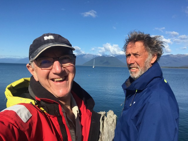
Rob Latimer

One thought on “On Our Way – North”