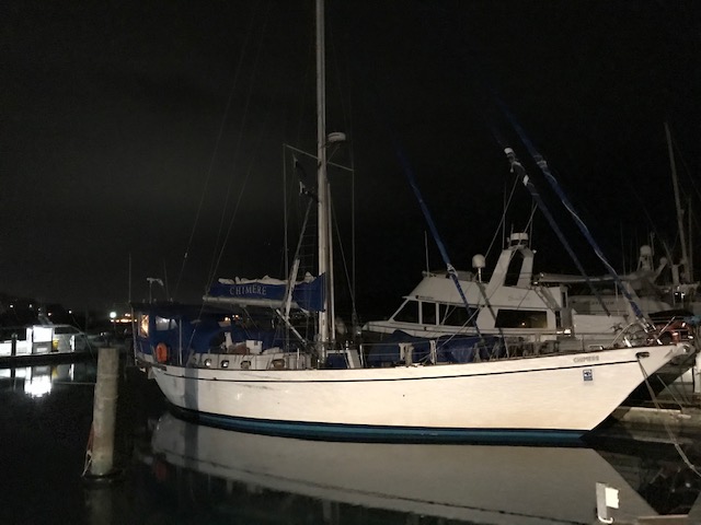
Mana Marina (near Wellington)
Friday 20 March 2020
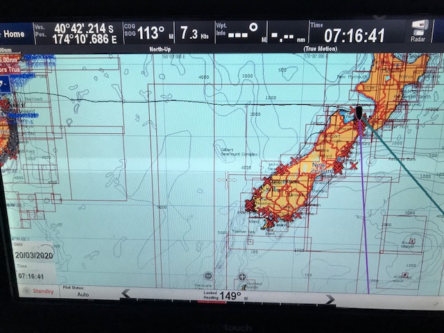
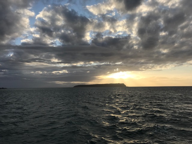
Farewell Spit curves around the tip of the South Island, like the beak of a kiwi … the bird that is. It’s long, thin and extends in an easterly direction away from Cape Farewell for maybe 20 miles or so. It was dark as we travelled along its full length, keeping about 4 miles offshore, in the deeper water, so as to avoid as best we could any confused sea.
In the end the seas flattened off somewhat as we came into the lee of the southwest swell. But this was short lived, as we then made our way across Tasman Bay; the lumpy, confused sea, a product of the continued 25-30 knot wind against the usual tidal flows.
John and I maintained a regular watch, alternating around the usual shared-tasks of adjusting sails, discussing course changes, or, as occurred a couple of times musing over how to interpret navigational lights in the distance and how best to respond.
On one of these occasions John emerged into the cockpit after hearing me talking to someone – not just a dream, or a question of madness – but an attempt to raise, what we assume was a fishing boat, who appeared to be aim straight for us about 3 miles away.
It was about two in the morning and after a few minutes, having already turned on our deck lights to illuminate our sails, and tried several times to raise a response with a “All ships, all ships in the Cape Farewell area … this is etc etc “ message, I received an unexpected response from a women at Maritime Radio, asking if all was ok and whether we required assistance.
“Yes, all good. Just trying to raise a vessel, who appears to be on a collision course” I explained.
“I can see your vessel on AIS” (Automatic Identification System), she returned, “But I don’t see another vessel, OVER” Then finally finishing off with … “Chimere, if you need further assistance, just call back. OUT”
In the end, it was reassuring to hear that our AIS signal was being received … by someone. And we suspected our AIS presence was also displayed on the other vessel’s chart plotter , However, as we’d come to learn, fishing boat skippers tend NOT to reveal their positions on AIS and are often too pre-occupied (catching fish) to bother with the radio … so whether he was anywhere near the chart plotter to see us can’t be guaranteed. In the end we turned on our radar and had little option but to adjusted our course around him
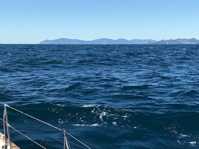
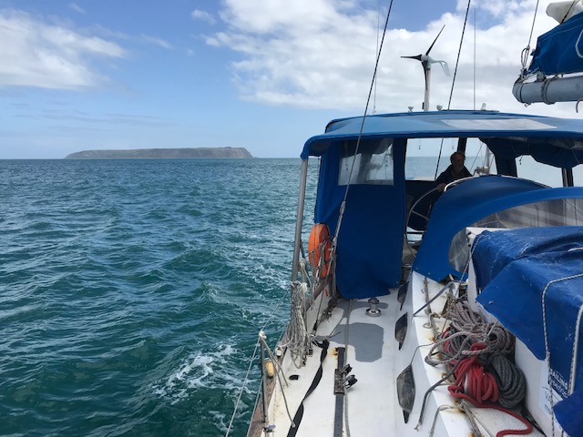
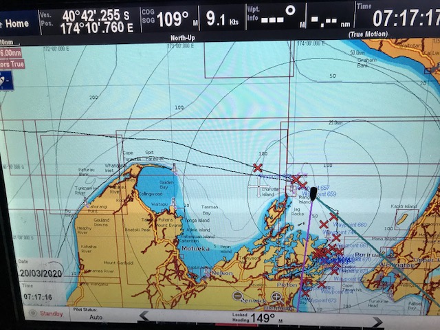
At dawn, we were still racing along, with the outer islands of Marlborough Sounds off to the right and Cook Strait before us.
The latest weather forecast predicted that south east winds would start coming on the nose around mid-morning, so we hugged the coast of the South Island before setting the 20-odd mile course across the strait to Mana Island and the entrance to Porirua Harbour.
Around this time, we crossed our in-bound track from Australia, way back on the 4 February, having now successfully circumnavigated the South Island. It was a good feeling, but it seemed we were returning to a very different world to the one we’d left, less than two months ago.
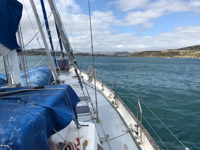
On arrival in the early afternoon, we dropped anchor in Onehunga Bay, just to the side of the Porirua Harbour channel entrance, to await sufficient tide to cross the bar. We’d been advised that 2 hours either side of High Tide would be fine, based on us having a draft of around 1.8 – 2.0 metres, and so at 7:00pm we retrieved our anchor and made way.
The approach to the Mana Marina was in two parts. First, we needed to following the initial lead beacons (which we could see onshore) on a bearing of 100 degrees, then take a hard right to follow a second set of leads on a heading of 171 degrees. It was then a case of entering the marina breakwater, before making our way to the allotted 18m berth close to the shore and to the right “F02”
All went to plan, despite the disconcerting small numbers displayed on the depth sounder … 3.1m … 2.8m … 1.9m … 1.8m … 1.6m … come on … deeper, deeper … still no feeling of scraping the sand … before the numbers started to climb again… 1.9m … 2.2m and so on.
Fortunately, our depth sounder transducer is located around half a metre below water level … which means that even when 1.6 metres is showing on the display panel in the cockpit, the depth of the water is actually around 2.1m. Still, we were very pleased to have made it safely into the harbour, found our berth and successfully tied up.
There to meet us, waving from the marina walk-way and eager to help grab the lines, were our new crew for the next stage north – Annette, husband Martyn and brother of Annette, Gary … plus Gary’s wife Theresa.
It was also a great thrill to catch up with my cousin, Keith Latimer, who just happened to live in the area, with his wife Christine. We don’t catch up all that often, but it’s always fun when we do. Over the years, Keith has done a lot of boating out of Mana Marina, where he also once owned a berth and boat, so his assistance has been invaluable in finding the right people (when necessary) and planning the voyage more generally.
For now, it was time to take breath and relax over a few night caps … then catch up some overdue sleep.
We’d travelled the 230-odd miles from Westport at an average speed of 7.5 knots, which was remarkable given the first few hours yesterday were rather slow, with little wind. Certainly, it left John and I liking the feeling of travelling at 8-9 knots, rather than 6 knots. It may not sound much … but on a percentage basis, 7.5 knots is 25% faster than 6 knots … which all adds up. Helping us, of course, to better plan around “adverse weather events” … which are the things that cause us to tack … which as I’ve said before, “… gentlemen don’t tack”
Planning for the voyage north to Opua, along with re-stocking Chimere’s pantry would have to wait … at least until tomorrow … at around 10am.
Smooth seas, fair breeze and Race to Mana
Rob Latimer

Well done completing the bottom of the figure of 8. Maybe we’ll return one day with you to do the northern loop… wouldn’t that be fun.
Ps.. impressed with all the fish caught and hey, where is a photo of curly??? Dean
LikeLike