Tuna Slayer Delivers

At Sea, West Coast NZ

Tuesday 17 March 2020

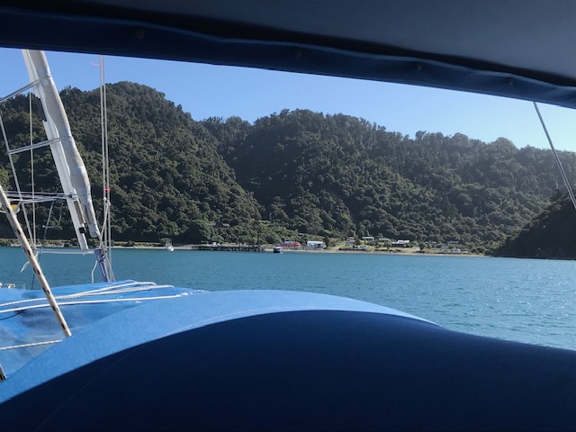
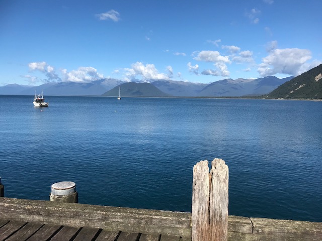
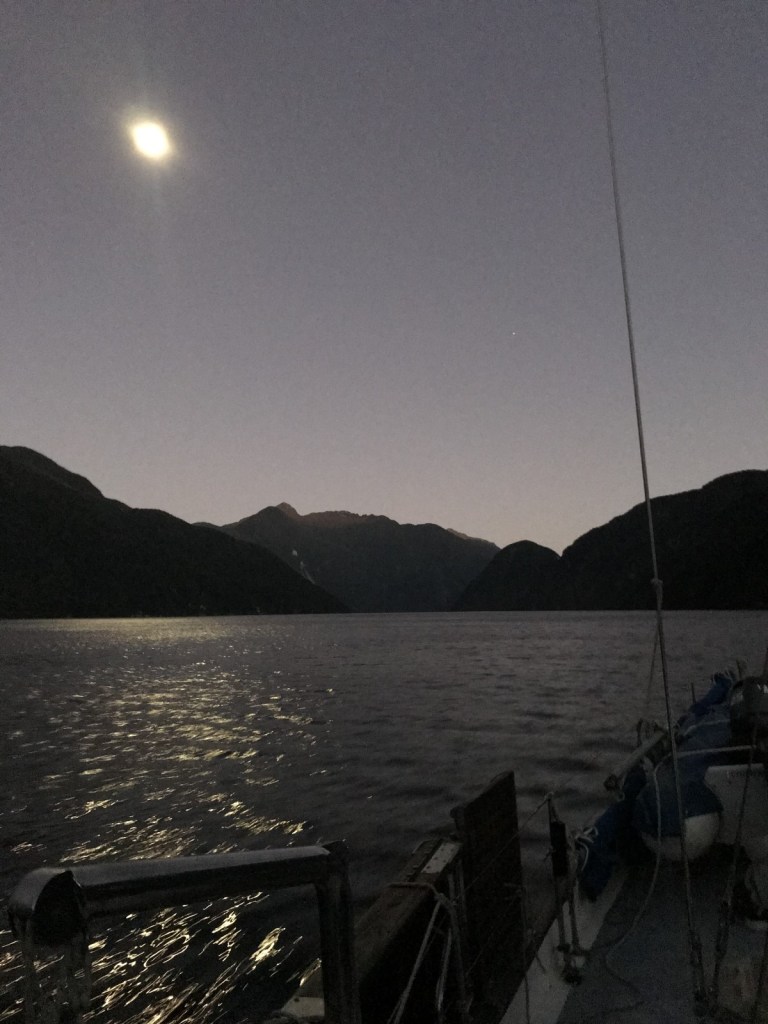
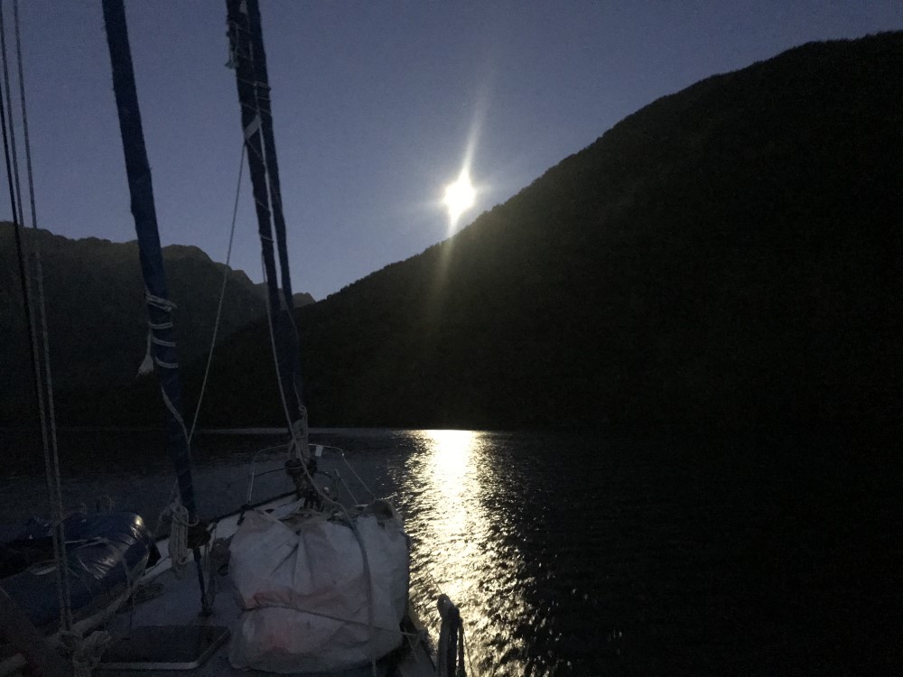
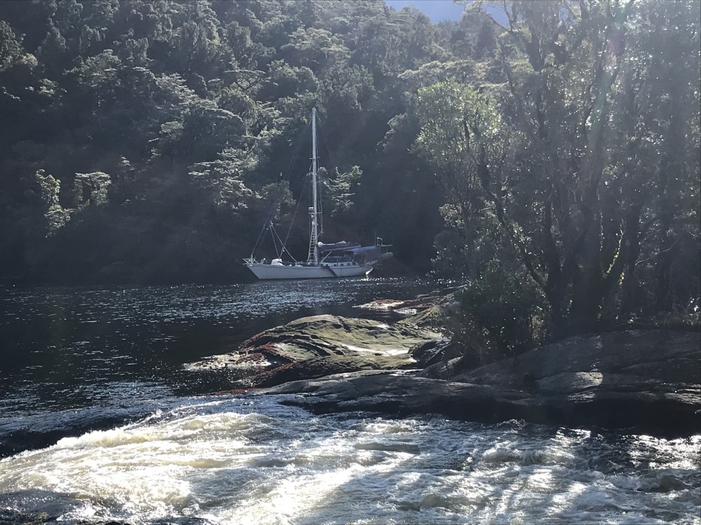
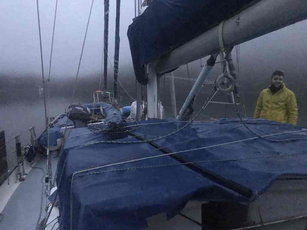
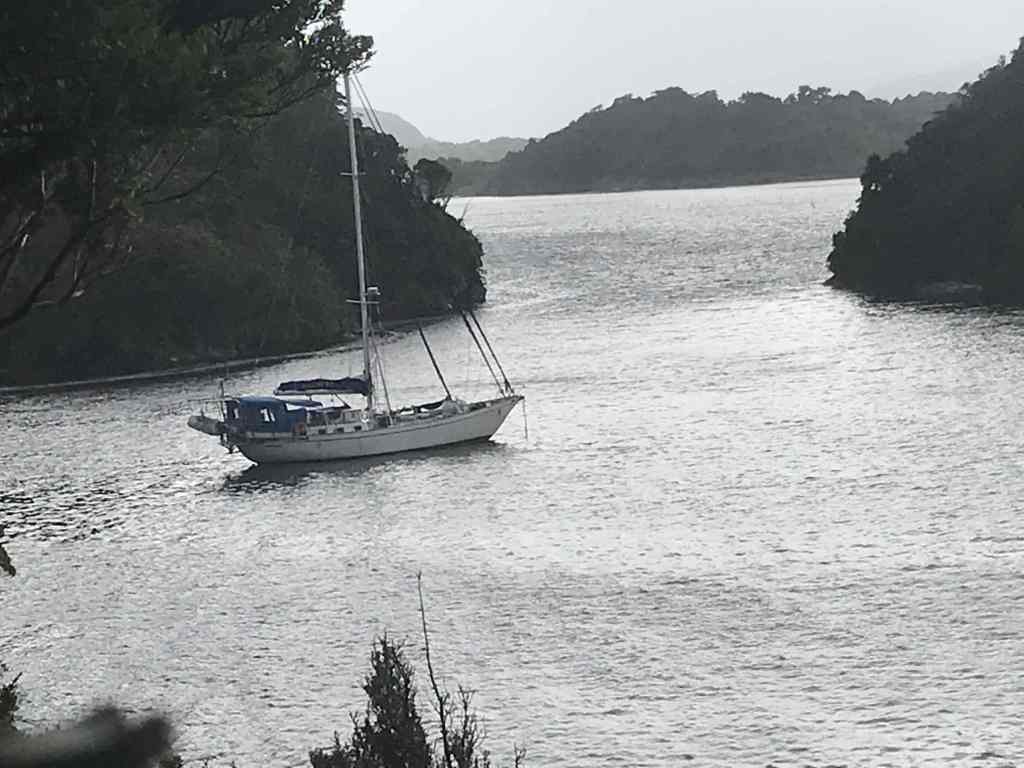
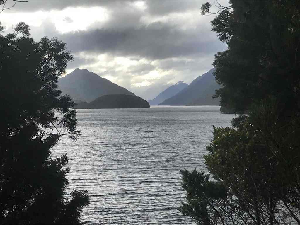
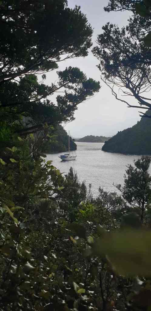
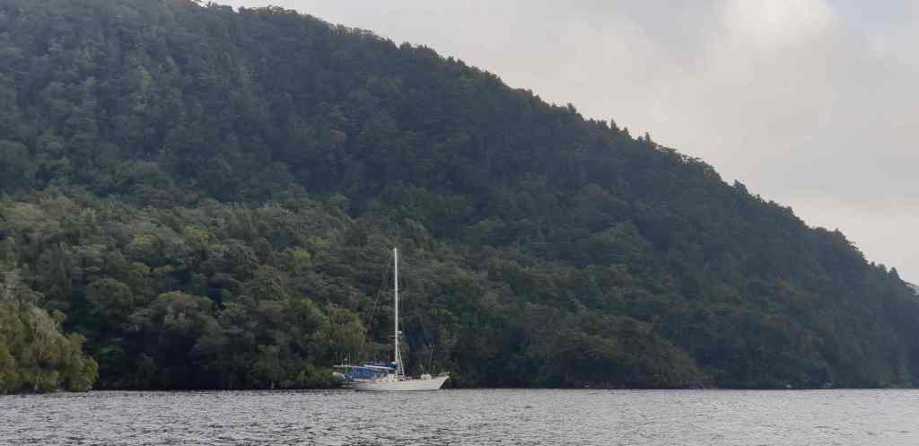
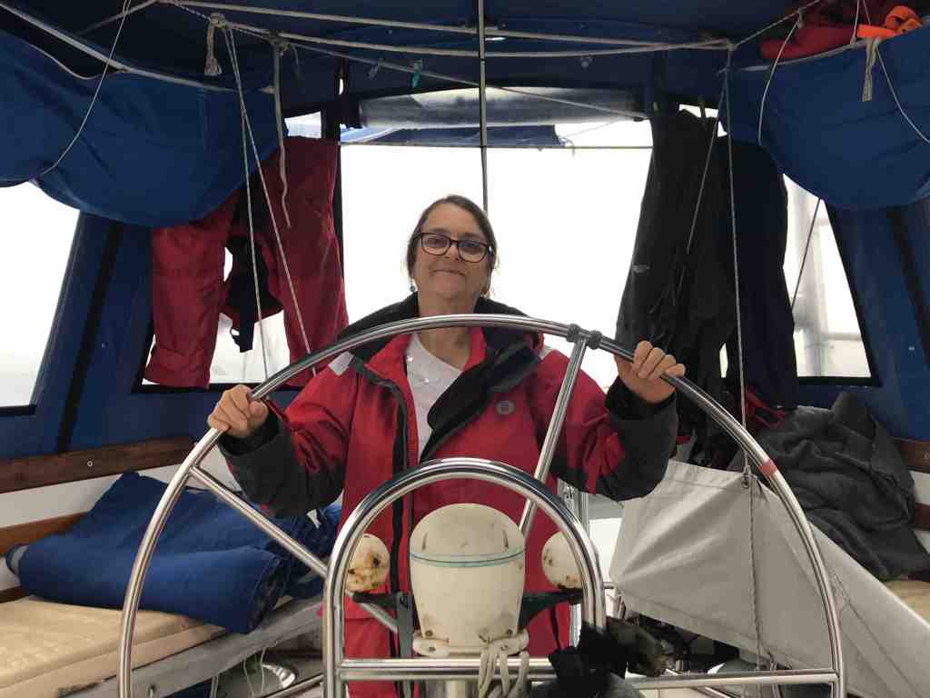
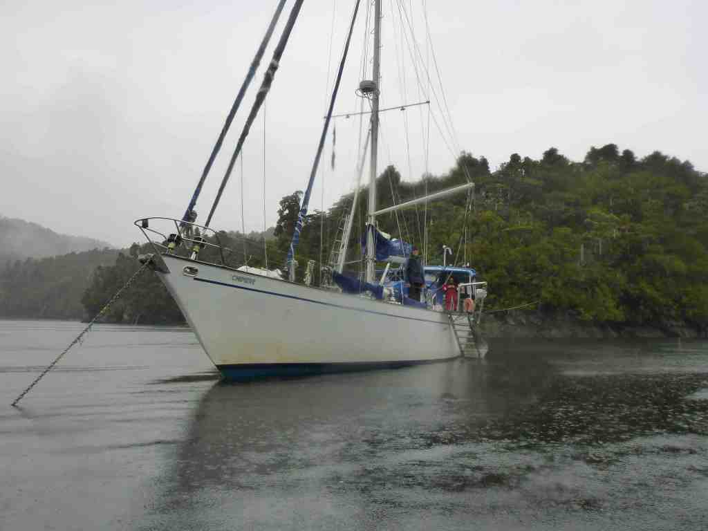
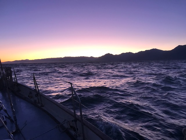
It would have been a perfect night’s sleep at anchor in Jackson Bay, if it hadn’t been for the anchor alarm sounding at around 12:00 midnight, as the change of tide drew Chimere to the chain’s outer limit, albeit in the opposite direction to when we arrived. 

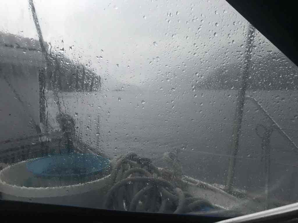
Despite being relatively close to the shore, a short chop had established as a result of a brisk easterly wind that had built up.  Still, all was safe.  The depth was good.  The anchor was holding.  And there were no better alternatives. The slight boat-movement and increased noise in the rigging, would soon be lost to sleep, as we retreated to our bunks; after first re-setting the alarm of course.

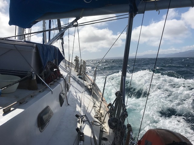
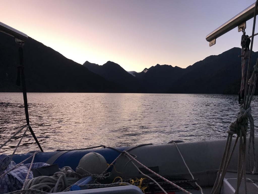
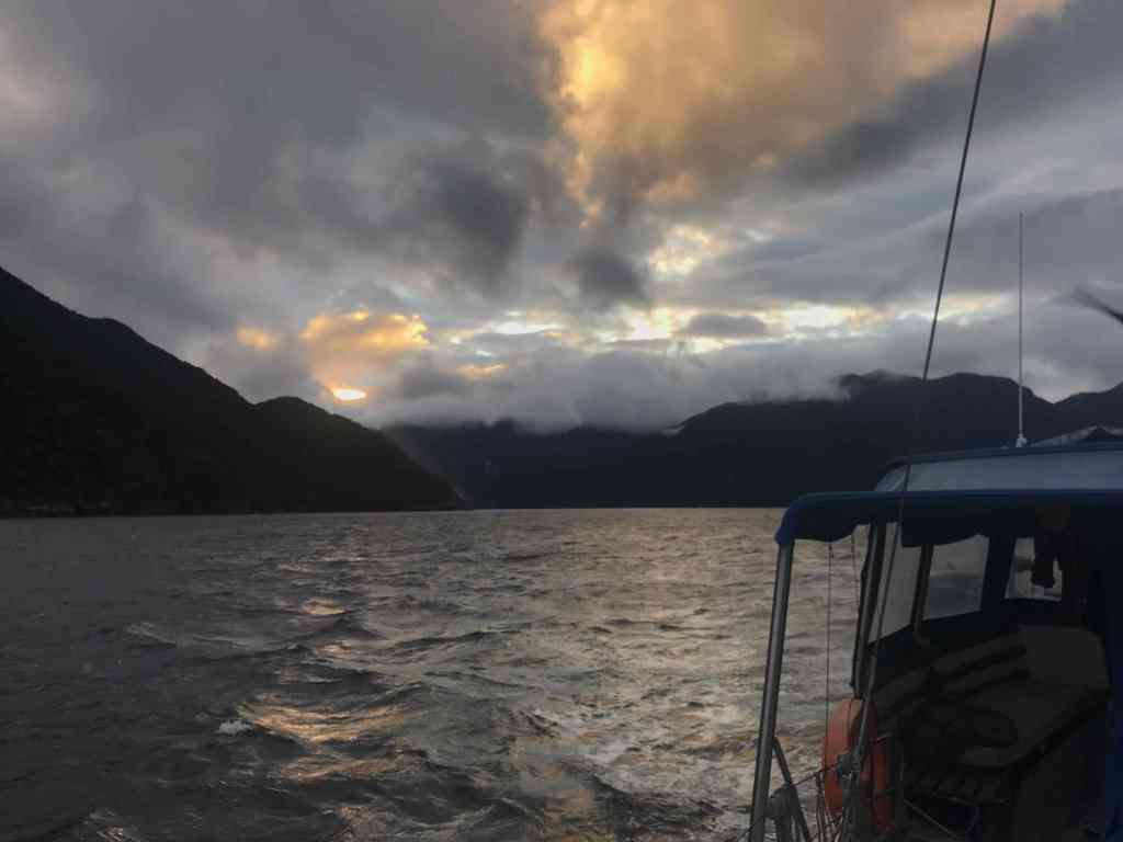
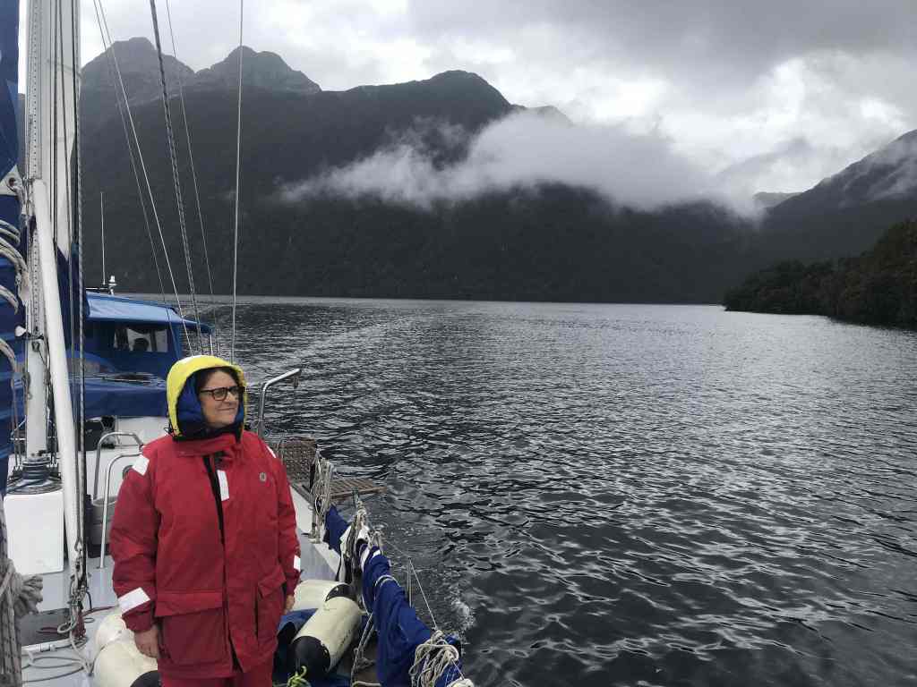
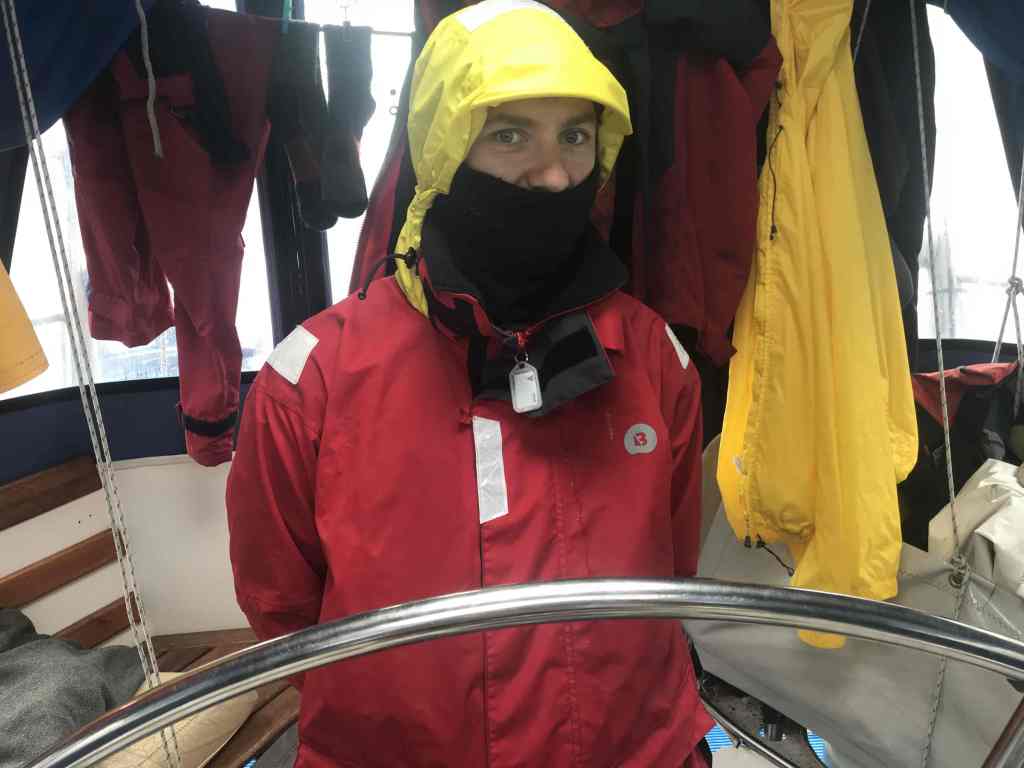
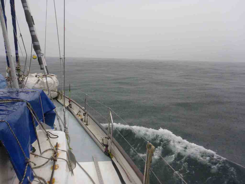
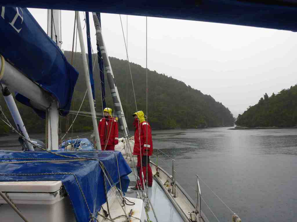
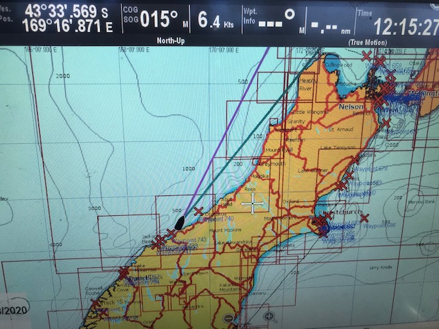
After departing Jackson Bay at 5:45, making sure not to snag any boat moorings in the dark, we made good progress up the coast, with the wind gusting up to 30 knots, blown down off the mountains (of ever-increasing size) on our starboard side.

Leaving Jackson Bay
After a couple of hours sailing the sun began to emerge in the east

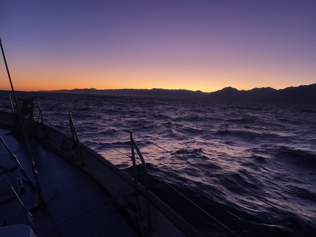
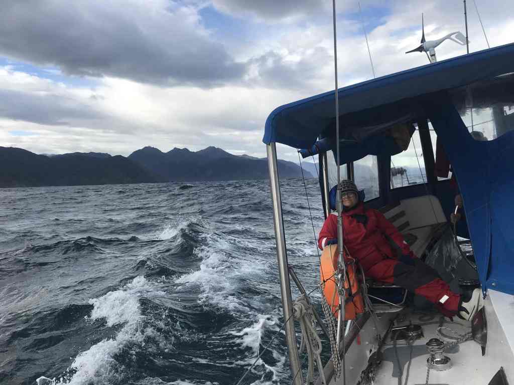
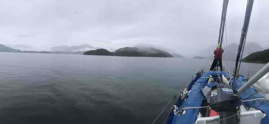
By 11:00am, however, the wind was but a breeze and in order to maintain a speed of at least 6 knots we had no choice but to keep the motor ticking away in the background at around 1600 RPM.

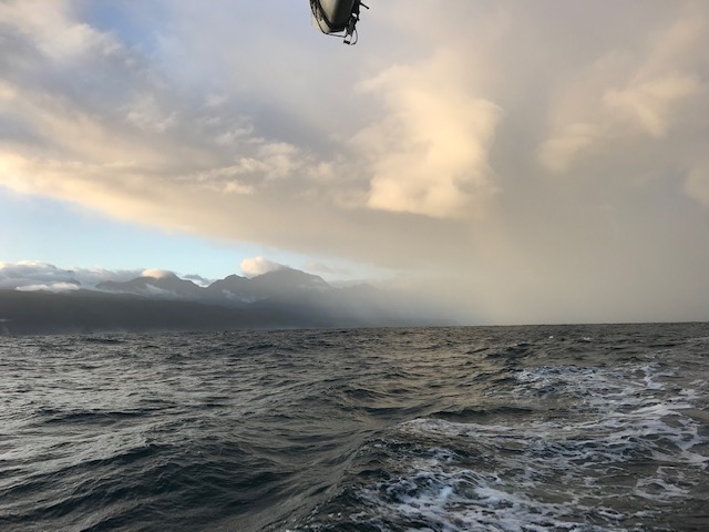
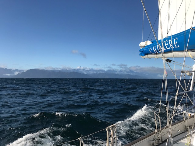
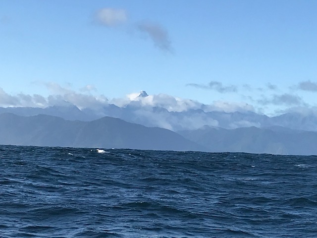
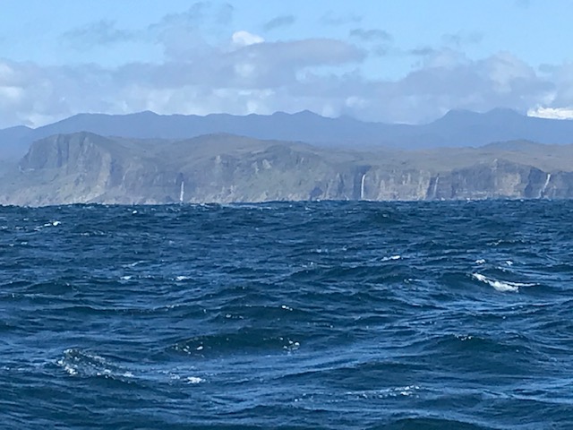
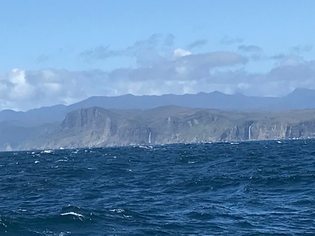
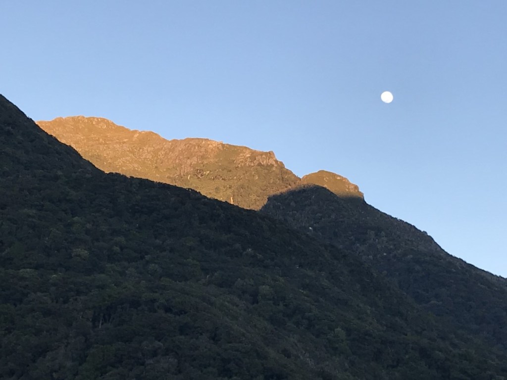
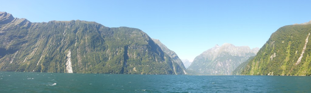
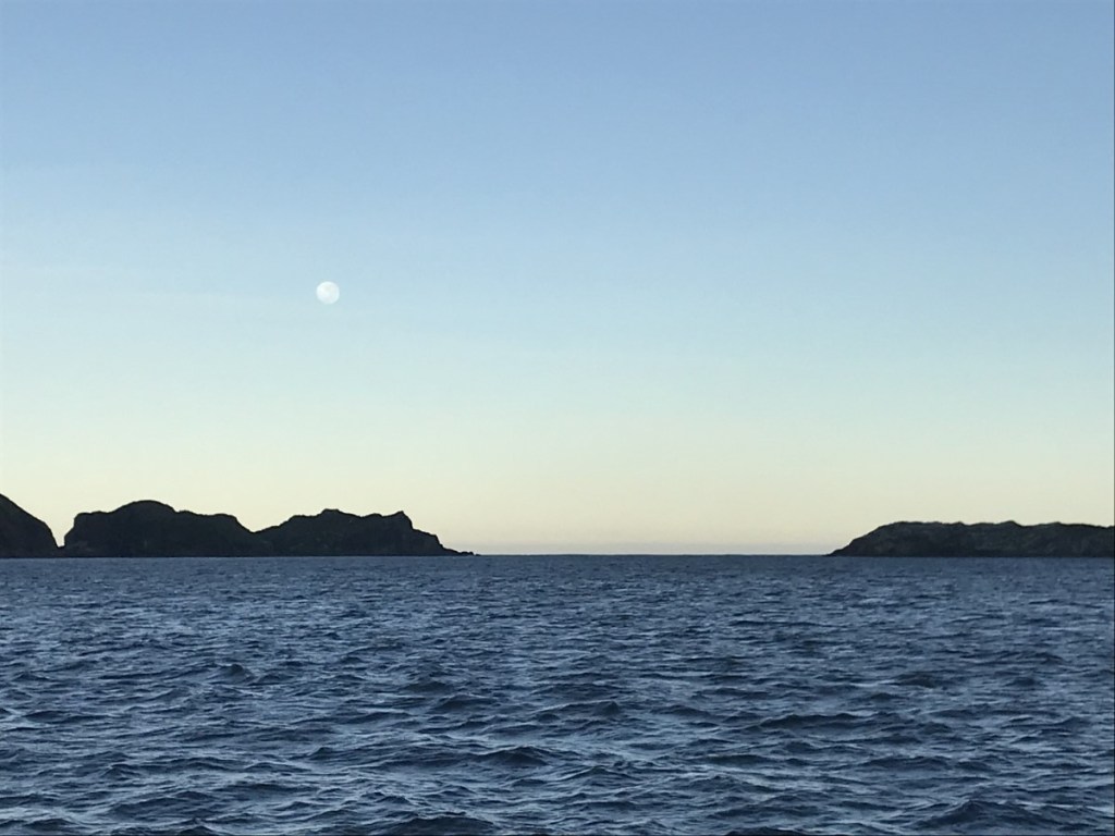
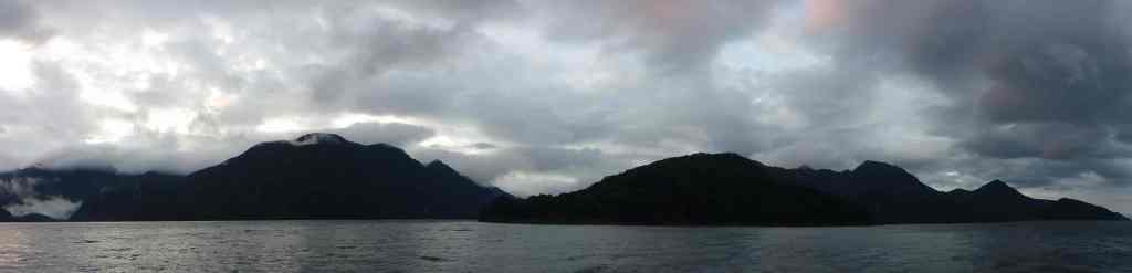
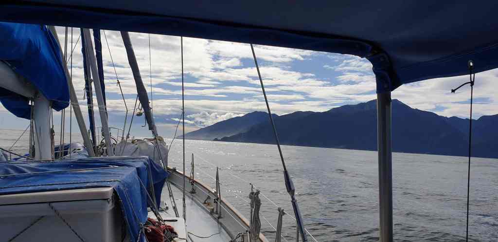
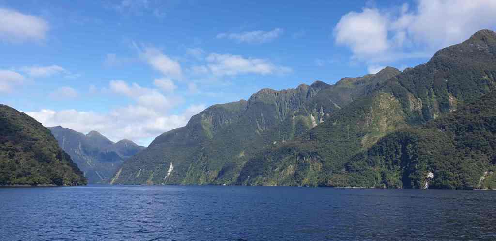
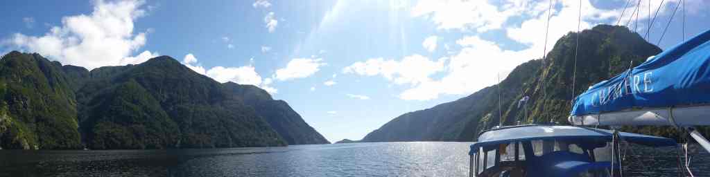
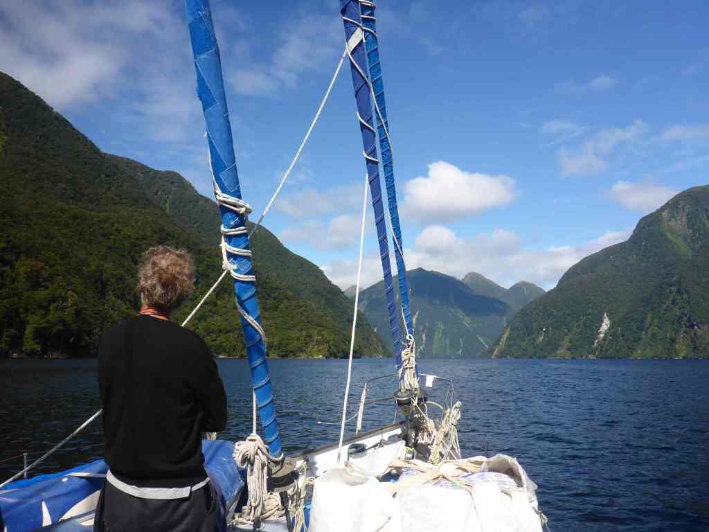
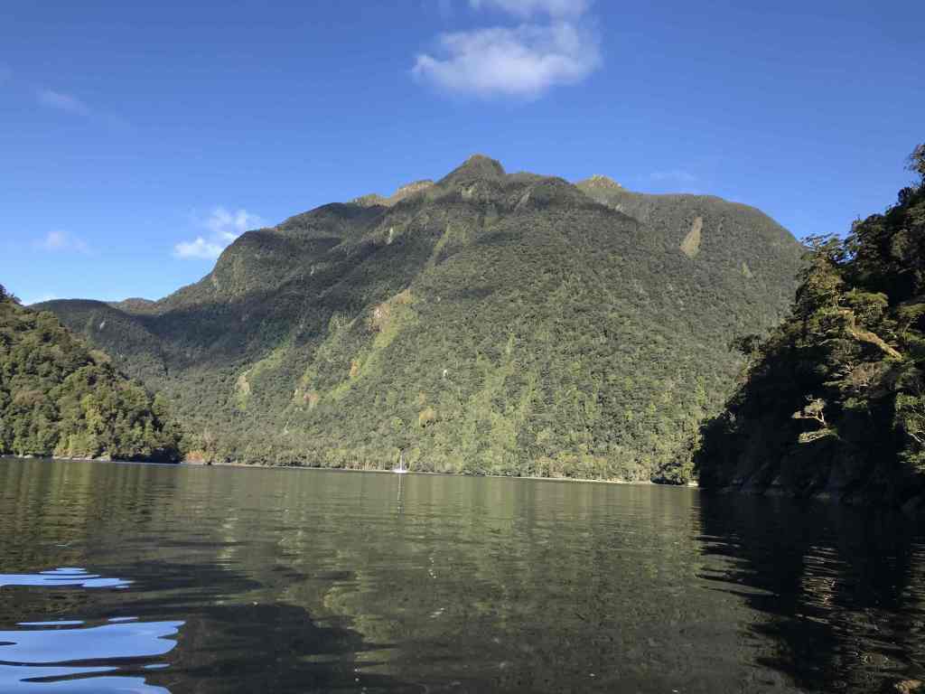
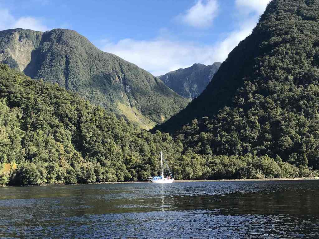
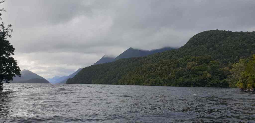
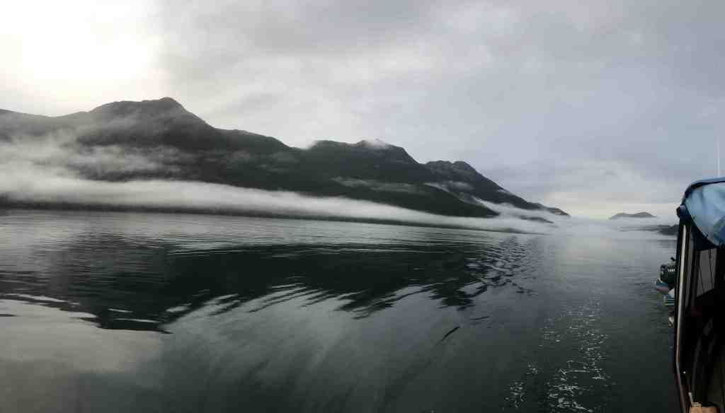
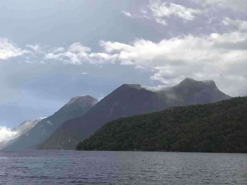
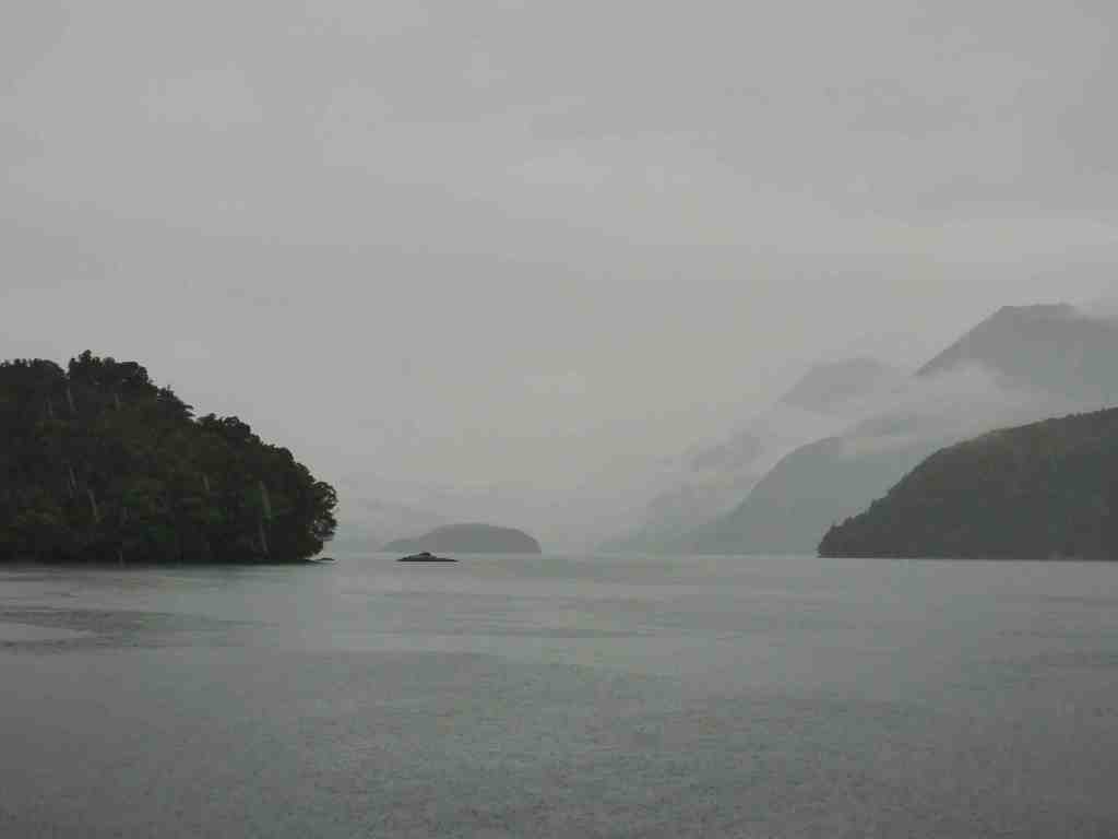
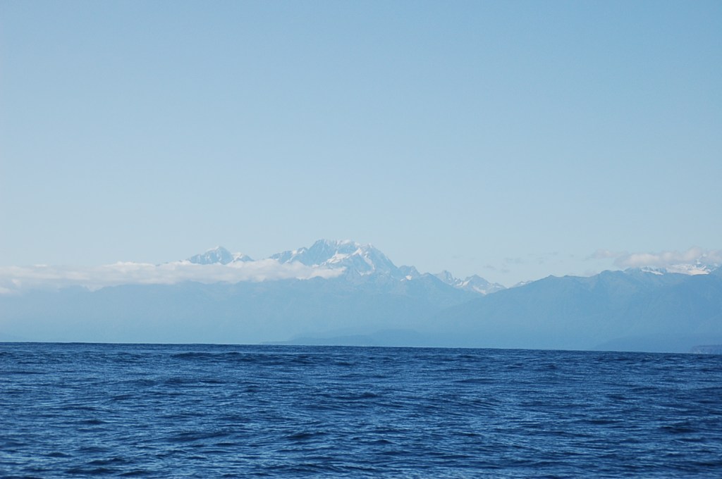
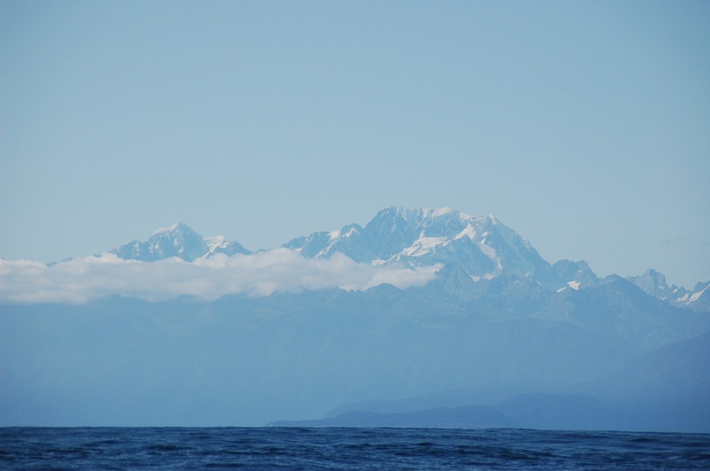
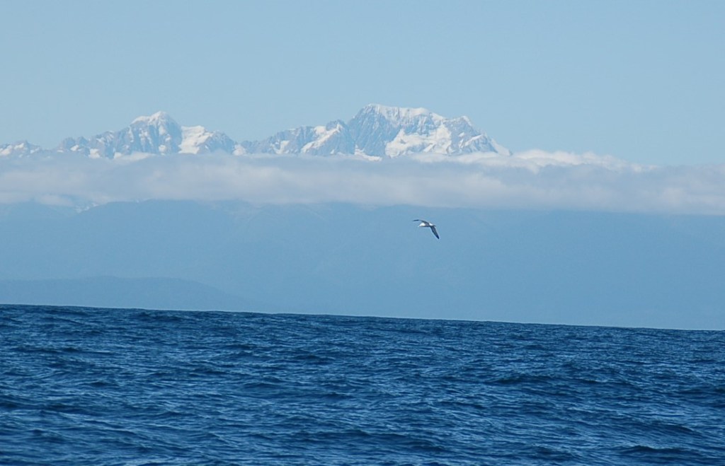
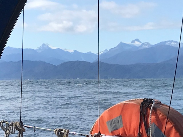
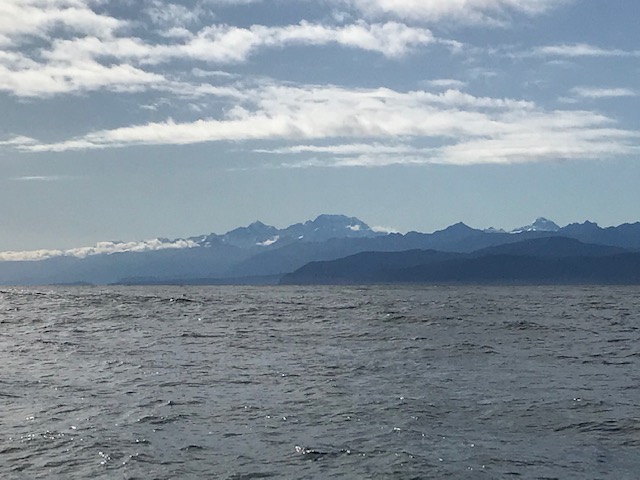
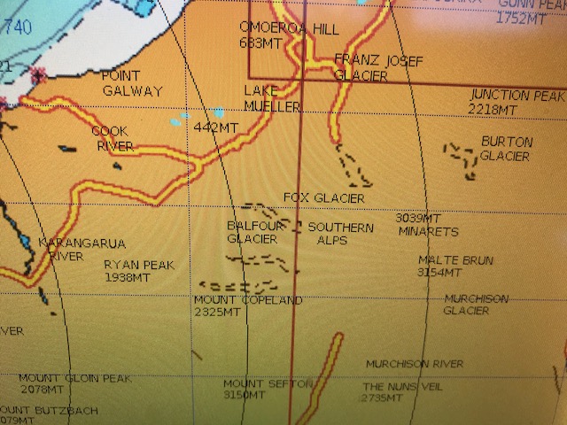
The sea was as calm as the wind, and the sun, as it rose in the east, highlighted more and more, the glistening snow-capped mountains that towered over, what seemed now to be just coastal hills that rose directly from the sea. 

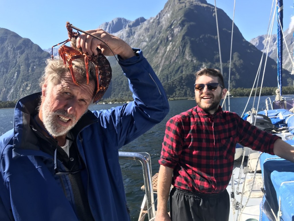
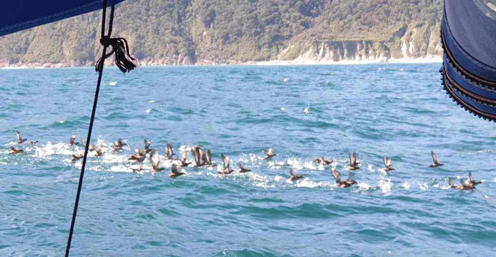
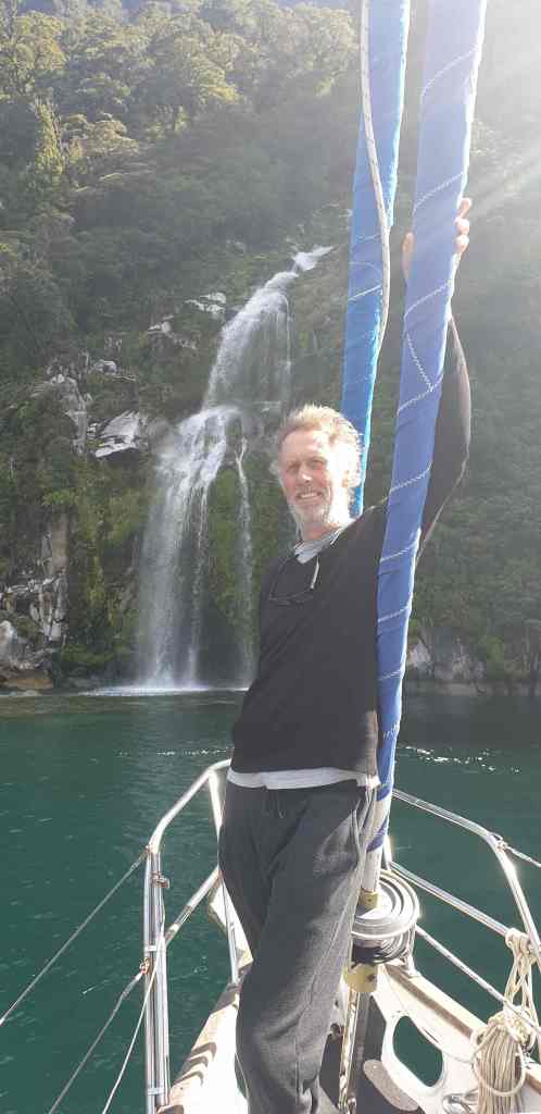
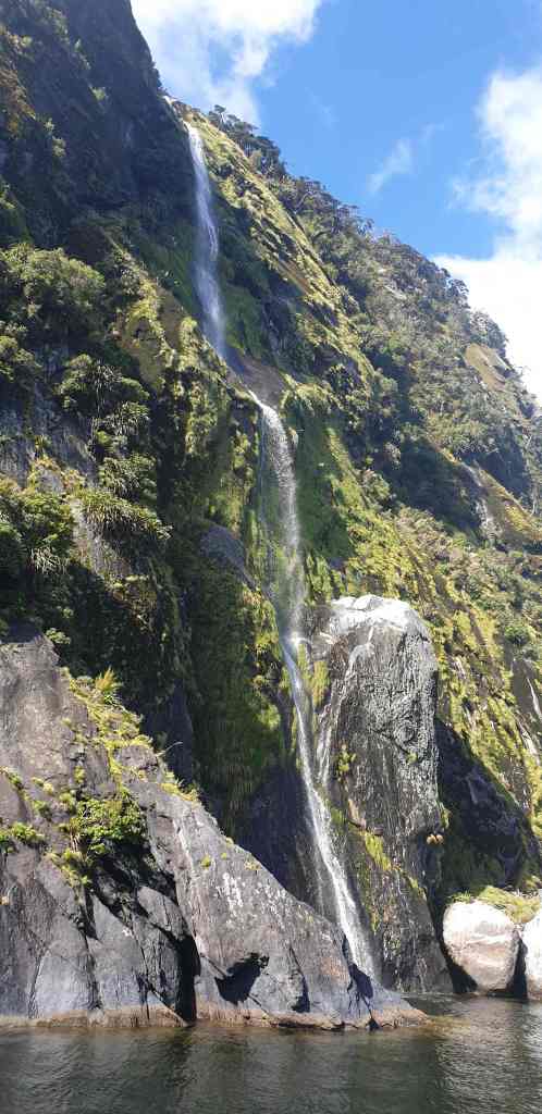
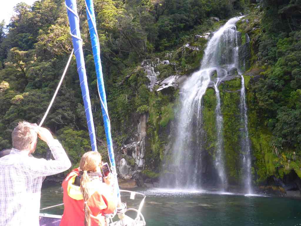
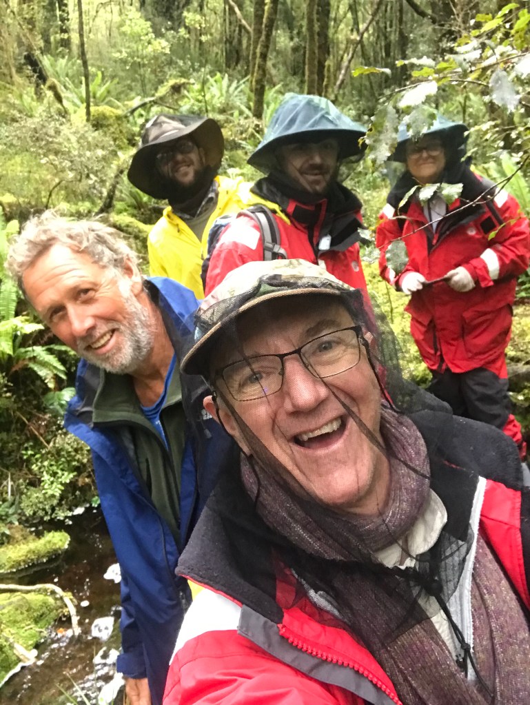
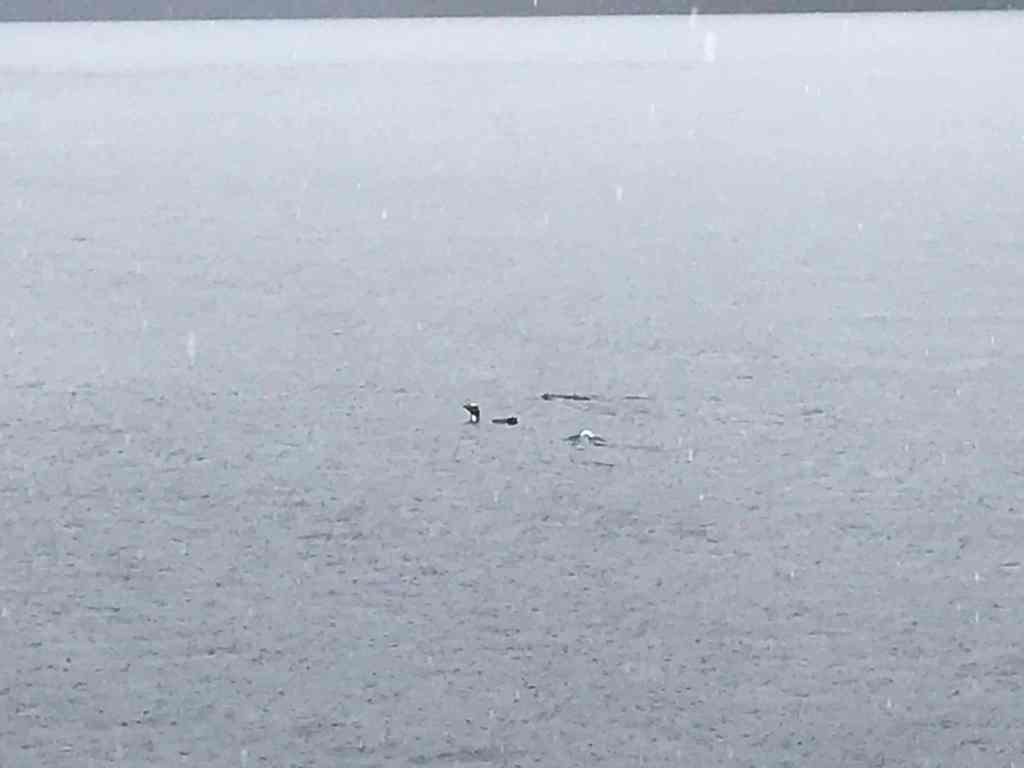
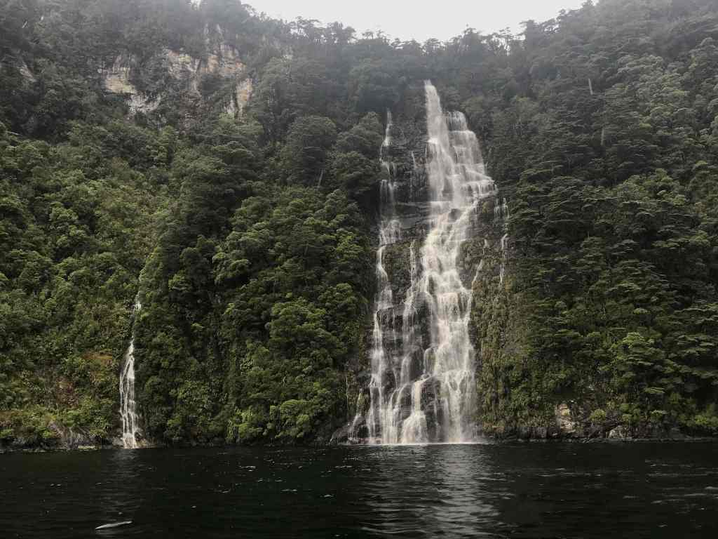
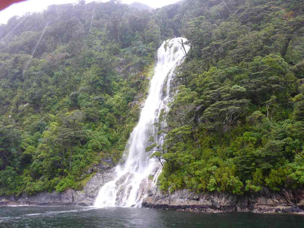
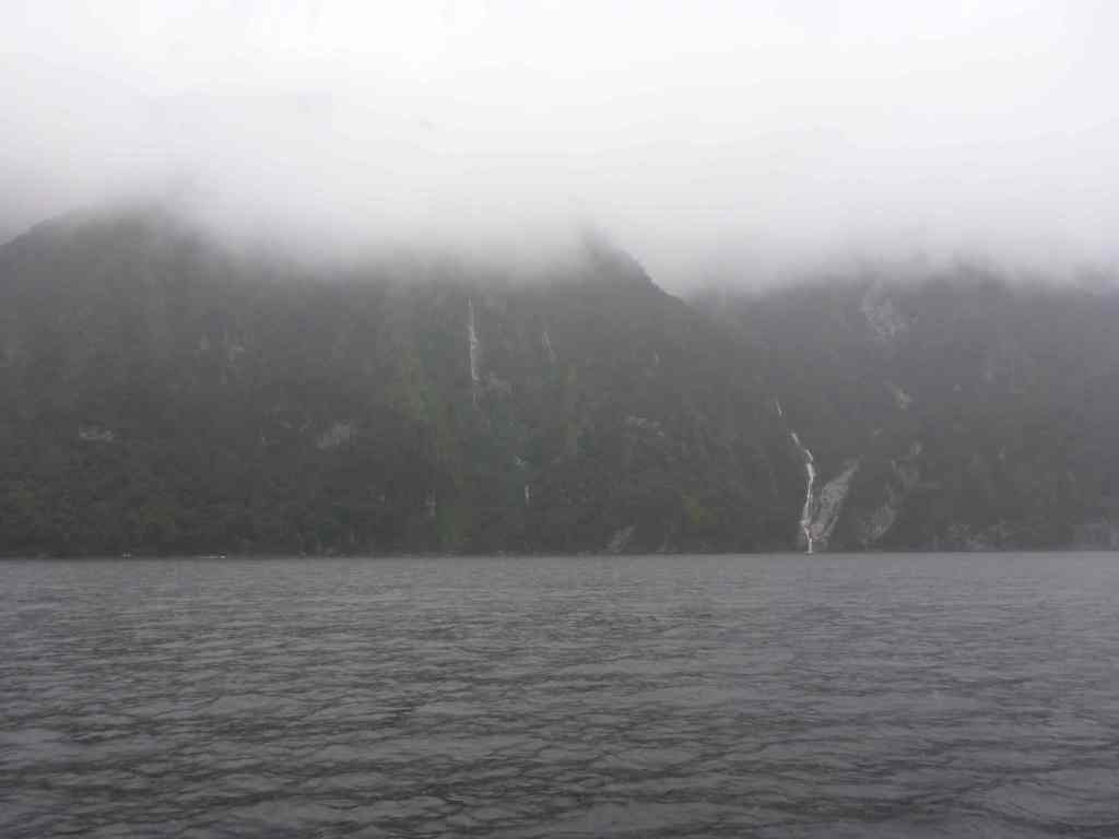
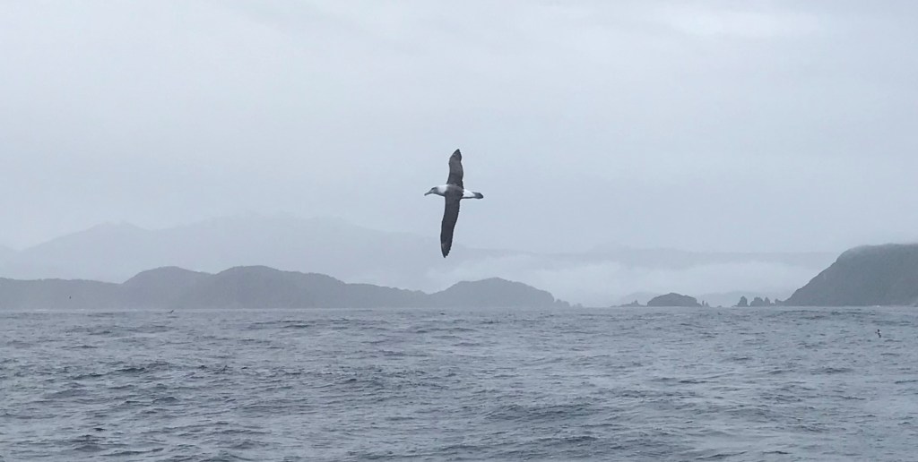
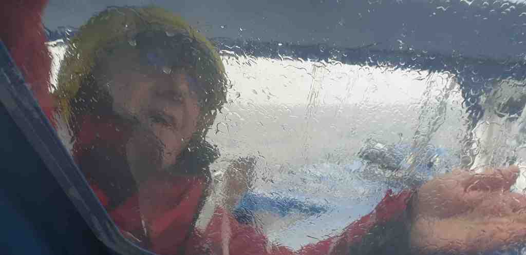
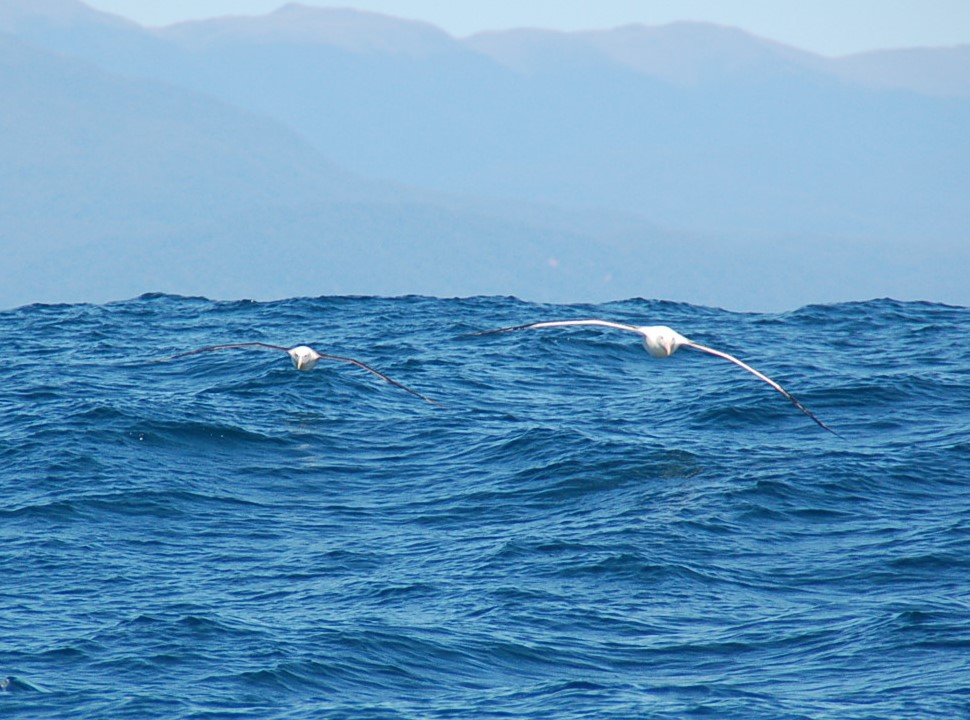
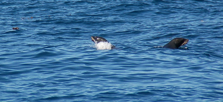
The mountains remained a feature for most of the day – Mt Sefton, Mount Cook, Mt Tasman to name just a few – All over 3,000 metres high and all shining in the sun and at times with basins of glacial white between the peaks. We were occasionally joined by pods of dolphin, as well as groups of seals, plus the ever-present albatrosses, which are just magnificent to watch.

To view the Southern Alps from the sea has been a long-held dream of mine
Getting the albatross to fly just where you want it is more difficult than you might think …?!
These two seemed to know each other and just seem to revel in the wind on their wings … as they fly just inches above the surface of the sea
Ho hum … more stunning mountains off to the side …
Slowly working our way up the coast …
That’s Mt Cook off to the left … I think
The chart plotter provides better detail of the sea and marine matters … fortunately, because on land it doesn’t give much away…

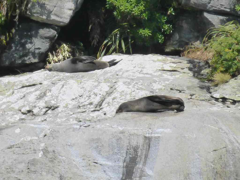
On one occasion, John moved quickly to turn off the Auto Helm, grabbing the wheel in order to quickly steer around what he thought was a big tree floating in our path.  The floating hazard soon revealed itself to be a collection of seals, all sunning their flippers – whether to cool down, or warm up, I’ve never been sure.

“Change course, it’s a tree in the water …!!”
“No, hang on … it’s just some seals, sunning themselves”

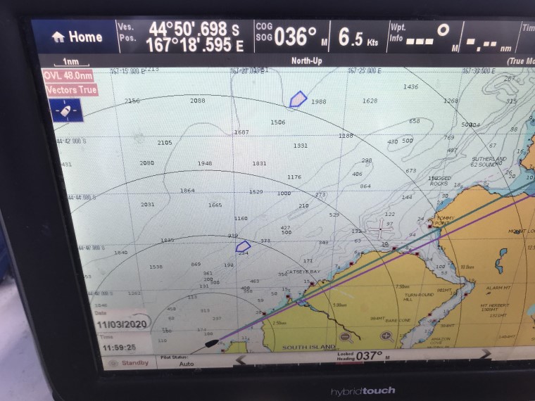
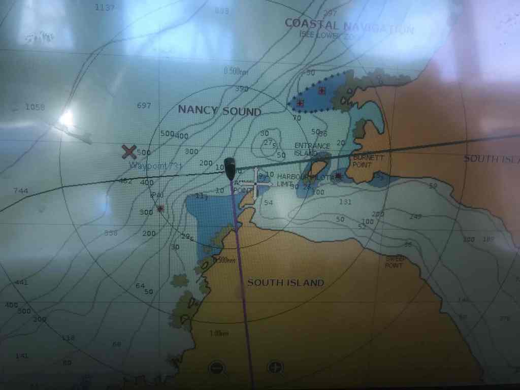
We were passing through a designated fishing ground – according to the chart – and for a while we notice a couple of boats going this way and that, presumably trawling for tuna.  Then John made the comment … “that fishing boat is coming straight for us” … and sure enough, they seemed to have no idea there was someone else in the vicinity. 

We made the necessary course adjustments and then as we passed saw the crew, and presumably the skipper too, on the back deck attending to their lines.  Good thing at least one of us was on watch.

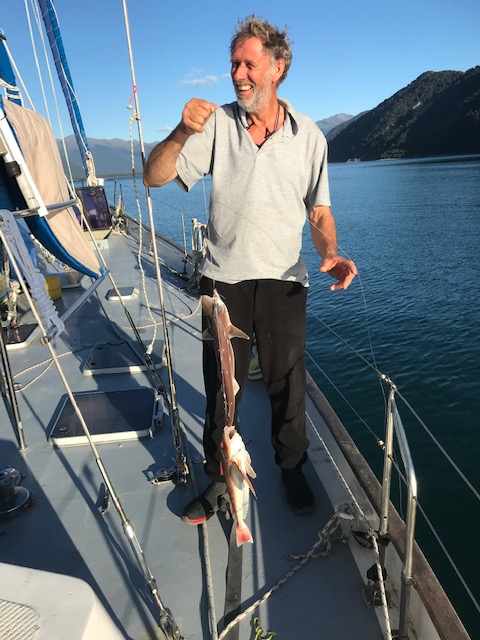
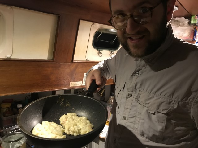
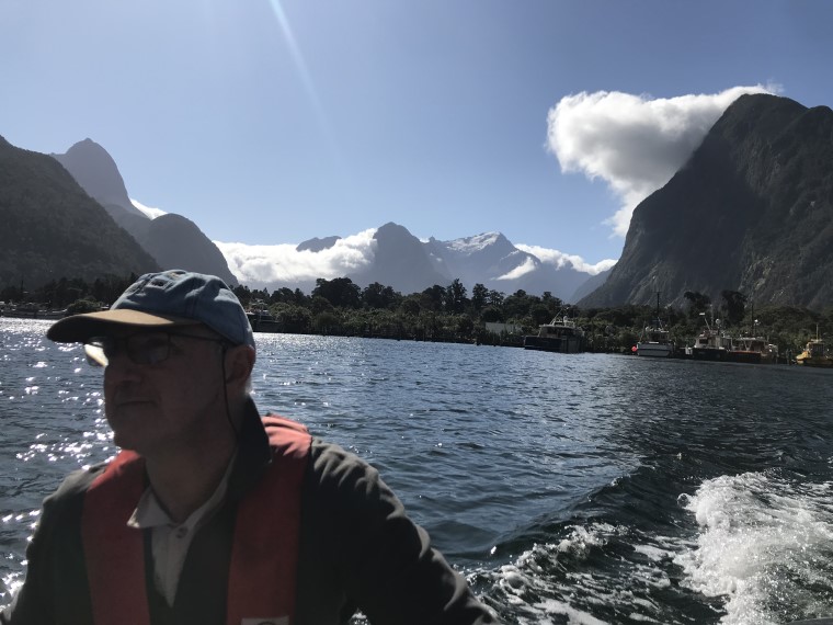
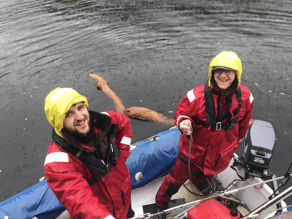
It was around this time, as afternoon was starting to become evening, when John let up the cry … “I’ve hooked a fish !!!”   Sure enough, the line was tight and there was a lot of splashing way back on the end of the line.

After a tense time, slowly winding in the line and finally deploying the hand net, it was confirmed, John had caught himself an Albacore Tuna!  Another fish hooked itself a short time later, but slipped off in the process of retrieval … but still, the Tuna Slayer Lure had finally delivered.  

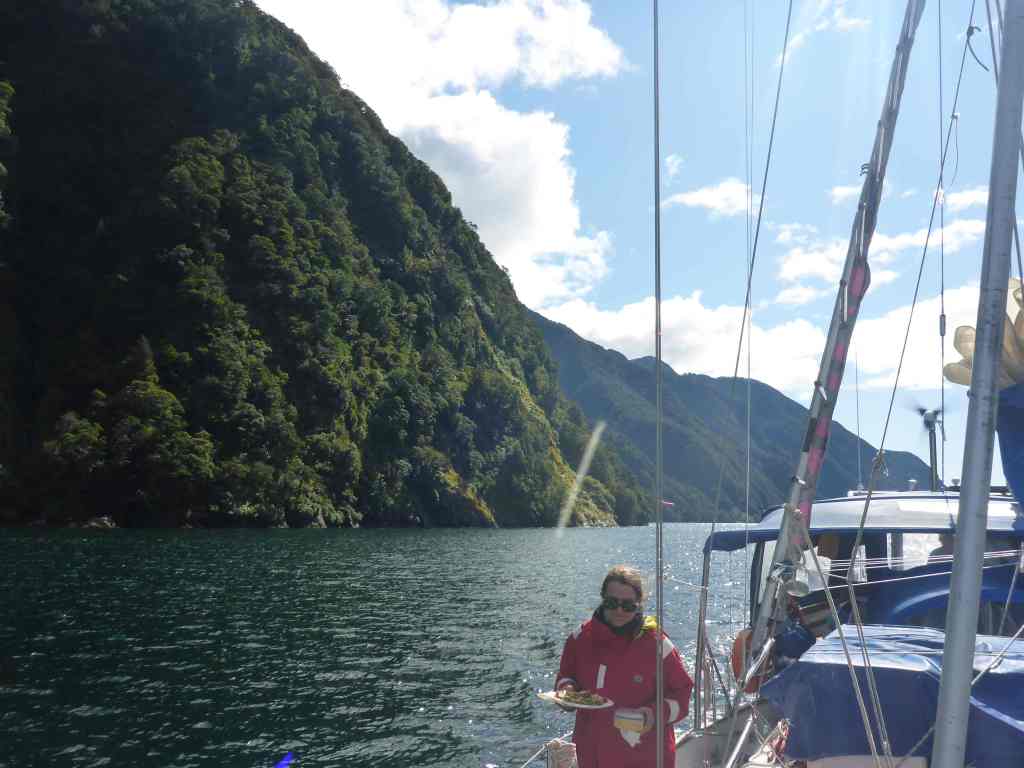
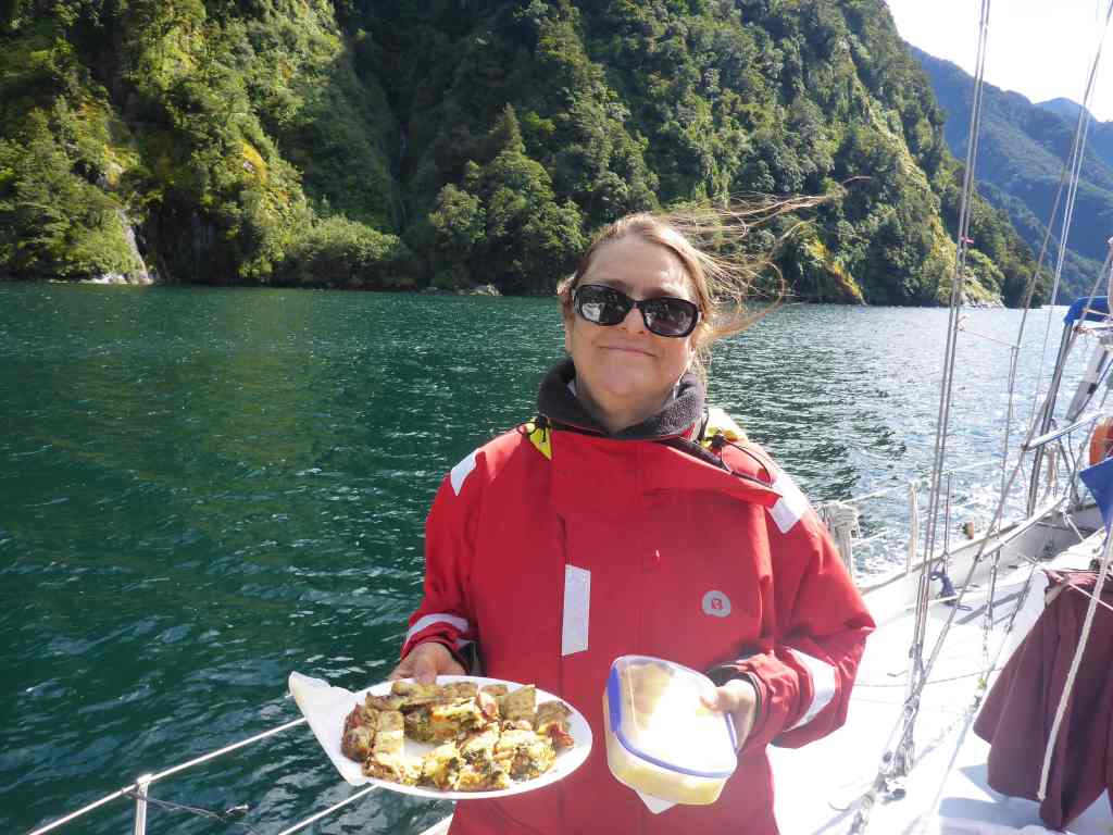
As evening closed in, all of a sudden we received “Pings” on our phones and found that we had “2 Bars” enabling us to receive emails and transmit – if only for a brief time.    It was long enough for us to discover more details of the world’s response to the Coronavirus disease; including Australia and New Zealand.  This included travel restrictions, food shortages and strangely runs on toilet paper … or should that read runs on the sales of toilet paper. 

Linda mentioned that racks of once stocked supermarket shelves were now bare, and some people were taking to hoarding selected items, in particular toilet paper.

After our call I somehow felt compelled to check Chimere’s stocks of the goodly paper, and there seems enough to last a few weeks yet – barring significantly increased demand of course, which we don’t expect – but who knows, this “NZ2020 – In the wake of Captain Cook” voyage might become even more authentic than anticipated, as we are forced to utilise the softest wooden handled brush we can find – as was the practise aboard the Bark Endeavour in 1770 – stay tuned …

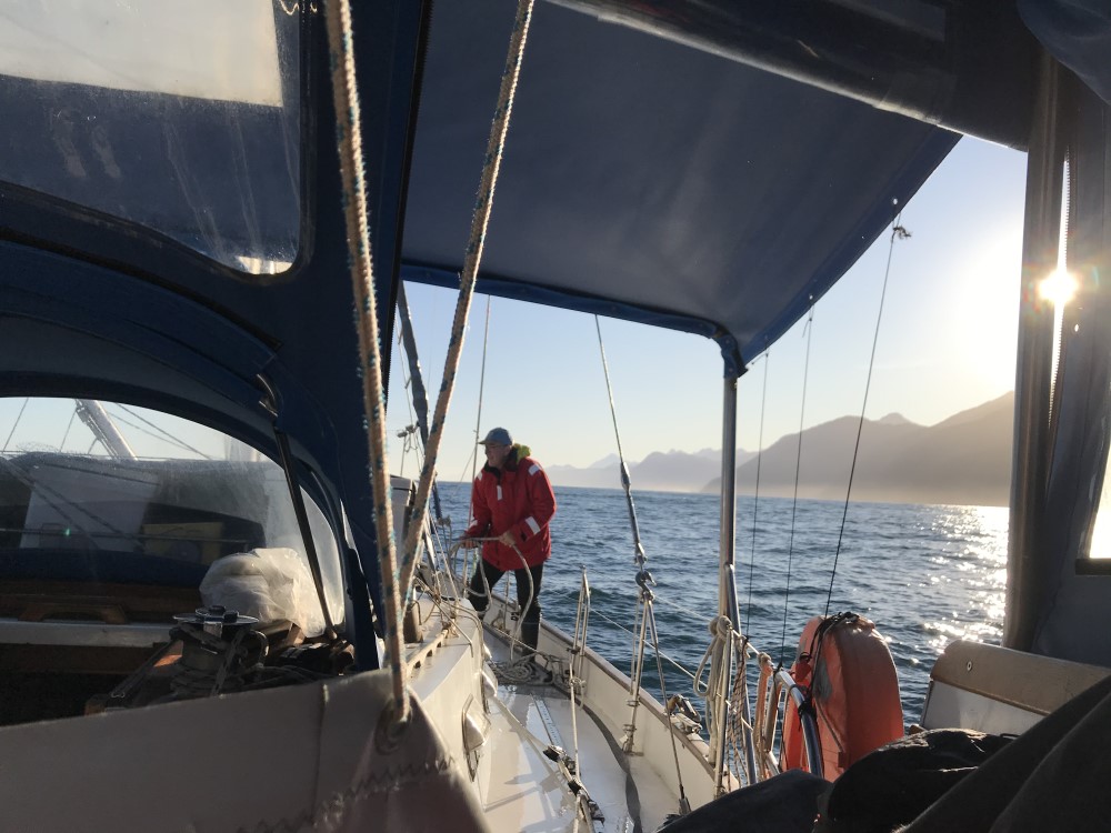
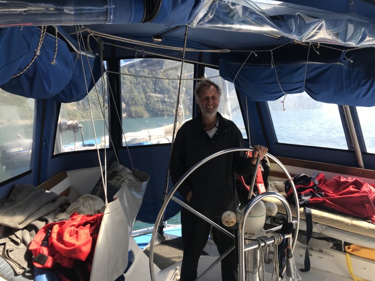
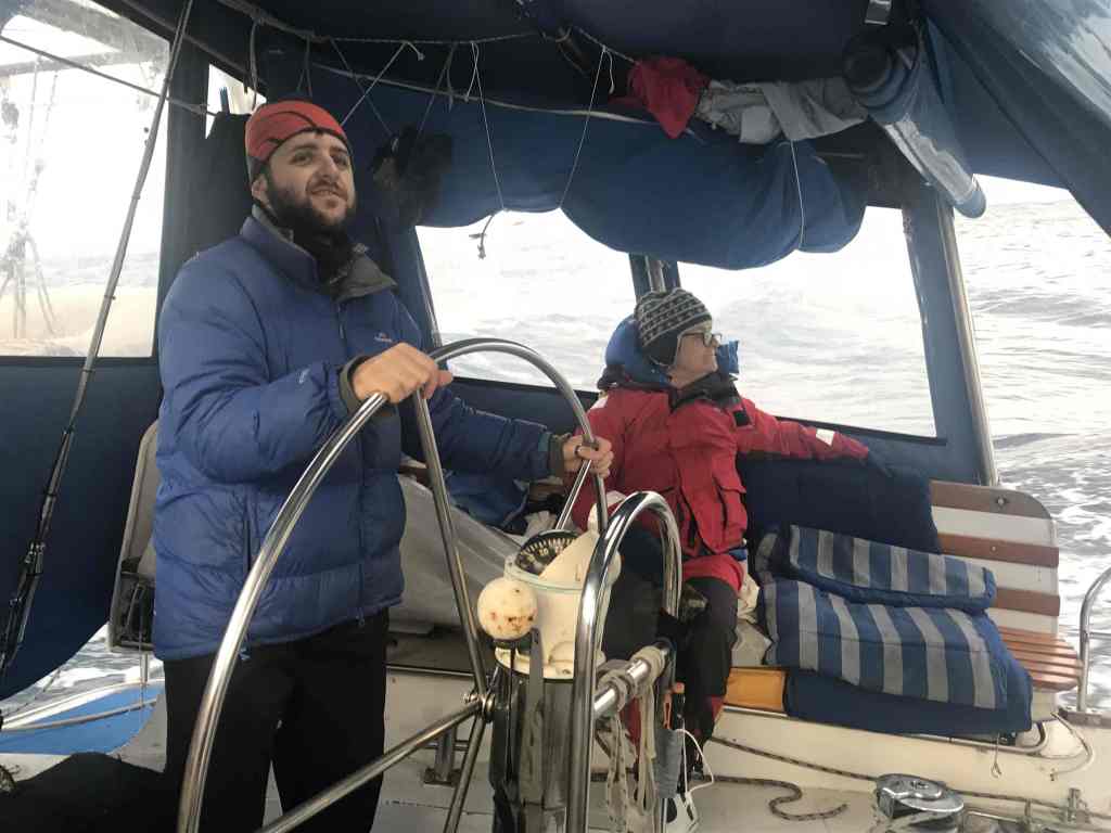
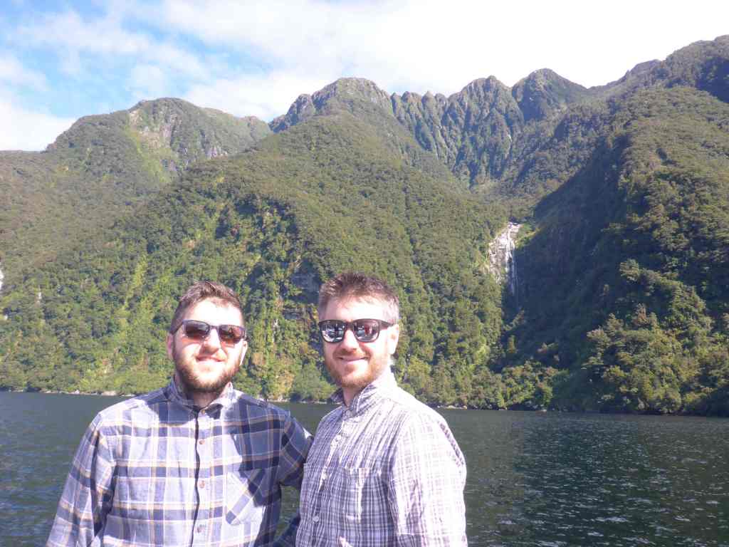
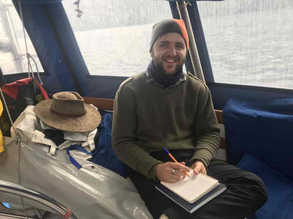
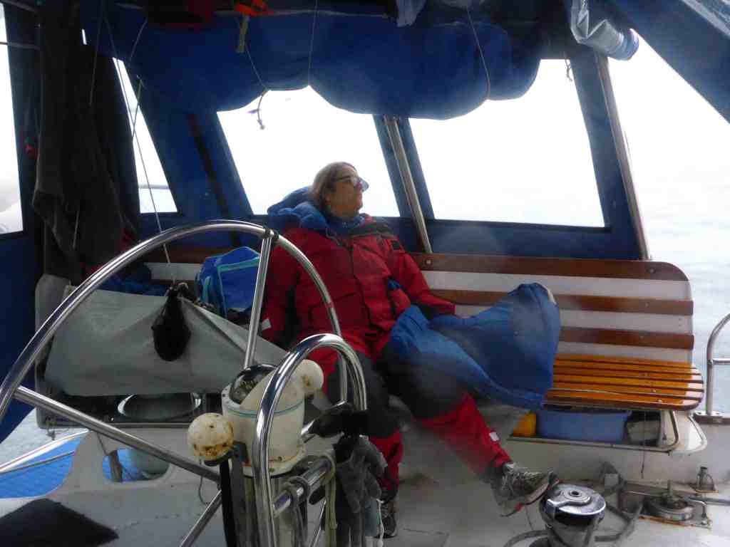
As the night continued, John and I took turns at being on watch … 3 hours on, and 3 hours off … till the welcome sight of dawn.  Our current plan is to make the most of the kind weather and mild seas, so as to arrive in Porirua Harbour, behind Mana Island on Friday, when friends will be joining us for the next stage north to Opua and the Bay of Islands

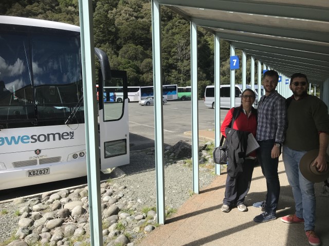
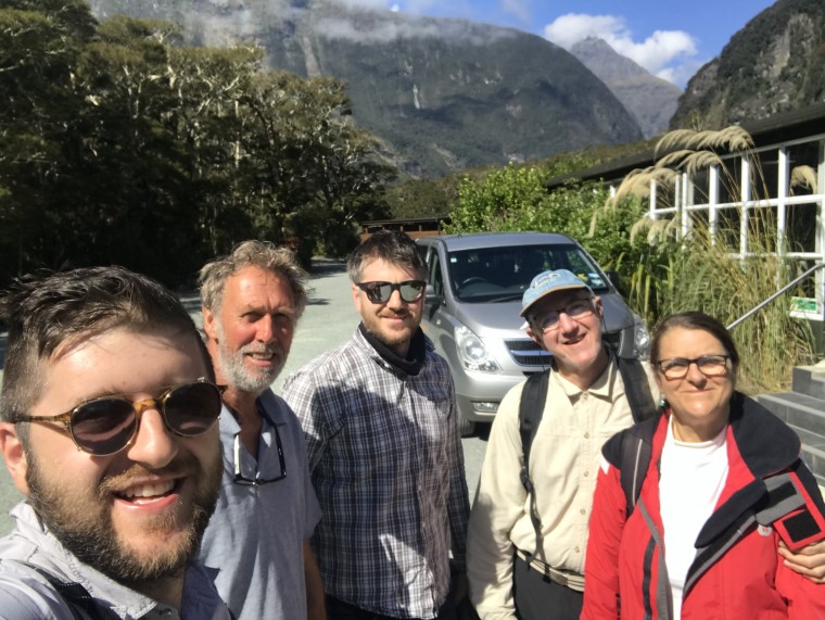
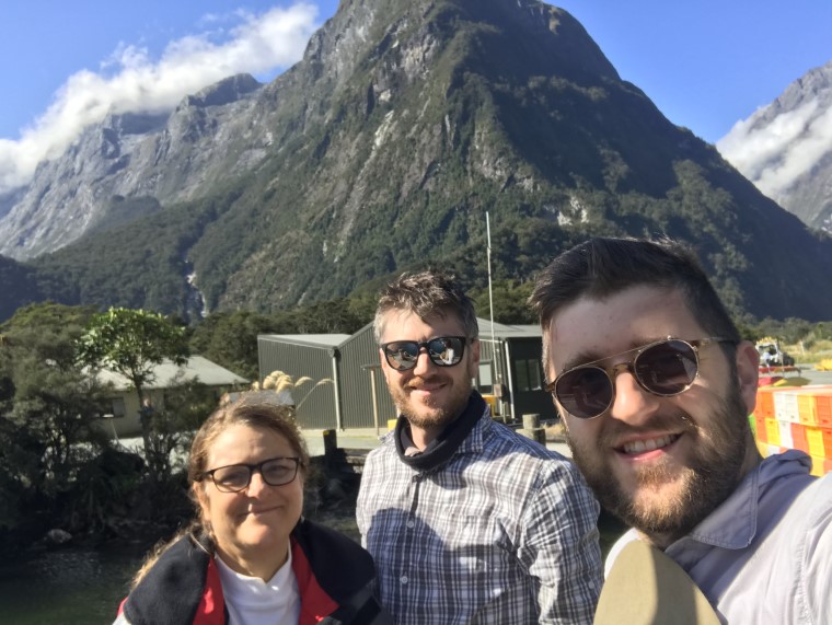
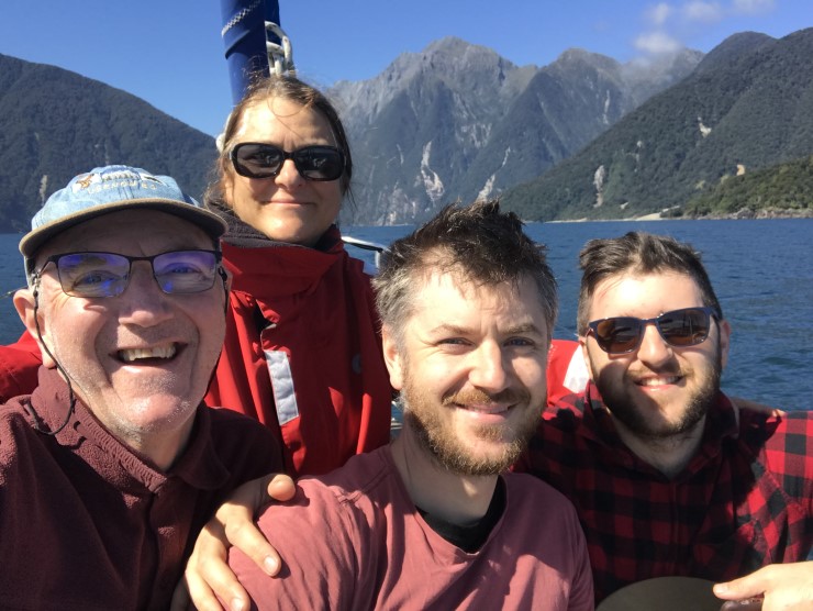
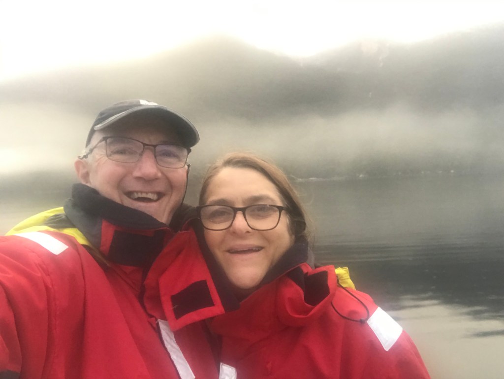
There is no doubt the travel plans of family and friends, planning to join us in a few weeks, will be disrupted.  As it was, Linda, Matt and James got back into Australia on Sunday, just 6 hours before the introduction of the 14-day self-isolation requirements.  Talk about self-isolation?!  Surely, Chimere must qualify as the ultimate in self-isolation … although at there moment there’s me AND John aboard … so it’s not quite what you’d call solitary isolation …

At the moment, no matter what’s happening “out there” … all I can do “right now, right here” …  is sail the boat and adjust our future plans as circumstances dictate.  I’m reminded of the quote attributed to Franklin D. Roosevelt, from his 1932 political campaign speech, during the depths of the Great Depression, when he said  … “The Only Thing We Have to Fear Is Fear Itself” …

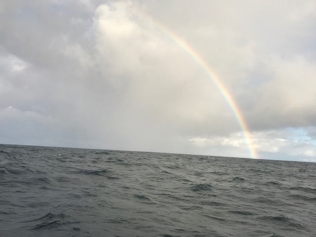
Smooth seas, fair breeze and Tuna Slayer Delivers
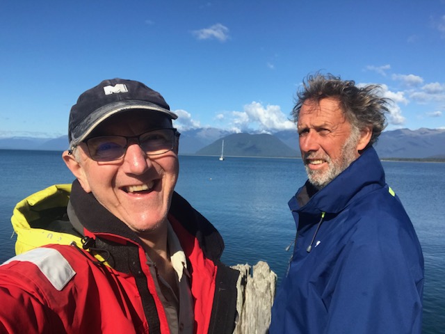
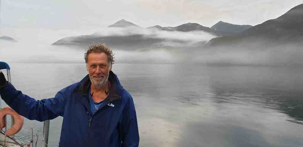
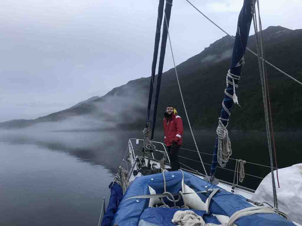
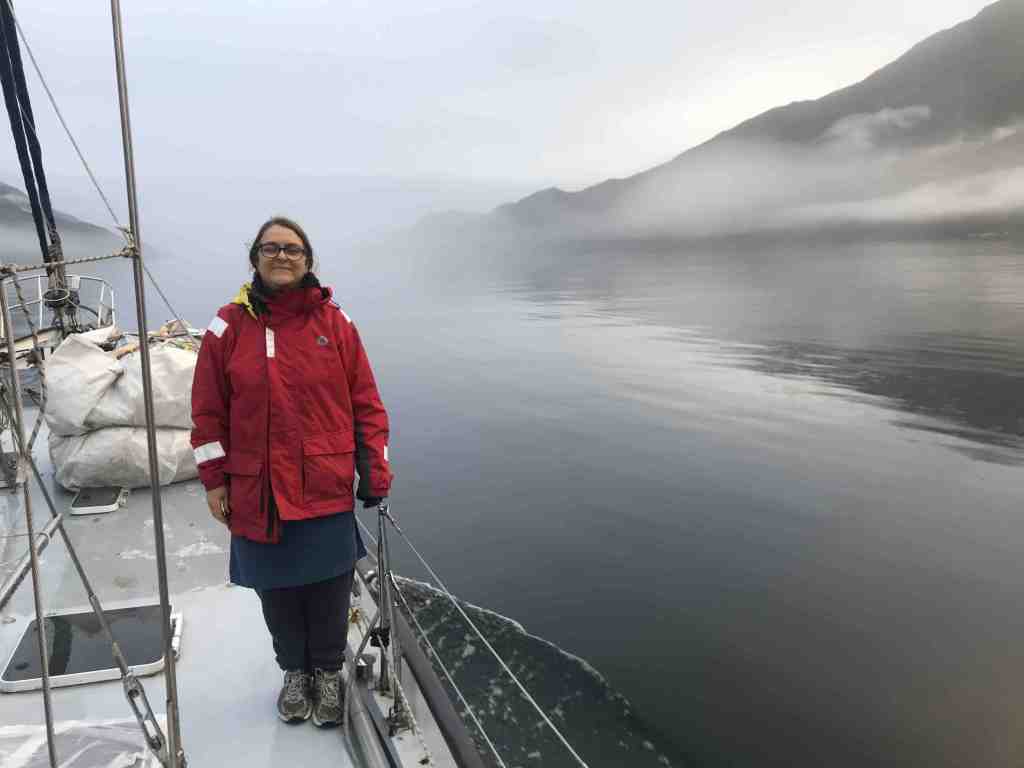
Rob Latimer

On Our Way – North

Jackson Bay, West Coast NZ

Monday 16 March 2020

Up at 4:00, away by 5:00… 

In fact, we actually got away at 4:45am.  a Personal Best to be sure.  No anchor of course, so it was  a simple act of letting go our mooring line; that had held us safe and secure these past four days here in Milford Sound’s Deepwater Basin.

The rain and wind that had continued most of the night, was now past, and in its place was a bright half-moon, shining from a calm, half-clear sky.   The only noise being the sound of the new waterfall that had started up off the cliff close by.

Leaving “port” in the dark, just like arriving, has it’s added obvious risks.  There are usually more hard objects to potentially run into – than being 25 miles off-shore – and NOT being able to easily see them, presents a challenge. 

With high tide at 5:00am – the very time of our departure – the senses were heightened even more, because to run aground now would mean little chance of further in-coming tide to help “float” us off.

Heading out out of Milford Sound, the wind and rain caught up with us in the early morning
Fringe benefit of the rain and sun … a nice rainbow
The Southern Alps began to appear off the starboard side as we left Fiordland in our wake

Not that we were planning on hitting anything, or running aground, but the possibility was always there … in the back of your mind.

John assumed his now usual, position at the wheel, while I used the search light and adjusted and checked the chart plotter.  The chart plotter not only shows where you are headed, but it also leaves a trail, in the form of a black line, of where you’ve been.  This is particularly useful when retracing your path OUT of a place.  The only problem we found here, was that because of the high cliffs and terrain, there seemed to be a significant “lag” in the GPS position-locator and the display on the screen.  Not usually a problem when you’re out at sea, but when the channel is only 100 metres wide and it’s really important to stay the correct side of Red-and-Green-painted navigational markers, there’s no substitute for a pair of eyes, a good torch and a loud voice.

So it was with a sense of relief that we found our way into clear water and out into Milford Sound, where the moon reflected off the many new waterfalls cascading from the cliffs either side of us, as we made our way out to sea.

This is the wind we had waited an extra 24 hours in Milford to catch up the coast

The beginnings of daylight emerged as we made our way out into the Tasman Sea and began to feel again the south west swell coming in off our port side.

Whilst we are keen to reach Mana (Porirua Harbour, near Wellington) around 430 miles away, as soon as possible, we couldn’t resist the opportunity of dropping into sheltered Jackson Bay for the night – just 60 miles up the coast. To rest and prepare fully, for the next 2-3 days and nights of constant travel.  With just the two of us aboard, the trick will be to maintain our alertness and energy levels.  Fortunately, the weather forecast still looks good for the next few days

Finally, the much promised and anticipated SW wind came in at around 15-20 knots, which strengthened to 25knots later in the day, allowing us to turn off the motor completely, while still making around 7 knots. 

Our travels were now leading us north, away from Fiordland and along a stretch of coast known as the “West Coast”.   Named, to be sure, in far less imaginative time, when things and objects were named and described in practical, no-nonsense ways.  “South Island” … “North Island” … “West Coast” … names you could set your watch by.    Then, every now and then you get names that mix it up a bit.  That speak to a deeper message, conveying something of the emotion and experience of the time … such as … “Anxiety Point” … “Preservation Inlet” and “Doubtful Sound”.  In a sense, conveying the notion that despite the years, nothing has really changed.

In place of the amazing Fiordland off to our right, we are now being spoilt by views of the Southern Alps, which make what we’d been seeing to date look like mere hills.  It started with a glimpse of towering Mt Aspiring, which at 3,029 metres is New Zealand’s answer to the Switzerland’s Matterhorn.  Then, way in the distance we were tempted by glimpses of more snow-capped peaks, all shimmering in the morning sun.  But they would have to wait.

Mt Aspiring at around 3,000 metres, pokes it head above all else in the vicinity

After around 10 hours sailing we were beginning to close in on Jackson Bay, but first it was necessary to round Cascade Point.  Our eyes now confirmed what the chart showed – a simple line of cliffs and headlands, with land rising behind into forest-covered mountains (in Australia)  … hills, here in New Zealand.  

But with a name like “Cascade Point”, what else do you think you might find, apart from cliffs and mountains … that’s right, waterfalls.  Not one, but FOUR.  All pouring over the top of the cliffs, maybe 50-100 metres high, fed from separate streams.  Presumably, as the chart shows, the Hacket, Hope, Gorge and Cascade rivers, which in turn flowed down from the McKenzie Range and the Hope Blue River Range further inland; just stunning!

Well named Cascade Point … nearly at Jackson Bay now.
Just a wonderful spectacle … Cascade Point

At 4:0pm we made our way into the sublime, still, lonely waters of Jackson Bay, pulled down the sails and dropped our anchor.  In what Captain Jack Aubrey, (of Patrick O’Brian’s) Master and Commander fame, would have described as,

Entering the blissfully calm Jackson Bay … but NOT calm in north east gales

“… a damn good Christian anchorage, in 7 metres on sand.  Splendid!!”

The warm sun had us quickly taking off layers … at least until we got ashore and encountered once more, the persistent, pesky and painful sand flies.  These Jackson Bay guys seemed hungry, and were determined to get from us what they could, there not being a lot else on offer in these parts – apart from the occasional tourists in motor homes keen to reach, literally, the end of the road.  But I don’t think they got out of their vehicles for long.

Chimere at anchor in beautiful Jackson Bay

As the evening cast a yellow-orange glow over the surrounding mountains, we could just make out even more of the larger and whiter peaks further north, which we figure included the tallest of them all, Mt Cook, at around 12,000 feet (3,752m by my chart, although a rockslide in recent years reduced this by a few metres I believe)

Quick, before the sand flies bite
Closed at 4:00pm. An enterprising local cafe – the only retail establishment in the bay,. We were an hour too late. Note, the ropes holding down the umbrella
Look like volcanoes letting off steam in the distance … but it seems the best days of the Jackson Bay fishing infrastructure are behind it.

Back on board Chimere, and largely away from the sandflies, that is, after we’d put up our netting and sprayed mercilessly at anything that moved, we got into making dinner.  Sure,

John caught two fish on dusk … two hooks, two fish, simples!

we had fish in the freezer, plus one remaining cooked crayfish in the fridge, but to mix it up a bit I said to John … “fancy spag bol?” 

“Yeah, cool as, bro” came the response. 

So that’s how I made enough spaghetti bolognaise to feed ten grown-ups.  Or, more to the point … enough to feed two blokes in five sittings – tonight, plus lunch tomorrow, dinner tomorrow, in addition to lunch and dinner the following day. 

With the likelihood of us being at sea for a couple of days, it’s always handy to have something quick and simple to heat up, when the need arises.  It seemed like a good idea.  That’s why they call me … “the ideas man”

After our day on the water, and the early start from Milford, we went to bed a bit after 8:00pm, keen to get away around 5:30am in the morning.

Smooth seas, fair breeze and on our way – north

Rob Latimer

Preparation Day

Deepwater Basin, Milford Sound

Sunday 15 March 2020

John and I awoke to quiet boat, as the next stage of the NZ2020 got underway.

Not that we were going anywhere. At least, not just yet. But with Linda, Matt and James heading back to Australia, yesterday, we now began seriously planning our departure from here tomorrow morning, when the wind is predicted to shift from NE to SW.

An overnight text from Linda, via Satphone, alerted me to the possibility that the global Coronavirus outbreak might prevent family and friends returning to join Chimere in the weeks ahead, with New Zealand imposing restrictions on travel. At this stage it’s too early to tell, but it’s highly likely some will be adversely affected.

By 10:30am John and I had travelled ashore and walked up to the Milford Lodge where we again made use of the WiFi, in order to make calls, check emails and in my case, upload some photos to the blogs from the past few days. It’s a long, slow business, but there’s nothing like a few photos to enhance the message, and whilst it’s started raining now, (and all you can see outside is grey-upon-grey) we really have been fortunate to capture this region in some stunning weather. Particularly since Milford receives around 6,700mm of rain (264 inches) each year, with rain falling on about 200 days in the year.

After a walk around to the Milford Visitors Centre, John and I were struck by how quiet everything is at the moment. Most of this will likely be as a result of the damage to the road, following torrential rain last month, and the limited ability of cars to get in.

Back on Chimere, John and I made good use of the remaining hour before it began raining, to lift the big dinghy back on deck. Lash everything down and stow all loose objects. We even had time to make some sewing repairs to the back cockpit dodger and apply some adhesive sail tape and patches to a few small frayed edge on the top part of the main sail; more as a preventative measure.

In reflecting on the voyage so far, it’s nearly 2 months since we left Westernport, with a total of 12 crew members joining John and I, for differing periods of time, along the way. In addition, there have been a further 5 visitors coming aboard for a day out. So far, we’ve covered around 2,500 miles, having seen some amazing things and experienced some equally amazing places.

Thank you to everyone for your interest and encouragement; and especially for Mike Clarke who uploaded the last week’s blogs, and Matt Latimer, who has agreed to resume the task – at least for the next 5 days – while we are again out of internet range

I’ve just managed to download the latest PredictWind forecast, via SatPhone, and it looks good for our 5:00am departure tomorrow morning; and for the next 5 days up the west coast. The rain should get heavier between now and morning, with the swells out at sea diminishing throughout tomorrow and over the next few days.

Smooth seas, fair breeze and preparation day

Rob Latimer

A Day for Good-Byes

Deepwater Basin, Milford Sound

Saturday 14 March 2020

After 14 days of action-packed adventure, fun and unique family time together, we knew this day would always come.  The time to say good-bye to Linda, Matt and James, and send them on their way home to Australia.

This part of the itinerary had, of course, been built into the overall plan.  But up until now it had all been on paper. Involving a 4 ½ hour bus ride to Queenstown, where overnight accommodation had been booked, followed by direct flights to Melbourne for Linda and Matt and a flight to Sydney followed by a bus to Canberra for James.  They will all be tired little puppies when they finally put their head on the pillow tomorrow night.

Finally packing of bags was done throughout the morning, as John and I went ashore to pay a visit to the Milford Lodge, where we again made good use of the internet connection.  

About to board their Uber Dinghy – Linda, Matt and James
Letting go the lines for the last time
All bags safely stowed away from the possibility of “wetness” on the way to the bus terminal

Then, after lunch together aboard Chimere, all the bags and belongings were loaded into the dinghy for the 20 minute “Uber” lift out of the Deepwater Basin, across the bay, and into the ferry/bus terminal; thereby saving a heavily-laden walk along the road. 

All on shore – dry and safe
Which bus …?

Despite the breeze and slightly choppy sea, everyone arrived at the transport hub safe, and above all … dry. 

After the inevitable, final good-byes, I re-traced my path back to Chimere, where life aboard seemed very quiet indeed; just me and John rattling around making priority-lists of things to do before we start heading north.

At the moment, the wind is blowing down the coast, from the north east. And is predicted to keep doing that until late Sunday night.  This would have been great if we were heading south, but we’re not.

So as to avoid as much “pain” as possible, John and I figure it’s best to simply sit here on our Deepwater Basin, until early Monday morning when it’s predicted the wind will shift to the south west. 

With around 430 miles to cover, we hope to spend the first night at anchor, around 60 miles up the coast at Jackson Bay (near to where the Haast Pass Rd meets the sea).  Then, spend the next two days (and nights) clicking off the miles to the north west tip of the South Island – Cape Farewell – taking it in turns to stay on watch; making sure we maintain our energy levels.  The longer term forecast currently looks favourable for this strategy.

From Cape Farewell, it’ll be a hard right turn in the direction of Cook Strait and Mana Island, behind which sits the entrance to Porirua Harbour and the Mana Cruising Club, where we hope to tie up for a couple of days.

At the moment, we are just getting used to the quietness aboard.  Not that Linda, Matt and James were noisy.  It’s just that there was inevitably more interaction, discussion and activity when five people are aboard compared with two.  A space probably no bigger in size than the average suburban bathroom.

On a very domestic not … the north east wind may not be good for sailing up the coast, but it’s been great for drying the washing … yes, we do wash our clothes, and we even have a hot shower from time to time.  On the topic of washing clothes, John and I have slightly different strategies.  I have 14 pairs of underpants, so by day 12 and 13, I’m starting to plan a wash.  John, on the other hand has significantly fewer pairs, which he claims, forces him to wash more often.

While I’m on domestic matters, I’ve mentioned that Linda’s sand fly defences were well planned, extensive and meticulously implemented.  Making her look all the part like a bee keeper, every time we went ashore.  Linda also came equipped with a full suite of drugs, lotions, creams and medications to treat any bites, should they occur; having been pre-warned by friends who’d been in these parts before.  This was fortunate, because, whilst all of us suffered bites, none copped more bites than Linda, and none seemed to swell up as much either.  

While Linda is no longer on the boat, I’m sure one tip she would like to pass on to future travellers, (and she’d do this in person I’m sure if she was here) is … if you are fully kitted up against sand fly attack and you happen to get insect repellent spray-drift in your mouth, (it’s not important who sprayed it) always LIFT the fly netting off your face before spitting.  Remember the slogan … “Lift before you spit”

While I’m on a roll …

… it’s an interesting observation that when people share a confined space, for extended periods of time, it’s [hopefully] normal that you try to both modify your personal behaviour, so as NOT to deliberately aggravate others, while at the same time turn a blind eye and ear and nose, to the small (and potentially annoying) habits of others. 

That said, the build up of “gas” … maybe from eating too much crayfish perhaps, or (traditionally) beans, can lead to embarrassing “noises” being emitted from either, or both, ends.  Hopefully not at the same time.  But something I learnt years ago from a dear sailing friend, Bob Brenac, was that “Sea Frogs” are found on boats … some boats more than others … and of course Sea Frogs make croaking noises, which surprise, surprise, sound remarkably like other noises … that humans often make.  So, when you hear someone say … “Sea Frogs are particularly active tonight dear” … you know what’s coming … or might have just been.

Chimere also had Sea Crickets … which often came out after a meal and made noises that once upon a time I recall being told were … “signs of appreciation for a wonderful meal … luv”

I could expand, with an epistle to our wonderful electric toilet and holding tank system … and the sense of panic and foreboding that overcomes you when you think you might have blocked or damaged it … but I I think I might have already said too much. 

Smooth seas, fair breeze and a day for good-byes

Rob Latimer

Postcard from James – Living that Fjordlijf TM * (14/03/2020)

Hello there regular www.nz2020.travel.blog  readers. Today’s entry comes from the junior foreign correspondent James “the Crayfish Cooker” Latimer.

As I sit here in my last few hours aboard Chimere, I look back on the past two weeks of sailing adventure.

Beginning in Bluff, (essentially Invercargill – don’t tell any Kiwis I said that), we headed south to Stewart Island, and then northwards along the Fjordland coast, eventually stopping at Milford Sound. It is here in the sound/fjord/fiord/loch (pick your preferred nomenclature) most frequented by tourists and civilisation that I ‘pen’ this reflection postcard.

Cooking up some crayfish fritters – our latest recipe
Your dinner …

These last two weeks aboard Chimere with Matthew, Linda (Mum), Rob (Dad) and John have been terrific. We’ve had calm days of mirror-flat seas with no wind. We’ve had 40 knot breezes with 6+ metre lumpy swell. We’ve had bright, sunny days of crisp distant views. We’ve had days on end of glorious deluge, creating countless waterfalls and shrouding the previously visible peaks in mist and cloud.

And through it all we’ve had our constant companion, our rock, our point of reference when compasses fail and the sun refuses to rise in the east, our one true constant in these turbulent times: the sand flies.

Aside from the minor ‘immunocollapse’ by which my first few days onboard were defined, (ie I arrived from Aussie as crook as, bro) the entire trip has been one stunning vista after another.

If forced to refine the trip into a few personal highlights they would be these:

  1. Swimming in the cascades of Lake Alice’s waterfall at the end of George Sound. The crystal-clear waters gushing and pooling about, creating a variety of bathing and massage options to suit every need.
  2. Leaving our anchorage at Edwardson Sound in the rain, with the ethereal mists clinging to the mountains and sea. The landscape that was just the day before sunny and clear was now seen in monochrome, with mountains just different saturations of black like a Japanese ink artwork.
  3. Receiving our first batch of six crayfish from a charter vessel in Preservation Inlet. All the ‘crayfishermen’ are currently massively oversupplied with crays on account of the crash in Asian markets, so they’ve all been pretty happy to hand them out. As regular readers will be aware, these six were not our only gifted crays for the trip, with our total (as of the time of writing this) being 16.
  4. Acquiring a recipe for crayfish fritters from Manny the ‘overly-cut’ rough diamond in Milford harbour, thus opening a multitude of new crayfish-related recipe options.
  5. The rather alarming entrance into Otago’s Retreat around Puysegur Point, (and our first entry into Fiordland) with the large swell breaking on the rocks either side of the <200 m entrance.
  6. Visiting Astronomer Point in Pickersgill Harbour, Dusky Sound, where Captain Cook set up what could well have been New Zealand’s first microbrewery.

These are but a few of the memorable moments strewn throughout the terrific trip that has been the last two weeks of sailing. Our food has been consistently top notch, with the sea (and in the case of our numerous crayfish, the locals) providing us with significant bounty. For example, one meal I cooked a few days ago included on the plate beer battered shark, grilled blue cod, and crayfish fritters. Attempting to acquire an equivalent spread outside these bays would be both a difficult and costly exercise.

If you’re looking for a bit of adventure just on your doorstep (if you’re an Australian or New Zealander – it’s obviously slightly further for you European readers) then I would absolutely recommend heading over to the fjords of New Zealand’s southwest coast. Better yet, contact Robert Latimer on msm1@clientsatmail.com.au and check which legs of his return trip are still lacking crew, and become a part of the journey you’ve been reading about!

James signing off.

* Fjordlijf … tr. Fiord-life: a James creation, inspired by recent travels  

Rest Day At Milford

Deepwater Basin, Milford Sound

Friday 13 March 2020

It was a particularly lazy start to the day aboard Chimere, with the morning sun highlighting different faces and angles of the mountain-tops forming the backdrop to our new world; at least our world of the past 18 hours or so.

The highest priority was to check out the water and diesel situation over at the fisherman’s wharf; while it was still and calm, and the many other working-boats seemed inactive.

On our way over to the dock, John and I spied the enormous outline of a cruise ship out in the Sound, and a short time later I think I saw a second ship.  It seemed they didn’t stick around.  Their strategy possibly being to provide their passengers with a “drive-by-look”, rather than an “off-the-boat-walk”.

Still, there was a steady stream of light planes, helicopters, coaches, mini-buses, tour boats and even kayak flotillas (including pre-training onshore) getting underway by 9:30am; when John and I checked out the wharf office  

“Sure, you can fill up with water … just tie up alongside.  And we’ve got diesel at $2 per litre.  No Eftpos, or electronic transactions though, unfortunately.  Cash is preferred here”, explained the guy in charge.

Fortunately, I had a bit of cash, and so was able to top the tanks up with 150 litres of diesel … to be sure, to be sure … and we were even able to offload two week’s of accumulated rubbish in an onshore dumpster.

“Fill er up mate…” At $2 per litre, and folding notes the only form of exchange, we could afford to put an extra 150 litres in the tank. Not a bad view from the servo …
Tied up for fuel and water, looking back across Deepwater Basin to our mooring

The water tanks overflowing, and the diesel reserves replenished, John and I put Chimere back on the mooring, while Linda, Matt and James went for a walk down to the waterfront, with the plan being to meet up at “The Lodge” accommodation facility, a short distance up the road.

Not a bad backdrop

As John commented, as we walked back past the air strip, after spending a few hours partaking of “civilisation”, in the form of WiFi and Lodge/Hostel facilities … “it’s good that the development here – the buildings and structures – are situated in a way that doesn’t dominate the environment.  The powers-that-be haven’t destroyed the pristine look that everyone comes to see and enjoy”.    Which is actually quite true.  The development is of a more subtle and eco-friendly type; in contrast to the likes of, say, Queenstown.

Back to “civilisation”, as defined by access to WiFi
The industrial part of Milford Sound
The 1km walk to the Milford Lodge, along the bank of the Cleddau river. Note the erosion on the far bank – the result of recent torrential rains

On arrival at “The Lodge”, John and I found a table with a nearby power point, so that I could plug in my computer and we could each enjoy a coffee.  Unfortunately, it was in a room just off the main reception and restaurant area, so that when Linda, Matt and James duly arrived at the appointed time, they didn’t find me.  Meanwhile John had gone for a walk, intending to meet our other crew members, so as to point them in the right direction.  As it turned out, John didn’t realise Linda, Matt and James were already in the building, sitting in a further alcove, just off reception.  Consequently, our 1:00pm reunion didn’t occur until closer to 2:15pm, and only then after Matt wandered into the room, where I’d set up the laptop, so as to have a lie down on the couch – now that was a bit awkward.  If only I’d remembered to take my mobile VHF radio …??!!       

Back to our home on the water, with Milford Sound and Mt Pembroke in the distance
James sporting the new, modern marine man motif with an Aussie Akubra twist …

After lunch at the Lodge/Hostel establishment, it was back to Chimere, and then up the Arthur River as far as the rapids, for a quick explore, making it back to the boat around 5:30pm for a rest and in the case of Linda, Matt and James gathering up all their belongings in readiness for catching the bus, from here to Queenstown, tomorrow afternoon.

As for me and John, it looks like we’ll start the process of heading up the West Coast soon after our travelling buddies have gone.  We are now starting to look more seriously at the 5-day weather forecasts, plus anchorages and potential stopping points along the way. 

Our snug and secure mooring in the Deepwater Basin
At low tide, the mudflats and logs are just a short distance off our stern

Stage 4 of this 113-day NZ 2020 voyage is about to come to an end, with the 460-mile Stage 5 “hop”, from here to Porirua Harbour (near Wellington), about to commence. 

We held off the urge to climb the local hill off the starboard side…

Once in Porirua Harbour, (in about 6 days) we will tie up at the Mana Cruising Club Marina, before being joined by friends to commence Stage 6 … the voyage north to Opua, via the east coast of the North Island.

For now, we’ll just enjoy this beautiful part of the world, for a little while longer.

Smooth seas, fair breeze and rest day at Milford

Rob Latimer

There’s Only One Milford Sound

Deepwater Basin, Milford Sound

Thursday 12 March 2020

CAPTAIN COOK, Second Voyage, March 1773

Cook’s Journal, Fiordland: “The country is exceedingly mountainous; not only about Dusky Bay, but through all the southern part of this western coast of Tavai Poenammoo (South Island, New Zealand)  A prospect more rude or craggy is rarely to be met with; for inland appears nothing but summits of mountains of a stupendous height, and consisting of rocks that are totally barren and naked, except where they are covered with snow.  But the land bordering on the sea-coast, and all the islands, are thickly covered with wood, almost down to the water’s edge.”

In reading Cook’s journal from 250 years ago, then looking around at the landscape before us, it’s clear that very little appears to have changed.  The vegetation still clings to the slopes and cliffs right down to the waterline and the towering mountains extend up and beyond inland; seemingly forever.

Unlike Cook’s ship, the Resolution (second voyage), however, life aboard Chimere was a tad more leisurely.  Although that said, “up at 6:00, away by 7:00”, has been the familiar mantra of the past few days.  And it’s amazing how quickly it takes for “alarm time” to come around after the head hits the pillow.  Although the body and mind are, by now, pretty much attuned to such things, there is still the dilemma of whether to …

1. get up just before you sense the alarm is about to sound, or alternatively,

2. wait till the alarm beeps, so as to gain the maximum amount of “bunk time”. 

Leaving Alice Falls anchorage under moonlight on our way from George Sound to Milford
The morning sun slowly waking up George Sound as we make our way back out to sea
The moon going to bed as the sun wakes up

It was still dark – but bathed in moonlight from a clear, cold sky – as we slipped our stern and bow lines, retrieved our anchor and crept past Alice Falls, out into George Sound.  It was then an hour or two of motoring to the entrance, all the while watching the sun’s rays slowly wake up the mountaintops above us.   

Once out at sea, it was a short sail up the coast, over flattening seas.  Past Bligh and Sutherland Sounds to the entrance of Milford Sound and the towering mountains rising shear from the water’s edge.  It was around 12:00 noon that we rounded Saint Anne Point, past Anita Bay and into Milford Sound, for the 8-mile journey to the end and our anchorage for the night – in Deepwater Basin

Making our way up the coast the short distance from George Sound to Milford Sound
Approaching the Milford Sound entrance
Linda gets into bread making
The final product
John takes helm
Don’t try this at home children

I’d been to Milford Sound a couple of times, but nothing quite compared to today’s visit.  Entering the Fiord under sail … the sun, the breeze, the blue sky and of course, the spectacular scenery … around and above … the sheer cliffs, the glacier up on Mount Pembroke, Stirling and Bowen Falls and the all-familiar vista looking back out of the Sound of Mitre Peak.

Milford certainly stands out as the most impressive of all the Fiordland’s Sounds, so it’s not surprising it’s also the most popular and accessible, with our arrival greeted by at least ten tour boats, of varying sizes, doing their afternoon run.  First, up the left side of the entrance, then home again down the right.  The attraction for the many visitors is obvious, especially on a day like today.   

James on the look out for floating trees and logs as we approach Milford Sound
Milford Sound was certainly the steepest of all the Sounds
Stirling Falls in Milford Sound on an absolutely stunning day
Looking back out of the Sound, with Mitre Peak to the left and Mt Pembroke to the right and the remains of the Pembroke Glacier

After dropping the mainsail, we made our way past the red and green navigational markers and down the short channel that leads into the Deepwater Basin.  Well named, this enclosed parcel of water is 53-metres-deep, shallowing to around 20 metres at the edges, quickly followed by zero metres when the tide recedes a short distance beyond that; making for extreme care and not a little anxiety in placing the anchor.  

Chimere Wos Here !
Approach to Milford from the sea

Into the Basin, at one end, flows the Cleddau River and at the other end, Arthur River.  Both of which having deposited significant amounts of debris – logs, trees, branches etc – during the recent torrential rains; all making for a fine collection of anchor-snags for the innocent and unwary.

Shortly after dropping anchor in around 20 metres, our stern a short distance from fast drying mudflats, we received a visit from yachties off one of the other two boats moored in the bay.  They were very helpful in pointing out the hazards of anchoring in these parts, and suggested we attach ourselves to the mooring they had been occupying for the past week, when they headed off south in a few hours.

“Who owns the mooring?”, I asked, only to be told that a guy called “Manny” off a fishing boat in the corner of the bay said it was ok.   

“Do you want a crayfish?” the man asked.  At which he handed us a very much alive critter – “re-gifted” from a present to them … from their font-of-local-knowledge, Manny.

“That’s really great, thank you” we said, as they motored off to prepare for sea.

Sometime later, the folks off the second yacht, made the effort to come over for a chat.  They came aboard for a cup of tea, and suggested we could use the mooring they had been attached to, when they also headed off … in company with the first yacht.   In the course of our conversation they confided that on arrival they’d snagged their anchor on a very big log, swept down the river, after which they spent a day and a half retrieving it.  Not ideal!

They also confirmed that Manny would be a good chap to meet, if only to say hello and pick up any other information we might need – such as who to speak with about getting water and fuel from the wharf.

John and I then launched the large dingy off the foredeck and finally zoomed across to see the fisher-man himself … to introduce ourselves and have a chat.  On arrival and after calling out the universal “AHOY” greeting, Manny came onto the afterdeck, crowded with cray pots, and invited us to come aboard.  There we met him, his wife, plus an older bloke who seemed to be a friend and “helper”.  We talked about life at sea, the fishing industry, and that “yes” it was OK to use the mooring vacated by the other yacht.   As Manny explained… “And if anyone tells you to move – insert lots of expletives here – and also tell ‘em Monkey said it was OK”.  They were certainly a “colourful” trio, with a turn of phrase and vocabulary to match, aboard a very “distinctive and unique” fishing boat,

After maybe 30 minutes or so, as we made our farewells, Manny asked … “would you like a crayfish?”    That would be fantastic, we replied.  “How many onboard your boat?” inquired Manny.

 “There’s five of us” replied John.  To which Manny said … “Well one (insert many expletives here) crayfish won’t fill you.  Here, take these”, as he pulled out 7 from his hold.

“Wow, that’s amazing”, we replied, as John inquired, “do you know any crayfish recipes?”

Well, as it turned out, there was very little about crayfish that Manny didn’t know, to which he provided a demonstration of how to tail and de-shell them, plus a crayfish fritter recipe involving onions, egg, milk and a few other ingredients, all which John memorised.

So, guess what we had for dinner tonight?   That’s right, crayfish fritters.  Or, crayfish hashbrowns, which may seem a bit sacrilegious to the lobster purists, but they WERE yummy.

CRAYFISH FUN FACT: If you’ve been following this blog for a couple of weeks now, you’ll know that we’ve “caught” quite a few crayfish; due to the generosity of others we’ve met along the way.  The total, to date, amounting to … 6 (Useless Sound) + 2 (Breaksea Sound) + 1 (Milford Sound) + 7 (Milford Sound) = 16 Total  

On returning to Chimere, we retrieved our anchor – thankfully without hooking a tree log – and picked up the mooring a short distance away.

It was then down to dinner after which we watched the sun set over the mountains, not to mention glacier, in the distance.  On closer inspection, the glacier, although smallish, wasn’t your pristine white-looking colour, but rather a tinge of reddish brown.  Or could that be an “Aussie” Reddish Brown – the result of good ‘ol Australian smoke and soil from our fires and dust storms; which were particularly bad this year.  Not only had we gifted New Zealand some stunning red sunsets and orange coloured skies, it looks like we’ve shared some of our treasured topsoil as well.

It was nice to retire to bed, without the need to be “up at 6:00” … with Friday 13th officially declared a “Rest Day” … for doing very little.  That is, apart from filling the water tanks, getting a bit of diesel, and maybe finding some WiFi, or an internet connection somewhere to re-connect with the outside world; apparently there’s lots of “news” we’ve been missing out on?!

Smooth seas, fair breeze and there’s only one Milford Sound

Rob Latimer

PS  I’m still looking for extra crew to assist with the 8-day voyage, from Milford Sound to Wellington, starting on 14 March.   If you or a friend want to join us, please sing out ASAP.  Email me on the satphone at …   msm1@clientsatmail.com.au and latimerfamily4@gmail.com but remember, no file attachments)

Another Day, Another Fiord

Alice Falls Anchorage, George Sound

Wednesday 11 March 2020

The sun seems to be getting up later and later these days, with our 7:00am departure from Toe Cove in Nancy’s Sound being in the dark, as we relied mostly on the black trail left on the chartplotter from yesterday’s arrival, to guide us out.

Exit by moonlight from Nancy’s Toe
Out to sea past Point Anxiety as the moon goes to bed

There was almost enough light, however, from the setting, near-full-moon as we made our way down the Sound.  But soon enough the sun was shining on the high peaks above and eventually the chilly, dewy morning was replaced by a warm, sunny; almost balmy day.

It was a relatively short hop up the coast, past the entrances to Charles Sound and Caswell Sound to our planned destination for the night … George Sound.  This Sound was described as having … “lots of interesting features”, very steep and spectacular, with its proximity to Milford Sound making it a popular stop-off point for tour boats.

Certainly, the sight of two cruise ships – Ruby Princess and Silver Muse – heading south, just a few miles further off the coast than us, put us on notice, that we should expect to see people and boats inside George Sound.  But as it turned out, we had the place all to ourselves; much like Nancy Sound and many of the others as well.

Two cruise ships, Ruby Princess and Silver Muse, coming down the coast appear on the chart plotter as we travel north …

As we made our way up the coast we tried fishing (again) using our much hyped … “Tuna Slayer” lure.  Unfortunately, the results were the same, but we hold out great hope of catching something, one day, eventually, on a lure … which looks so tasty!

Having considered the rugged mountains we’d seen to date to be “impressive”, we were now treated to glimpses of even bigger, more impressive mountains further up the coast, in the order of 8-9,000 feet in height.  Some of these peaks even bore patches of ice and snow, which glistened in the sun, making them appear even higher. 

Linda staying snug and warm as we head from Nancy to George Sound
Cool John at the Helm …
When someone sleeps this soundly, you’re tempted to check for a pulse …

It was around 12 noon that we entered George Sound around 12:00 noon, and over the next two hours we worked our way up to the head of the inlet; the twenty-knot head wind slowing our progress to around 5 knots.

By now, we’d become used to the Fiordland, sailing routine …

– make a short hop along the coast,

– enter a narrow gap from the sea,

– cruise up a long passage inland surrounded by hills and mountains either side,

– finally arrive at a “basin” or abrupt dead-end, into which one or more rivers ran down the valleys; often terminating in a waterfall.

… this all naturally culminating in a stunning anchorage.

Well, George Sound had all of this, but as a special bonus, the anchorage was immediately next to the waterfall, which itself was a very impressive, loud and thunderous affair; swollen by the recent rains. 

On approach, the Alice Falls, seemed to completely fill the end of the Sound.  It was only when you looked a bit closer, and crept further in, that you discovered it extended a further 50-100 metres into the encircling trees, placing it effectively next to the waterfall. 

It was reassuring to read the Cruising Guide note … “In order to hold your boat steady from the water swirl caused by the falls during heavy rain there are two stern lines and two bow lines available, as shown in the sketch.  Be careful not to move too far back into the cove because it shallows rapidly.  Allow for the 1.2-1.8 tidal range”

Arrival at Alice Falls, the anchorage off to the left side isn’t immediately obvious
The Cruising Guide makes it clear where to go

In the end we dropped our anchor on approach, after which we ran out two stern lines and one bow line, holding us extremely securely. We didn’t bother with an anchor alarm tonight, figuring that if Chimere can escape this spiders web of lines then she deserves a reward.

Our chart plotter confirms our position, just next to the waterfall.

Soon after turning off the engine, we had the dinghy over the side and we being drawn to the waterfall, with thoughts of actually having a swim.  By now it was around 4:00pm and the afternoon sun was already starting to climb the walls of the surrounding mountains. 

Very snug, with stern and bow lines, plus the anchor down in 6 metres of water
It might be sunny on this side of the waterfall, but it’s still a bit on the chilly side in the water.
After 5 minutes or so, it doesn’t feel so chilly…
Truly a unique spot
Matt and James enjoy Alice Falls
James sporting his waterfall satire for the 2020 season … a blue, white and yellow sulfur crested cockatoo top

All the while the sand flies continued their relentless attack, as we used netting, spray and layers of clothing in defence.  This presented a particular challenge in light of the decision to make our way over to the nearby waterfall for a swim.  Swimming naturally involves baring a bit of skin to the elements, but this would all too readily be bitten by the bugs!  In the end this created a wonderful incentive, if one was needed, to get immersed in the frigid water, as soon as possible; cold water being more preferable to the risk of being bitten.

Heading home to Chimere after a n hour’s swimming at the Alice Falls, George Sound

After the initial temperature-shock, not to mention the saga of finding a suitable landing spot for the dinghy, plus path over the rocks and through the bush in search of a safe spot to enter the stream, we had a wonderful time in the water.  The sun’s rays on our side of the falls almost giving it summer-feel; if ever so briefly. 

Pretty soon our part of the valley was in shadows and it was time to make our way back to our snug – and fully netted – home on the water, with James taking charge of dinner.  In this, he made good use of the good use of the “new” crayfish (rock lobster), given to us two days ago

With the dramatic scenery just getting better and better, it is with anticipation that we consider our arrival in Milford Sound tomorrow; after another short hop up the coast.  It’s here that we will be able to stringing a couple of nights at anchor – in the one spot – and where we will have a full day to explore the region on Friday.

So small, yet so annoying … sandflies are easy to kill, but there are just so many of them!
Some people seem to attract more of these critters than others …

There’s also a chance I might be able to find a WiFi internet connection, so as to check a few emails.  In particular whether there’s been any interest in joining the sail from Milford to Wellington.  At this stage it looks like John and I will be the only ones sailing this 460-mile leg – leaving on Sunday.  But whilst we’re not holding our breath, there might be an eager back-packer or two on shore at Milford looking for their next adventure?!

For now, it’s time to go to sleep with the roar of nearby Alice Falls, thundering down the cataract, over the rapids and into the bay, just 100 metres off our port bow.

Smooth seas, fair breeze and another day, another fiord

Rob Latimer

PS  I’m still looking for extra crew to assist with the 8-day voyage, from Milford Sound to Wellington, starting on 14 March.   If you or a friend want to join us, please sing out ASAP.  Email me on the satphone at …   msm1@clientsatmail.com.au and latimerfamily4@gmail.com but remember, no file attachments)

Nancy’s Foot Arm

Toe Cove, Nancy Sound 

Tuesday 10 March 2020 

This was definitely an anchorage inspired by body-parts today. Derived from the fact that Nancy Sound – our anchorage for the night – is shaped like a leg. Nancy’s leg possibly, although the Cruising Guide doesn’t go into detail, other than to say the Sound is named after one of Captain John Grono commands, the “Nancy”. (Captain Grono being a sealer in these ‘ere parts from the early 1800s). 

The weather remained favourable for our skip up the coast from Breaksea to Nancy Sound
The leg-shape of Nancy Sound gave rise to a lot of body-part names … Foot arm, knee bend, heel cove, and our anchorage for the night Toe Cove. Plus there was the narrow entrance past Entrance Island and the well-named Anxiety Point

At the far end of the Sound, there is a bay called Toe Cove, then along the way there is Knee Bend, Leg Head and Heel Cove and at the other end – the entrance – there is a feature called “Anxiety Point”. Named, I’m sure, by someone who had to enter this enclosed water-way with a big, onshore sea running. The Point is just a pile of big rocks, seemingly blocking the Fiord’s opening, until you get close enough to see another pile of rocks called Entrance Island. If you’ve got this far, it’s then a simple right, then left, past Sweep Point and you’re home! As for the reference to an “arm”, this could be a little confusing until you realise it’s a reference to this branch of the Fiord – great language English!?

The early morning departure from Beach Harbour was just a simple task of letting go the mooring line … no need to retrieve the anchor
We had started getting used to the misty mornings
James on the look out for logs and obstacles as we headed off into the misty morning
The sun began to make an appearance as we made our way out of Breaksea Sound into the ocean proper

We chose Nancy Sound, after leaving Breaksea Sound 35 miles to the south, because it constituted a full day’s sail – after taking into account the additional 10-15 miles of travel, out of, and into each Sound. 

We HAD intended dropping into Doubtful Sound on our way north, but in the end, we were running out of time; with Linda, Matt and James needing to catch a bus out of Milford Sound on the afternoon of Saturday 14 March, less than 5 days away.

James takes charge at the helm as we make our way up the coast . Linda rugged up to stay warm
Favourable winds kept us moving along at a good pace, with stronger winds hitting us from the Sounds we passed along the coast … Dagg, Doubtful and Thompson…

In leaving Beach Harbour, it was nice to be able to simply slip our mooring, rather than having to go through the process of retrieving the anchor. Overnight, the rain cleared, with low cloud and mist hanging low around the enclosing mountains as we made our way the short distance to the entrance. 
Keeping Breaksea Island on our port side, we made our way out into the Tasman Sea and set a course north. We were hoping to be joined by a promised Southerly breeze, to help push us up the coast, but this obviously had other ideas. In its place we were left with a rather rolly, uncomfortable sea, and an “occasional breeze”, mostly when we passed by the coastal opening’s to bays and Sounds, which funnelled the wind out to sea. 

Groups of mutton birds reminded us of our familiar home sailing grounds of Bass Strait
Leaving Breaksea Sound in the early morning light
It was a dream run up the coast …
The sea flattened off even more as we entered Nancy Sound
Nancy Sound was guarded by Anxiety Point on one side and Entrance Island on the other – fortunately for us, the weather conditions for entering were perfect
The rock ledge just inside the Nancy Sound entrance was a favourite afternoon sunning spot for New Zealand fur seals

But at least the sun came out, causing us to remove our wet weather gear, as the temperature climbed. Off to our starboard side – maybe 2 miles distance, there was a progression of stunning coastal scenes, intermingled with waterfalls – the product of the recent rains – cascading down from the tree-covered hills and mountains that rose inland, almost from the high-water mark. 

Nancy Sound boasted steep sides, second only to Milford Sound
Looking back towards the entrance of Nancy Sound
John poses before one of the many waterfalls
Rob, James, Matt and Linda soak up the afternoon sun
All things nautical … tucked in to deter sand flies
Just awesome
Matt and James … and one more waterfall
Linda brings lunch to the foredeck
Catering officer and all round versatile sailor, Linda
The recent rains had topped up the many waterfalls in the Sound

If we had more time we’d have explored each of the Fiords in turn. As it was, all we could do is tick them off as we chugged along … Dagg Sound, Doubtful Sound, Thompson Sound … then Nancy Sound; unkindly described in the Cruising Guide as, “… one of the least interesting of the fiords to visit.” All aboard agreed this was a bit harsh, with the narrowness and steepness – not to mention the beautifully still, sunny weather – making this one of our favourites.

There were also the three New Zealand Fur Seals sun-bathing on a large rock as we entered the bay, with two of them remaining, despite us pulling up next to them for a proper gawk and photo op.

Nancy Sound’s waterfalls were no less impressive than others we’d seen, with the flat-calm Tow Cove presenting an expansive basin in which to anchor, surrounded by mountain peaks and fed by maybe 3 or 4 streams. 

It wasn’t long before we’d launched the dinghy, with Linda and I going for a spin back up the bay as the warm afternoon sun lingered. Back on Chimere, clotheslines were hung all over the foredeck, with all the wet weather gear out for drying, along with anything else that needed an airing. 

View from the helm with the front veranda down
Safely at anchor Rob and Linda set off to explore
Linda takes turn on the outboard
Lots or serenity here in Nancy Sound
Even a sitting rock
A brief walk up a local stream revealed a moss and fern covered , almost prehistoric scene
Chimere, dwarfed by the surrounding mountains
Chimere safe at anchor in Toe Cove
Linda getting dinner read

A small frustration, which we attributed to the steepness of the mountains was that it was virtually impossible to get sufficient satellite coverage to transmit the blog and download a weather forecast. All I got, time and time again, were frustrating commands very much like the following…

07:01:45 Attempt 1 of 1
07:01:45 Opening connection to xgate.gmn-usa.com
07:01:45 Connecting to Network Connection…
07:01:45 Dialing Iridium GO! at 192.168.0.1:80
07:01:46 Authenticating
07:01:51 Signal strength of 0% is insufficient to sustain connection
07:01:51 Disconnecting from device…
07:01:52 ERROR: Dialup failed
07:01:52 Finished.

As the collective number of bites and itchy swellings progressively increases, we are becoming ever-more vigilant in putting up flyscreens and rugging up when we venture out, or go ashore. John seems to have a form of home-ground-immunity, whereas the rest of us seem to be suffering more. Not always in silence, it must be said, with the first aid kit being raided progressively for evermore effective remedies.

Smooth seas, fair breeze and Nancy’s Foot Arm

Rob Latimer

PS I’m still looking for extra crew to assist with the 8-day voyage, from Milford Sound to Wellington, starting on 14 March. If you or a friend want to join us, please sing out ASAP. Email me on the satphone at … msm1@clientsatmail.com.au and latimerfamily4@gmail.com but remember, no file attachments)

Rain Equals Waterfalls

Beach Harbour, Breaksea Sound, Fiordland

Monday 9 March 2020 

CAPTAIN COOK, Second Voyage, March 1773
Cook’s Journal, Dusky Sound: “The almost continual rains may be reckoned another evil attending this bay, though, perhaps, this may only happen at this season of the year; nevertheless, the situation of the country, the vast height, and nearness of the mountains, seem to subject it to much rain at all times.”

“The most mischievous animals here are the small, black sand-flies, which are numerous, and so troublesome, that they exceed everything of the kind I have ever met with; wherever they bite they cause a swelling, and such an intolerable itching, that it is not possible to refrain from scratching, which at last brings on ulcers like the small-pox.”

Our friends in Blenheim (NZ), Simon and Jenny Hardgrave, when they learnt we were going to Fiordland, insisted … “You’ve got to have rain. Rain makes waterfalls, and they fall off the cliffs and mountains and make it a truly spectacular experience” 

Well, I can safely report, they were right. 

It made for a novel experience to be heading north via a sheltered, “inside passage”

My “wish list” in the weather department, of course, usually extends to a “fair breeze and smooth seas”. And the devastating impact of too much rain over the past month, will see many communities in these parts, (including Milford Sound to our north), making repairs for months, maybe a year or more. 

The rain gave us a good chance to give the covers a good clean

But, as in Cook’s time, this place is a rain magnet and so we shouldn’t have been surprised that after a few days of warm sunshine and blue skies, the clouds rolled in and decided to stay; dropping a continual blanket of rain for at least the past 24 hours.
The result has been swollen streams, bursting high-altitude lakes and falling water. All over the place … down steep valleys, over rock ledges, close to shore and high up near the peaks … pouring into the fiords as we drive along.

I’d like to say we “sailed”, but it seems no matter which direction the inlets and water-ways are orientated, the wind is just funnelled down, and either remains on the bow, is extremely fluky, or races down valleys and gaps on our sides to create “bullets” that can quickly tilt you over … spilling your carefully balanced coffee cup; at the very least. 

For example, while making our way up Cook Passage around midday, we experienced a full-on 25-30 knot, howling gale, with raised spray and whitecaps, all accompanied by driving rain and minimal visibility. Then, less than 30 minutes later the sun came out, it was dead calm and we even saw a small patch of blue sky; then before long the low cloud returned and it started raining again.

It was in this unusual calm patch that we saw what looked like three sticks in the water ahead. “They’re penguins!” someone called out. And sure enough, they were penguins, but not the Little Blue critters we’ve all seen at some time or other. These were bigger penguins, which didn’t just dive and disappear … only to pop their heads up a few hundred metres away. These had yellow stripes on their heads and swam like the ones you see in Antarctica, diving in and out of the water as they raced along; more like a seal. 

We initially thought they were the Yellow-Eyed Penguin, but later research led us to think they were the very rare, Fiordland Crested Penguin. We can only hope that along with being rare, they are also very resilient little critters, because they might have thought we were a big orca, or a whale, as we pursued them in hope of a better photograph. So, if you study our Yacht Tracker, trail, in Cook Passage from yesterday, that explains why it probably shows us travelling in a big circle … it wasn’t our fault … it was the penguins for not floating still, in the one place.

Whilst we did manage to select a sheltered corner of Pickersgill Harbour in which to anchor last night, the combination of strong gusty winds, tidal movements, and having a stern-line tied to a tree onshore, (to reduce our swing) left us a little more alert than normal throughout the night. 

Freeloading seagull
The day started grey and wet and soon became greyer and wetter
It was snug , dry and warm inside the cockpit

Come morning, though, we were ready to do some exploring ashore and so around 9:30am, during a brief break in the rain, we took the dinghy in past Astronomer Point to soak up more of the Pickersgill Harbour “vibe”. There was a brass plaque on the rocks just above high-water mark, plus a boardwalk, that encircles the very small promontory. It was a short climb to the metal “Trig Point” at the top of the hill, and it didn’t take much to imagine the industry and hive of activity that would have consumed this small piece of land, all those years ago. 


As Captain Cook wrote in 1773, “Thus situated, we began to clear places in the woods in order to set up the astronomer’s observatory, the forge to repair our iron work, tents for the sail-makers, and coopers to repair the sails and casks in; to land our empty casks, to fill water, and to cut down wood for fuel; all of which were absolutely necessary occupations”. 

Going ashore at Pickersgill Harbour to gain the Captain Cook “full immersion” experience.
Linda looking a little like a Lord of the Rings character with her staff and sand fly defensive wear …
It’s hard to under-estimate the importance of Astronomers Point , and this particular trig station, laid down during Cook’s visit in 1773, in fixing the exact location of New Zealand on all future charts and maps
Astronomer’s Point is the site of a temporary observatory set up by William Wales, of the Board of Longitude, during Captain Cook’s second voyage in 1773. The observatory was established to fix the position of New Zealand.
On this voyage Cook was testing the accuracy of Larcum Kendall’s copy of John Harrison’s chronometer H4. As a consequence of the observations made by William Wales at this point New Zealand became the most accurately located place on the globe at that time.
In the autumn of 1773 Captain Cook sailed the Resolution into Tamatea/Dusky Sound and anchored in Pickersgill Harbour. After an arduous voyage through the Antarctic his crew needed rest and the ship required repairs.
About an acre of forest on Astronomer’s Point was cleared by Cook’s men. The stopover was used for re-provisioning and overhauling of the Resolution. A forge was set up for iron work, tents for sail makers and a workshop for the cooper. Cook set up a brewery using rimu and manuka leaves. It was hoped the resulting beer would aid in the prevention of scurvy amongst the crew.
While in Tamatea/Dusky Sound, a host of scientific data was collected including observations of the local flora and fauna. Cook produced the first, highly accurate chart of Tamatea/Dusky Sound.
After a five week stay, with the Resolution repaired and the crew restored, they set sail on 29 April 1773 and left via the Acheron Passage and Breaksea Sound. https://www.doc.govt.nz/parks-and-recreation/places-to-go/fiordland/places/fiordland-national-park/heritage-sites/astronomers-point/
Selfie time at Astronomers Point
It wasn’t hard to imagine Captain Cook and his ship Resolution tied up in this very spot 247 years ago – 1773
There was even a spot to park the dinghy
1958 Offset Lithograph Pickersgill Harbour James Cook Ship ...
The view today is much as it was then; in 1773
Stumps of trees at Pickersgill Harbour cut down by Cap. Cook - no ...
“Stumps of trees at Pickersgill Harbour cut down by Cap. Cook – no doubt about it – R. Henry” Photo taken by Richard Henry around 1910 at Astronomers Point showing the stumps of trees cut down by Cook’s men to clear land to make their observations. Born in 1845, Richard Henry lived on nearby Resolution Island as caretaker from 1894 to 1908, and managed one of the worlds first sanctuaries for endangers species. He set an example that took a very long time for others to emulate. Find out more here … https://collections.tepapa.govt.nz/topic/1473
RESOLUTION FOR RICHARD HENRY
In May 1891, the government temporarily gazetted Resolution Island, in Dusky Sound, as the country’s first reserve for the preservation of native flora and fauna. Rugged and remote it certainly was, but there was some doubt as to whether it was far enough from the mainland to protect it from swimming preda­tors. Was rival island Little Barrier a better choice? Only after persistent lobby­ing from Otago over the next two years did the government finally vote funds for a curator who would stock Resolution with birds and look after them. It was Richard Henry’s dream job.

And what must go down as New Zealand’s original and very first “micro-brewery” … Cook goes on to write … “We also began to brew beer from the branches or leaves of a tree, which much resembles the American black spruce. … mixed with inspissated juice of wort and molasses, it would make a very wholesome beer, and supply the want of vegetables, which this place did not afford; and the event proved that I was not mistaken.”

Anchored at the bow and the stern, Chimere sat snugly in Pickersgill Harbour, despite the gusts and squalls that came through overnight
The view from Astronomers Point up the appropriately named Cook’s Channel
In 1773, Cook’s man cleared all the vegetation from the top of Astronomers Point to assist with their celestial observations
As John pointed out, these tree live several hundred years, so there’s every chance this one was a wee seedling 247 years ago when captain Cook was here in 1773

After five hours of travel through these high-sided waterways, stopping here and there to get close to the larger tumbling cascades – where the depth of water was often around 200 metres, little more than 50 metres from shore – we entered Beach Harbour in Breaksea Sound, with a view to dropping the anchor. A brief chat with the skipper of a large motor launch tied up to a mooring, however, revealed that there was a ban on anchoring in this particular bay because of a campaign to limit the spread of particular type of sea weed. 

Returning to Chimere after our exploration ashore
The view up Cook’s Channel from Pickersgill Harbour
As the day wore on the rain stopped and clouds slowly lifted … be even saw the sun break through a few times
Cook Channel led us inland, but connected up with other passages that would lead us north to Breaksea Sound. Note that the water is still pretty deep.
Not such a good photo, but they were trick things to follow … the Yellow-Eyed Penguin swam just like the ones in Antarctica, bounding forward in and out of the water like seals
There were regular stop-offs along the way to get close to the waterfalls enlarged by the rains

No shortage of water
Heading north along Acheron Passage with Resolution Island to port and the mainland to starboard, plus cloud down to a few hundred metres.
Linda whips up some magic in the galley
Matt dressed for the occasion
After coming aboard over a week earlier with a heavy cold, James was starting to feel better
John catching some quiet time in the forward cabin
Always a challenge catching time to write up the day’s blog

“But you can pick up that large mooring in the distance if you like, and if the owner of that mooring comes – which he probably won’t – then you can move to that other mooring with the red float. Failing that, feel free to raft up to my boat”, explained the skipper
So off we toddled to attach our line to a permanent mooring – much easier than anchoring! What could possibly go wrong?! 

Making our way to the northern end of Acheron Passage it was then a hard right , keeping Entry Island on our port side to our anchorage for the night in Beach Harbour … not sure we saw the beach Note: Chimere’s zig zag path to get close to a waterfall on the starboard bank of the channel

Of course, an hour later the big charter boat (small ship), that “probably won’t turn up” … DID turn up, but rather than ask us to move on, they instead picked up the “other” mooring … so all ended happily. 

All this happened while the skipper of the first motor launch, which turned out to also be a charter vessel, came over to say hello in his dinghy – while the rain kept pouring down. “Here, would you like a couple of rock lobster?” he asked, as he tied up alongside. 

We thanked him profusely and as the rain poured down, he stood there in his dinghy wearing shorts, thongs (sorry, jandals) and a simple wet weather jacket explaining how he’d dropped a couple of shooters off in the forest and needed to pick them up soon, and how he doesn’t’ really like crayfish but his customers keep wanting to catch them, plus which bays we should consider dropping in at further north. 

This was the third small charter boat we’d come across in the last few days, with customers/guests coming and going via helicopter, with every sort of individually planned experience built in … from shooting, diving and bush walking to fishing, sight seeing and photography … whatever takes your fancy, all within this amazing part of the world. Certainly, a different sort of “cruise ship” experience to the norm, and well worth considering if you want to get away from it all with maybe 8-10 of your friends.

As we set our sights on making Milford Sound by Thursday, for Linda, Matt and James’s departure on Saturday, it’s now important for us to cover some distance heading north. This means, maybe tomorrow night (Tuesday) anchored in Doubtful Sound and Wednesday night anchored in Bligh Sound, leaving Thursday and Friday in Milford Sound; certainly the most well-known, and steepest fiord of them all.

The weather forecast looks good for heading north, with the wind expected to come in from the south tomorrow; talk about good timing!?

Right now, we’ve completed the task of lifting the big dinghy back onto the deck (for our journey back out to sea tomorrow) and the saloon is full of wet wet-weather gear hanging out to dry. 

Smooth seas, fair breeze and rain equals waterfalls

Rob Latimer

PS I’m still looking for extra crew to assist with the 8-day voyage, from Milford Sound to Wellington, starting on 14 March. If you or a friend want to join us, please sing out ASAP. Email me on the satphone at … msm1@clientsatmail.com.au and latimerfamily4@gmail.com but remember, no file attachments)

Dusky Dreaming

Pickersgill Harbour, Dusky Sound, Fiordland 

Sunday 8 March 2020 

CAPTAIN COOK, Second Voyage, 28th March 1773 
Cook’s Journal, Pickersgill Harbour: “In the PM hauled the Sloop into a small creek and moored her head and stern to the trees and so near the Shore as to reach it with the brow or stage which nature had in a manner prepared for us by a large tree which growed in a horizontal direction over the Water so long that the top of it reached our gunwale. Wood for fuel was here so convenient that our Yards were locked in the branches of the trees, about 100 yards from our stern was a fine stream of fresh water and every place abounded with excellent fish and the shores and Woods we found not destitute of wild fowl , so that we expected to injoy with ease what in our situation might be call’d the luxuries of life” 

It was an early start from Lake Cove, heading down Edwardson Sound and out to sea. From here it was north to Dusky Sound and Pickersgill Harbour for the night
Sketch by Captain Cook of Dusky Sound and Pickersgill Harbour, 1773. Note the small narrow entrance to Pickersgill Harbour running north and south, between the mainland and the small island (Crayfish Island)

CAPTAIN LATIMER, First Voyage, 8th March 2020 
NZ2020 Blog, Pickersgill Harbour: “Might I indulge myself to reflect upon the many vicissitudes of life that hath conspired to bring me to this point, hitherto unacknowledged in conscious thought, but nonetheless hidden within ones being to this moment and time, I feel a sense of contentment and satisfaction at having at last reached the location of my dreams; up to this point unachieved…” 

File:Pickersgill Harbour, Astronomer Point notice on the boardwalk.jpg
Chimere tied up in the same anchorage as Captain Cook’s HMS Bark Resolution 247 years ago
1958 Offset Lithograph Pickersgill Harbour James Cook Ship ...

Sorry … having read so much of Cook’s journals, it seems I am starting to write like him – in the style of the 18th Century. 

The fact is, we have finally made it into Dusky Sound. More specifically, Pickersgill Harbour. The very spot where Captain Cook spent many weeks in 1773, replenishing and repairing his ship Resolution, not to mention charting the many, many islands, inlets, channels, bays and features of this region.  

The names on the chart … Anchor Island, Luncheon Cove, Stop Island, Indian Island, Seal Islands, and so on … they all refer to an incident, or events from Cook’s time here, with the stories and journal entries making for fascinating reading. 

Yesterday’s strong wind gave way to overnight rain and stillness, with our early morning departure being accompanied by mist and low cloud on the surrounding mountains, plus the occasional small waterfall. We were certainly starting to see a very different side to the region, after mostly clear skies to date. 

It was a misty, still exit from Lake Cove down Edwardson Sound
John in the mist…
James looks out for floating logs dislodged by torrential rain a month earlier
The mist seemed to close in behind us as we made our way down Edwardson Sound
The still mist gave everything a surreal quality … like we were passing through a Hollywood creation

After retrieving the 80 metres of chain we’d laid, plus the anchor weight, it was away back down Edwardson Sound; the first leg of our 40-odd mile journey north to Dusky Sound. Out in the Tasman Sea once more, we took advantage of the brief gap in the weather, with there being virtually no wind close in shore and the remains of the NW and SW swells, well and truly flattened out. Particularly once we’d cleared the rocks and shallow water of the Chalky Inlet.  

The rain soon returned mid-morning and whilst it then poured for the rest of the day, we never felt cold, but did begin to understand more why the “West Coast” is often referred to as the “Wet Coast”. At times, the rain completely obscured the land just a couple of miles off our starboard side, with the albatross finding it hard to remain airborne in the light airs. 

Linda rugged up against the cold
Red jacket 1 and 2 … Rob and Linda enjoy a magic moment together
The entrance to Dusky Sound , the hills looking all the part like extinct volcanoes

Before long we made the turn into Dusky Sound, and around 2:00pm we were entering Pickersgill Harbour in search of a suitable spot to drop the anchor. As the cruising guide explains … 
[Pickersgill Harbour] “Is an all-weather anchorage except in northeast and east conditions. It is accessible from either side of Crayfish Island. Cook navigated Resolution through the passage on the western side of Crayfish Island, but it is narrow, shallowish and quite exciting”  

Out at sea and heading up the coast to Dusky Sound … rain settling the waves
Once more the albatrosses returned to circle
Linda in charge

Cool! So, naturally we entered the small harbour from the Western side, and sure enough, it was narrow. Exactly 34 metres wide, according to the chart and probably close to only twice the width of Cook’s ship the Resolution.  

Chimere is only 5 metres wide, so the idea of bringing a large, 3-masted tall ship in through that opening is rather incredible. 

After finding water of around 7-10 metres depth, we dropped anchor, then proceeded to run a stern line to shore, which we initially secured around a medium sized tree. It was then time for lunch, which involved more crayfish sandwiches. 

Later, after dinner, John and I returned to the task, moving the line to a larger tree nearby, in light of the latest weather forecast that predicted 30 knot winds from the north – particularly overnight.  

Approaching the narrow entrance to Pickersgill Harbour … the mainland to the right and small Crayfish Island to the left . Captain Cook took his ship, the Resolution, through this 30-metre-wide passage in March 1773 ; 247 years ago
Rain began to fall as we entered Dusky Sound
Entrance to Dusky Sound
Washing your windscreen?? … got a tip sir?? “Yes … stay out of the rain young man”
Linda on watch
James reports back to the helm on any logs or obstacles in the water

It was still raining, and grey to the waterline, when a yacht called Sago entered the bay in the late afternoon; one of the first yachts we’d really seen in these parts so far. They came over close before anchoring and we had a good chat. As it turned out, over the past three years they had sailed from Germany, having purchased the yacht in the Netherlands. The guy was a Kiwi and the girl was from Heidelberg (Germany) and their two small children, who waved from the cockpit, were from … somewhere. 

As dinner preparations got underway, I took the opportunity to have an afternoon nap, waking an hour or so later to find that another yacht had snuck into the bay – a catamaran called “Felix The Cat”. We’d seen this yacht in the distance when we were down at Stewart Island a week ago and once John and I completed our “stern-line-to-tree-re-arrangement-procedure”, we went over to have a chat to the father and son sailing combination.  

After dropping the anchor it was then a case of attaching a stern line to the shore
The stern line needed to be a long, doubled-up rope to ensure easy release and retrieval from onboard , when it came time to leave
The stern line attached, it was time to consider coming aboard and drying out
Launching the big dinghy. Note the 30 metre wide entrance ahead of us. Captain Cook brought his ship the Resolution through the same narrow opening in 1773. Just like it said Cook’s Journal, in Dusky Sound it rained and rained and rained …
Linda took a fancy to a piece of driftwood that was … drifting by, so James and Rob went to retrieve it … gives a new, quite literal meaning to the phrase … “keeping the log” It was a rather big log and so, reluctantly, it was decided to let it go.

As it turns out, the son does a bit of diving and it took him just a few minutes on arrival to swim over to the rocks at the aptly named Crayfish Island that encloses this small bay, to pick up a good-sized crayfish in just 4 metres of water. Simples!! 

The rain stopped around sunset and with the lifting of some cloud and the brief appearance of some blue sky, we were treated to some glorious scenes of light and grey.  
Right now, it’s quite late with our first bouts of lightning and thunder to accompany the rain as the wind gusts to around 25 knots over top of Crayfish Island. We feel pretty secure, fore and aft with our anchor and stern line, but still, we are swinging around a bit, as much as the slack in the lines allow.  

Sitting proud in her new address for the night – Pickersgill Harbour, Dusky Sound
In a rare moment Matt gets a chance to play the guitar , watched over by Admiral Igor behind … the can of fly spray at hand (sand flies that is)
The objective measure of a “good anchorage “… will a sauce bottle stand on it’s head without falling over?!

Despite this, it’s still blissfully calm inside, with the movement unlikely to topple an upturned squeeze-bottle of Thousand Island Dressing, left sitting on the saloon table. This being our “Standard Measure” of whether an anchorage is deemed rough or rolly. 

In reviewing the latest SatPhone weather forecast, it looks like it’ll still be blowing tomorrow, which will give us a chance to explore more of Dusky Sound and nearby Breaksea Sound, before making the next hop up the coast on Tuesday, when the wind is expected to come in from the south; thereby helping us on our way, albeit a little cooler. 
Right now, it’s time to sleep! 

Smooth seas, fair breeze and Dusky Dreaming 

Rob Latimer 

PS I’m still looking for extra crew to assist with the 8-day voyage, from Milford Sound to Wellington, starting on 14 March. If you or a friend want to join us, please sing out ASAP. Email me on the satphone at …  msm1@clientsatmail.com.au and latimerfamily4@gmail.com but remember, no file attachments)

Design a site like this with WordPress.com
Get started