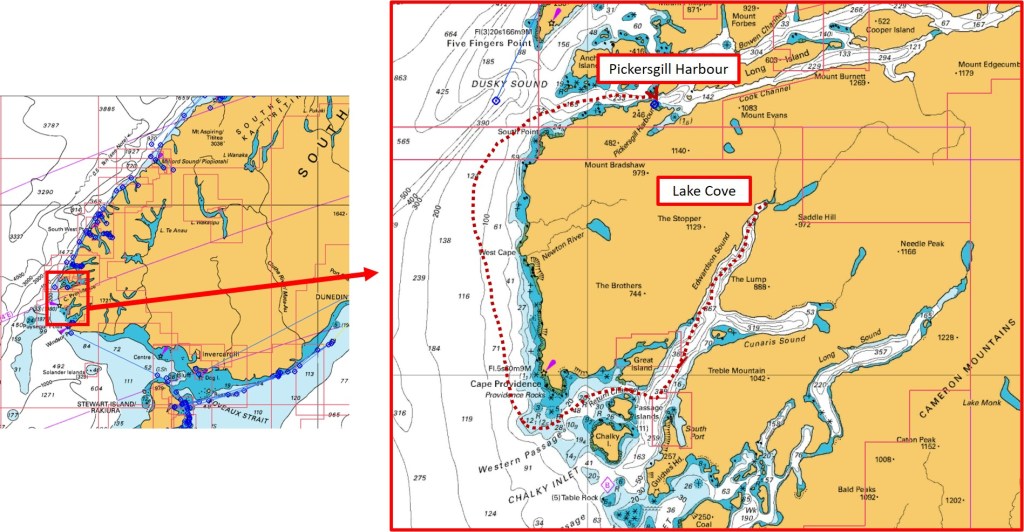
Pickersgill Harbour, Dusky Sound, Fiordland
Sunday 8 March 2020
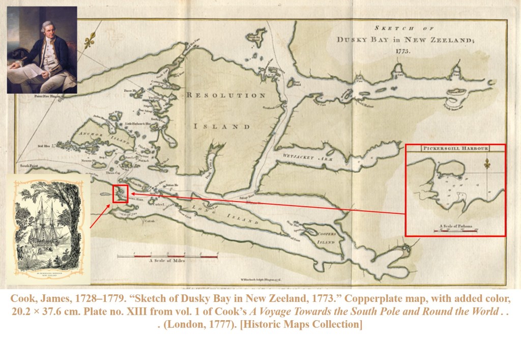
CAPTAIN COOK, Second Voyage, 28th March 1773
Cook’s Journal, Pickersgill Harbour: “In the PM hauled the Sloop into a small creek and moored her head and stern to the trees and so near the Shore as to reach it with the brow or stage which nature had in a manner prepared for us by a large tree which growed in a horizontal direction over the Water so long that the top of it reached our gunwale. Wood for fuel was here so convenient that our Yards were locked in the branches of the trees, about 100 yards from our stern was a fine stream of fresh water and every place abounded with excellent fish and the shores and Woods we found not destitute of wild fowl , so that we expected to injoy with ease what in our situation might be call’d the luxuries of life”
CAPTAIN LATIMER, First Voyage, 8th March 2020
NZ2020 Blog, Pickersgill Harbour: “Might I indulge myself to reflect upon the many vicissitudes of life that hath conspired to bring me to this point, hitherto unacknowledged in conscious thought, but nonetheless hidden within ones being to this moment and time, I feel a sense of contentment and satisfaction at having at last reached the location of my dreams; up to this point unachieved…”


Sorry … having read so much of Cook’s journals, it seems I am starting to write like him – in the style of the 18th Century.
The fact is, we have finally made it into Dusky Sound. More specifically, Pickersgill Harbour. The very spot where Captain Cook spent many weeks in 1773, replenishing and repairing his ship Resolution, not to mention charting the many, many islands, inlets, channels, bays and features of this region.
The names on the chart … Anchor Island, Luncheon Cove, Stop Island, Indian Island, Seal Islands, and so on … they all refer to an incident, or events from Cook’s time here, with the stories and journal entries making for fascinating reading.
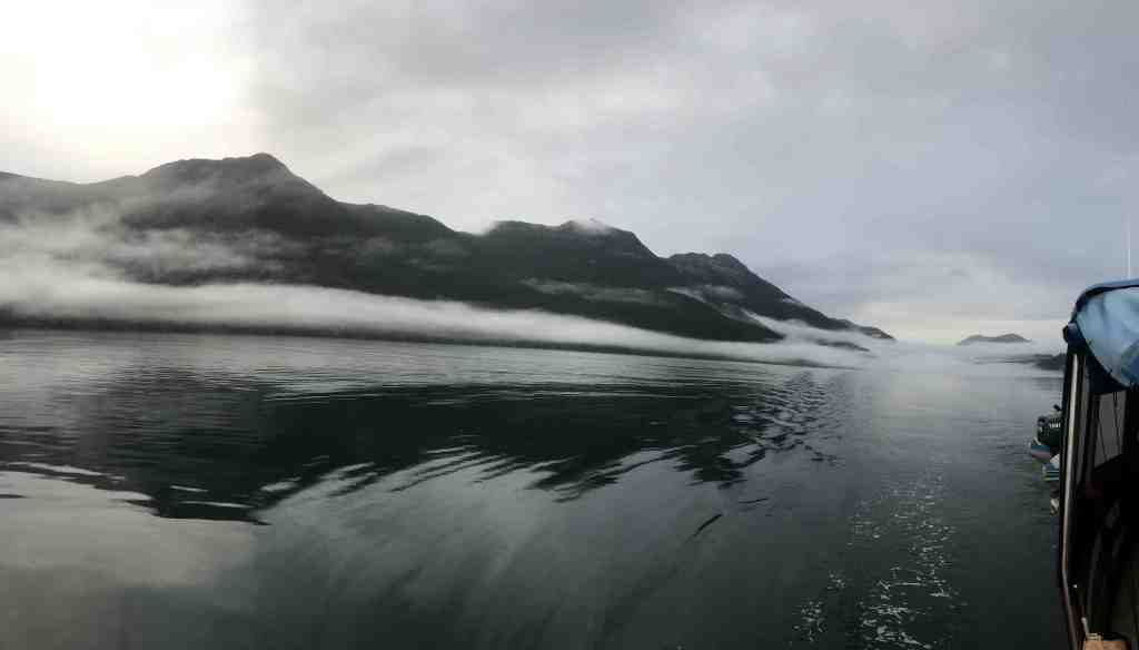
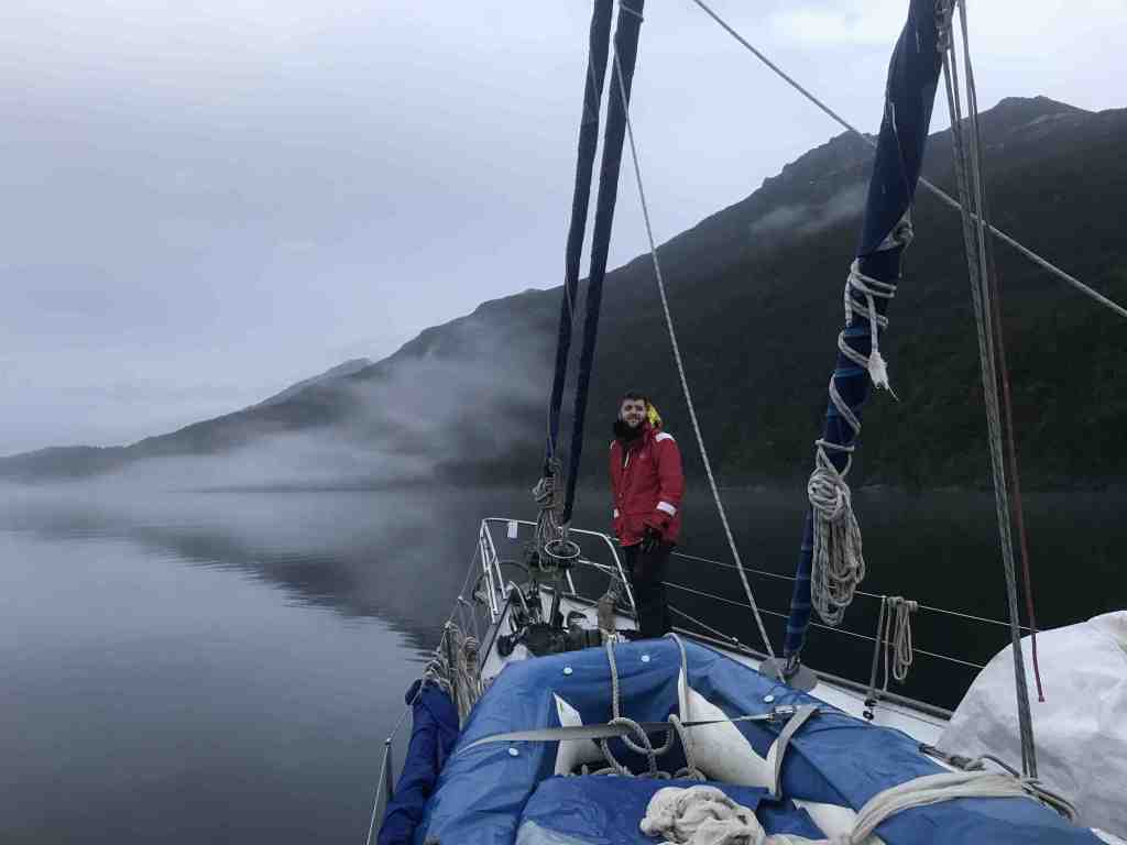
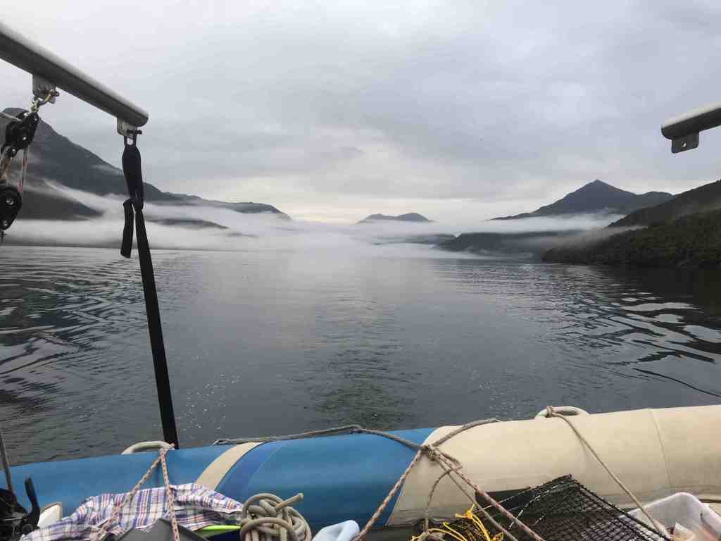
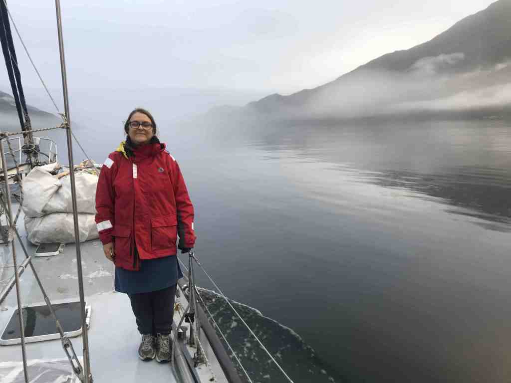
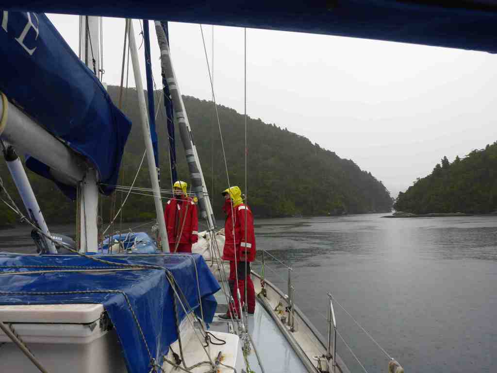
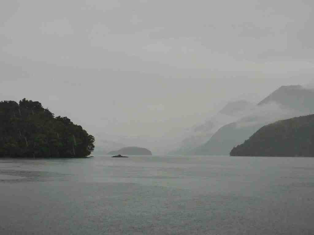
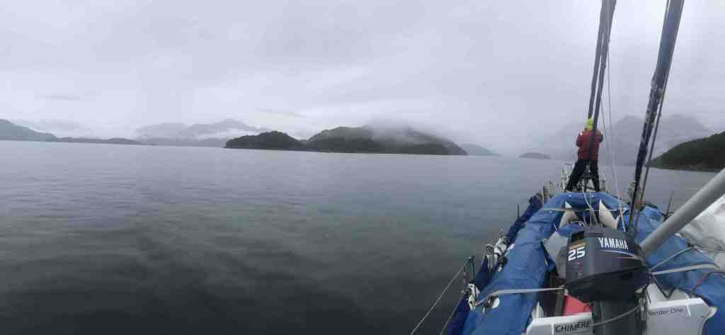
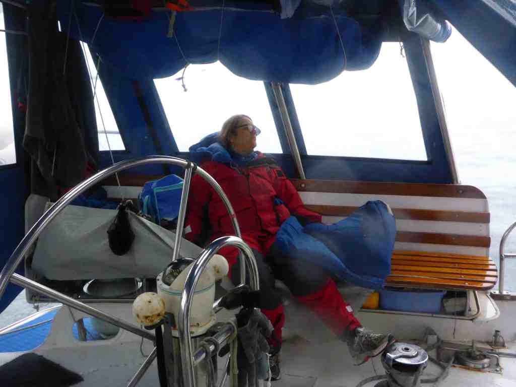
Yesterday’s strong wind gave way to overnight rain and stillness, with our early morning departure being accompanied by mist and low cloud on the surrounding mountains, plus the occasional small waterfall. We were certainly starting to see a very different side to the region, after mostly clear skies to date.

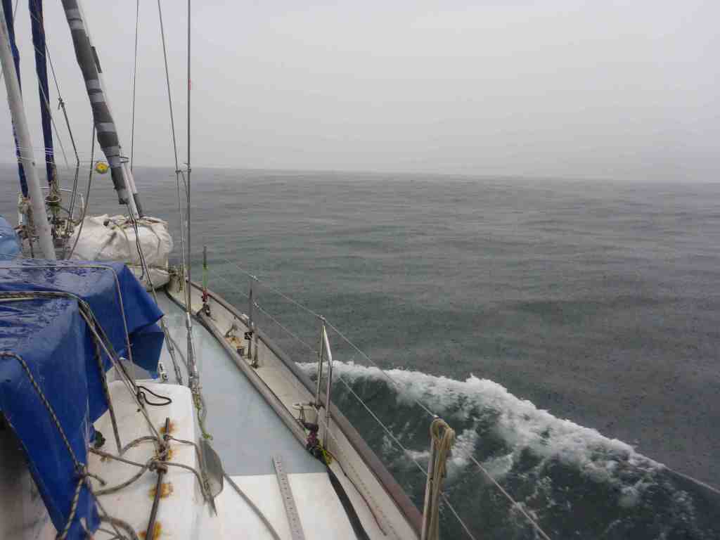
After retrieving the 80 metres of chain we’d laid, plus the anchor weight, it was away back down Edwardson Sound; the first leg of our 40-odd mile journey north to Dusky Sound. Out in the Tasman Sea once more, we took advantage of the brief gap in the weather, with there being virtually no wind close in shore and the remains of the NW and SW swells, well and truly flattened out. Particularly once we’d cleared the rocks and shallow water of the Chalky Inlet.
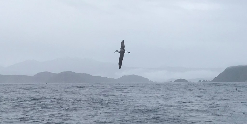
The rain soon returned mid-morning and whilst it then poured for the rest of the day, we never felt cold, but did begin to understand more why the “West Coast” is often referred to as the “Wet Coast”. At times, the rain completely obscured the land just a couple of miles off our starboard side, with the albatross finding it hard to remain airborne in the light airs.
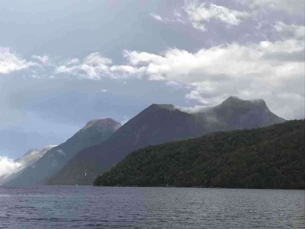
Before long we made the turn into Dusky Sound, and around 2:00pm we were entering Pickersgill Harbour in search of a suitable spot to drop the anchor. As the cruising guide explains …
[Pickersgill Harbour] “Is an all-weather anchorage except in northeast and east conditions. It is accessible from either side of Crayfish Island. Cook navigated Resolution through the passage on the western side of Crayfish Island, but it is narrow, shallowish and quite exciting”
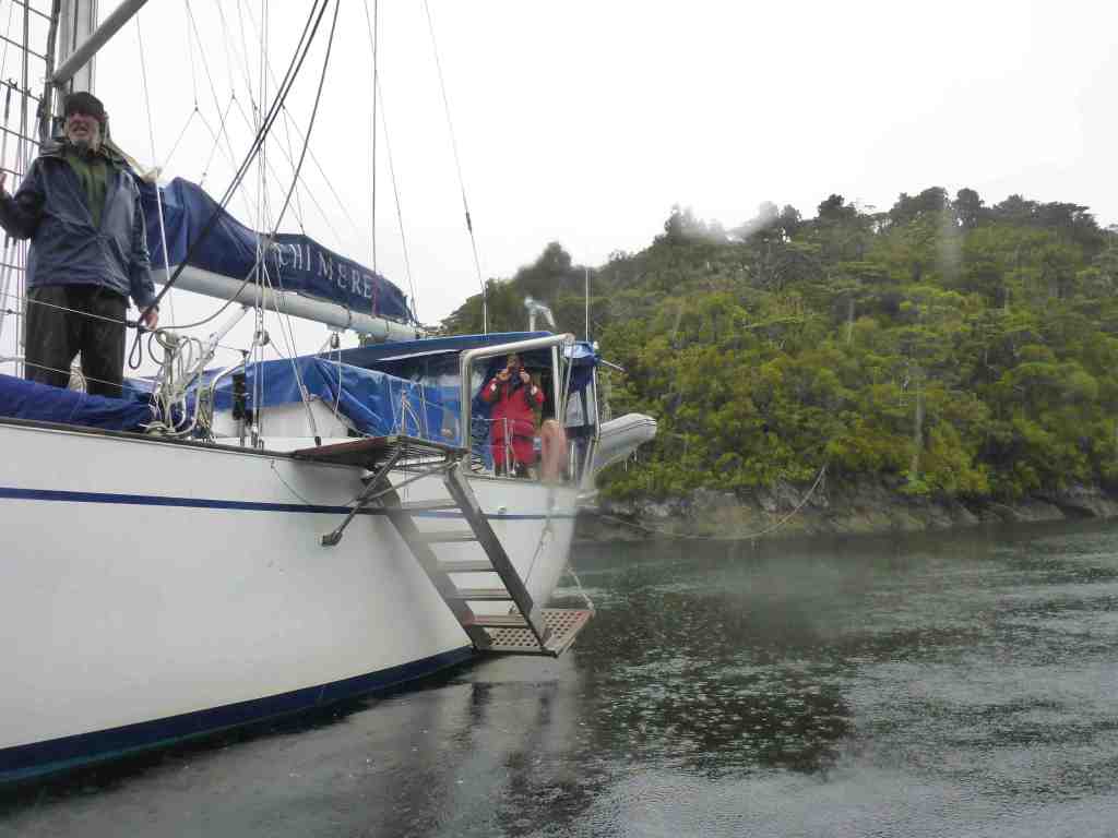
Cool! So, naturally we entered the small harbour from the Western side, and sure enough, it was narrow. Exactly 34 metres wide, according to the chart and probably close to only twice the width of Cook’s ship the Resolution.
Chimere is only 5 metres wide, so the idea of bringing a large, 3-masted tall ship in through that opening is rather incredible.
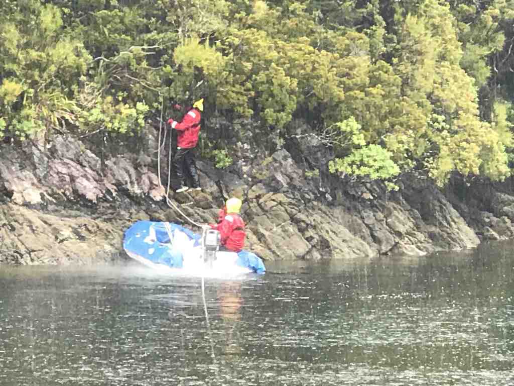
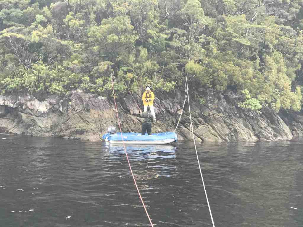
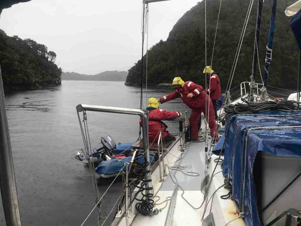
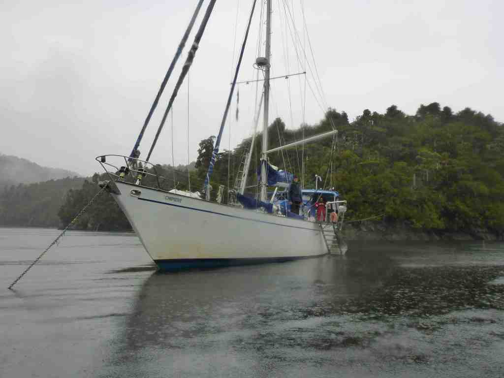
After finding water of around 7-10 metres depth, we dropped anchor, then proceeded to run a stern line to shore, which we initially secured around a medium sized tree. It was then time for lunch, which involved more crayfish sandwiches.
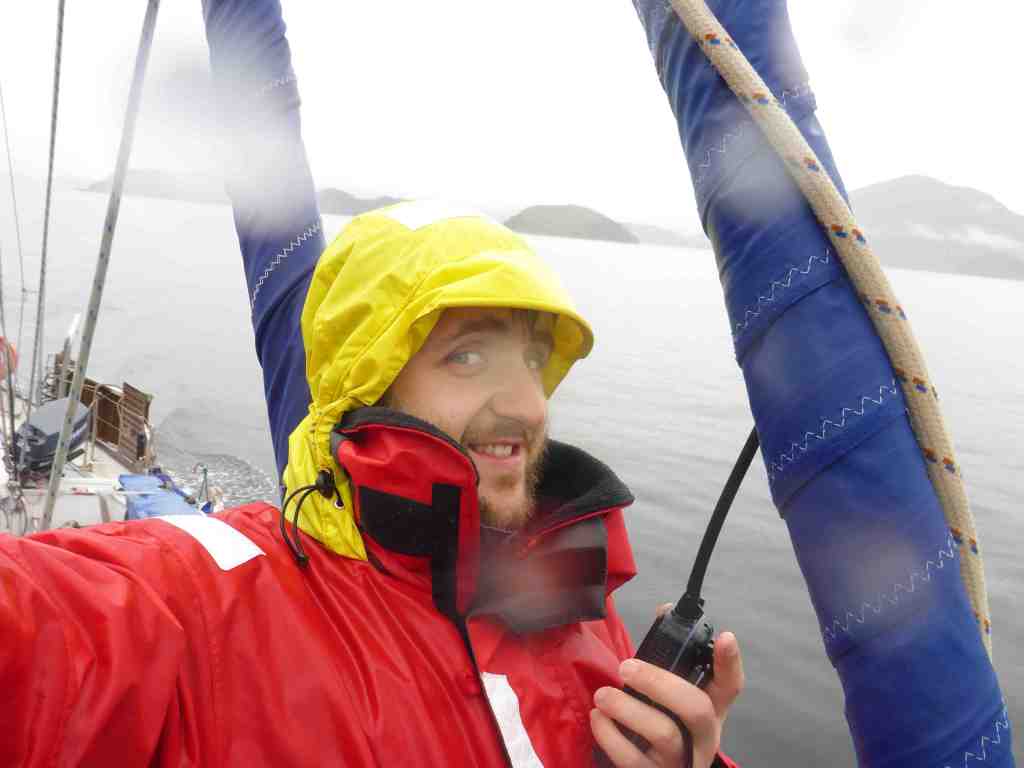
Later, after dinner, John and I returned to the task, moving the line to a larger tree nearby, in light of the latest weather forecast that predicted 30 knot winds from the north – particularly overnight.
It was still raining, and grey to the waterline, when a yacht called Sago entered the bay in the late afternoon; one of the first yachts we’d really seen in these parts so far. They came over close before anchoring and we had a good chat. As it turned out, over the past three years they had sailed from Germany, having purchased the yacht in the Netherlands. The guy was a Kiwi and the girl was from Heidelberg (Germany) and their two small children, who waved from the cockpit, were from … somewhere.
As dinner preparations got underway, I took the opportunity to have an afternoon nap, waking an hour or so later to find that another yacht had snuck into the bay – a catamaran called “Felix The Cat”. We’d seen this yacht in the distance when we were down at Stewart Island a week ago and once John and I completed our “stern-line-to-tree-re-arrangement-procedure”, we went over to have a chat to the father and son sailing combination.
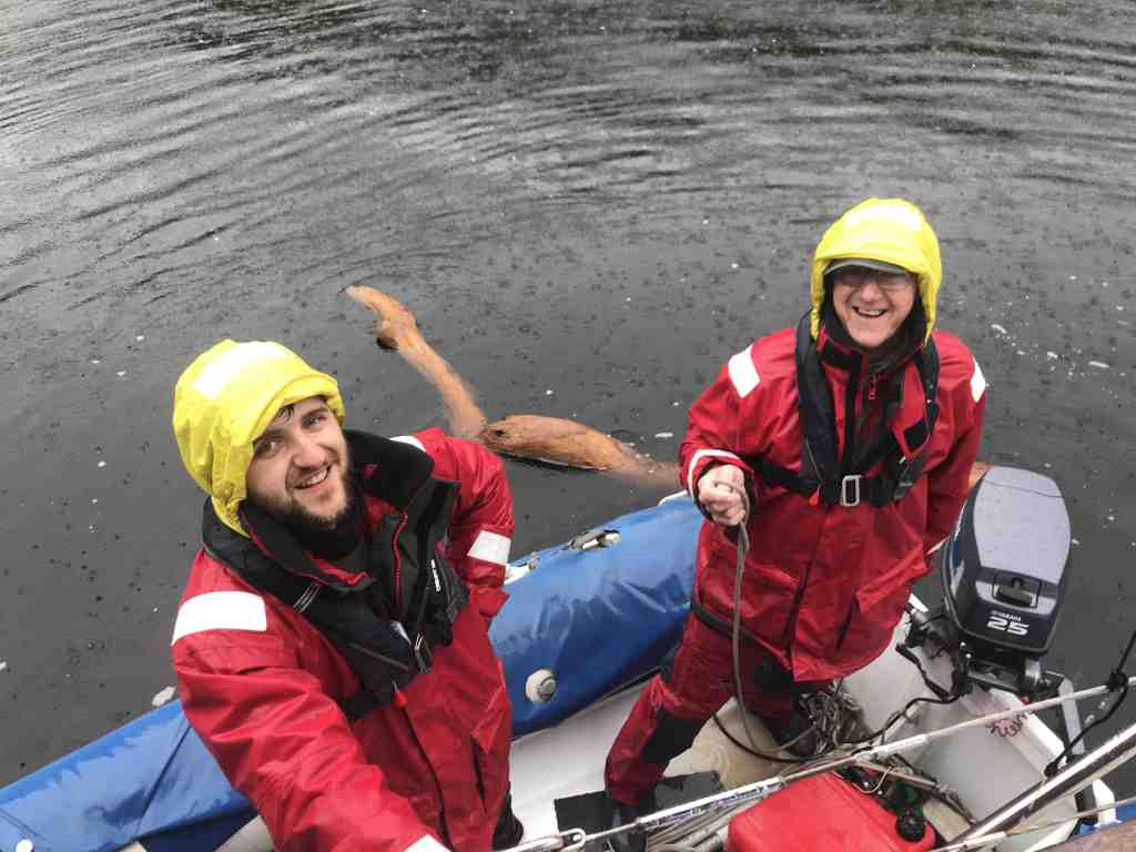
As it turns out, the son does a bit of diving and it took him just a few minutes on arrival to swim over to the rocks at the aptly named Crayfish Island that encloses this small bay, to pick up a good-sized crayfish in just 4 metres of water. Simples!!
The rain stopped around sunset and with the lifting of some cloud and the brief appearance of some blue sky, we were treated to some glorious scenes of light and grey.
Right now, it’s quite late with our first bouts of lightning and thunder to accompany the rain as the wind gusts to around 25 knots over top of Crayfish Island. We feel pretty secure, fore and aft with our anchor and stern line, but still, we are swinging around a bit, as much as the slack in the lines allow.

Despite this, it’s still blissfully calm inside, with the movement unlikely to topple an upturned squeeze-bottle of Thousand Island Dressing, left sitting on the saloon table. This being our “Standard Measure” of whether an anchorage is deemed rough or rolly.
In reviewing the latest SatPhone weather forecast, it looks like it’ll still be blowing tomorrow, which will give us a chance to explore more of Dusky Sound and nearby Breaksea Sound, before making the next hop up the coast on Tuesday, when the wind is expected to come in from the south; thereby helping us on our way, albeit a little cooler.
Right now, it’s time to sleep!
Smooth seas, fair breeze and Dusky Dreaming
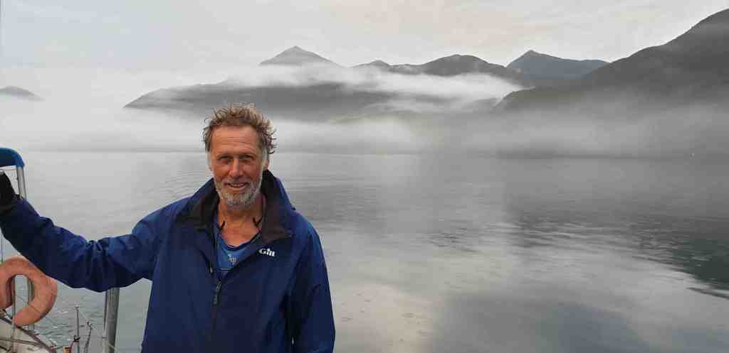
Rob Latimer
PS I’m still looking for extra crew to assist with the 8-day voyage, from Milford Sound to Wellington, starting on 14 March. If you or a friend want to join us, please sing out ASAP. Email me on the satphone at … msm1@clientsatmail.com.au and latimerfamily4@gmail.com but remember, no file attachments)

It’s so great to have Captain Cook’s log on hand. Nothing would have changed I imagine. Magical! Have you been in touch with the local and national papers? It would make a good story.
Love from Lorraine
>
LikeLike