Saturday 31 July 2021
Six miles south of Wingan Inlet, East Gippsland
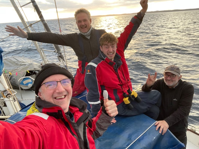
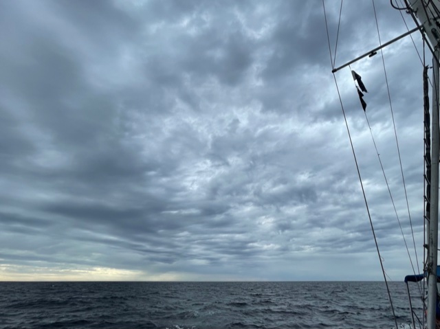
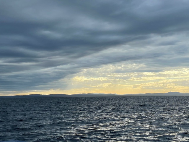
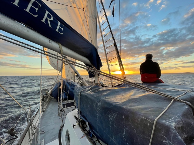
It was a grand sight – the eastern-most tip of Victoria. At first, it was just a faint, steely-blue strip along the southwest horizon. A dividing line between the two opposing greys of the sky and sea.
Soon enough, the indistinct line in the distance became a series of low land forms, interspersed with the occasional light colour – presumably sand dunes. Then there was the unmistakeable line of trees on the higher ridges. Not your typical greenish, forest-type vegetation, but lonely, dark sticks, standing side-by-side in the form of an enormous picket fence; one that only wildfire can create. Of course, this is one of the landmark regions burnt out in early 2020; a long, long time ago now.
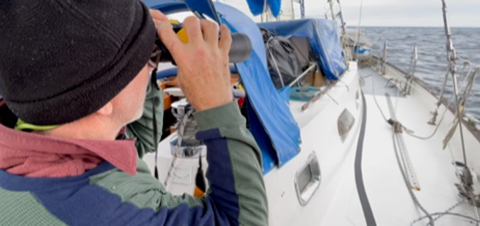
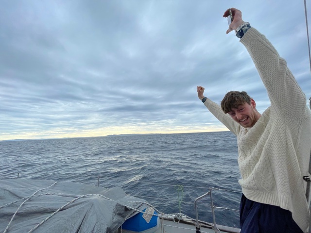
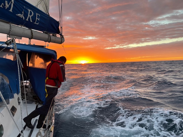
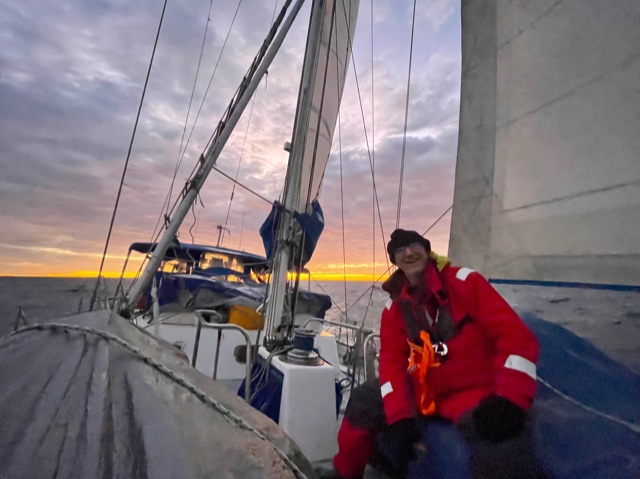
Excitement aboard was very real, that’s for sure. We hadn’t quite arrived at our final destination … but we were definitely entering the home strait – the often “tricky” … Bass Strait. After all the anticipation, Sam ended up missing the initial sighting of land.. After opting to take an all-night watch, his sleep bordered on the unconscious around 10:00am – surviving the hoots and holla’s of us three older folk, plus a whistling kettle.
After an hour or so, however, Sam made up for having missed the initial “LAND HO!!!” … as the realisation of spending 12 days at sea, battling storms, uncertainty, physical challenges … not to mention the complete absense of internet and Smartphone … began to sink in for real.
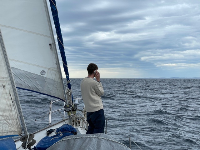
We all felt … there was land once more – the familiar – and here is my Smartphone, ping ping ping pinging to new life, like a bowl of popcorn, despite struggling to register barely 2-bars.
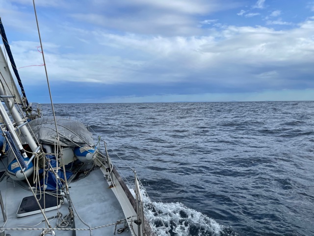
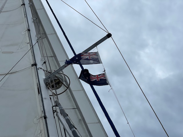
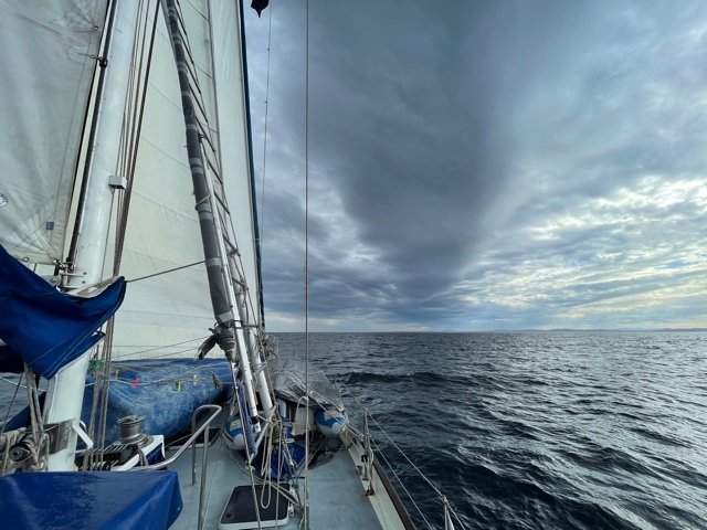
Having seen no other vessels since leaving Opua on the 19 July – except for two fleeting AIS images on our chartplotter – we were definitely back in civilisation now. This – the region just to the south of the Victorian coastline – being the busiest shipping lane in Australia. Within a few hours we had already encountered three ships passing by, the AIS alarm on our chartplotter alerting us to their presence if ever they were to escape our gaze.
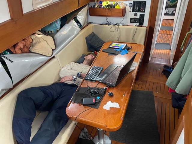
Soon after sunrise – which just happened to be the best so far for the voyage – Harm passed the IridiumGO device down from the cockpit to be re-attached to the charging unit below. “Funny, there’s no lights, maybe the battery is really dead” Harm commented.
After the ubiquitous “OFF and ON” again routine, still no life. Ten minutes on the charger, still no life. “Off and ON” again. Nothing.
Exhausting my reservoir of ideas in one foul swoop, I suggested … “Maybe the battery connections inside need a clean??”
“We’ll wait until Matt wakes up, if anyone can bring it to life, he can” replied Harm.
Sure enough, after ten minutes, or so, of unscrewing, wiping, and synchronised button pressing (using buttons I didn’t even know the machine had) – Matt, the Iridium-Whisperer, had the little device humming and flashing red and green again. In explanation, Matt used words and phrases like, … “cold-start”, “corrupted” and “firm wear”, but I’d be pretending if I said I really knew what he did, or was saying All I know is that we can still download satellite weather reports and that access to emails, texts and voice communications has been restored. Great work Matt !!
Whilst we have some phone and internet coverage close to the coast, it’s currently unreliable and fleeting – not to be relied upon.
In looking at the chart, and using an average speed of 6 knots, we estimate that the 280 remaining miles could be covered in 2 full days. That’s a potential arrival in at Hastings around 6:00pm Monday evening. There are a few other assumptions in there … particularly in relation to weather … PLUS whether Australian Quarantine will approve our arrival into Westernport, as opposed to another arrival port, such as Port Phillip (Melbourne)
Unfortunately, my email correspondence – with some in authority – has been hindered, by the fact that many of their emails are rejected on account of being greater than 50,000 bytes in size.
These are important emails, as you can imagine, but a simple “text only” email needs to exclude a corporate sign-off, and/or logo, because these alone will cause the email to exceed the limit; and be rejected. In this age of mass communication and storage, it’s no longer an issue for most people, so conveying the limited parameters of a “simple” Iridium sat-phone is proving difficult.
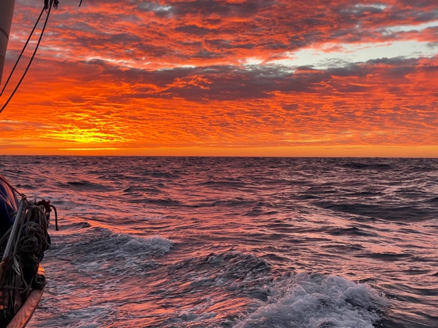
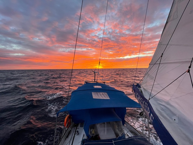
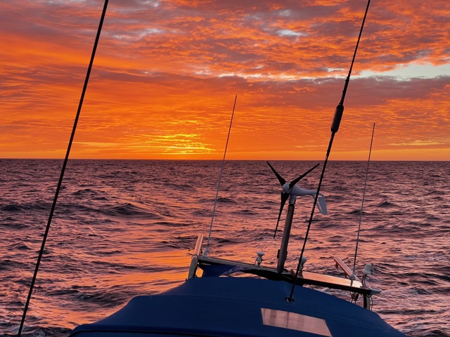
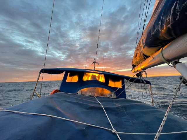
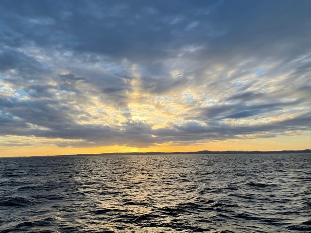
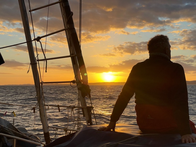
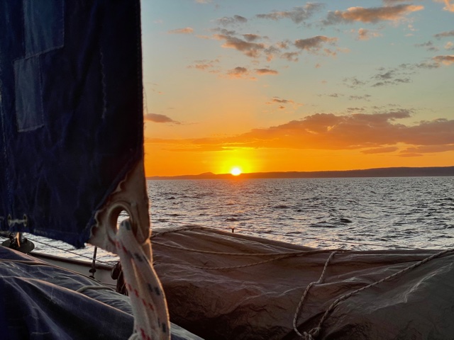
Back to more interesting things, like sailing, as I mentioned, this morning’s sunrise was truly spectacular … and I have lots of photos to prove it. Being largely “red” … and in the morning … I initially thought “oh ohhh” we might be in for some bad weather – time to look again at the latest forecast download. Then tonight, the sunrise was followed up with a spectacular sunset … “red” also … which might suggest we are in for some good weather. Or maybe they cancel each other out and we start afresh tomorrow.
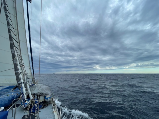
Regardless, we are currently racing along as fast as we can, (6-7 knots, engine assisted, given the calm conditions) … the East Gippsland coast just a few miles off to our starboard side. Our main goal is to avoid the worst of an approaching south-westerly wind due in the early hours of tomorrow morning. In truth, I don’t think we can avoid it, but due to the shelter afforded by Wilson’s Promontory, the seas will mercifully remain calm – I think/hope. so.
On our left – off to port – there is the Gippsland oil and gas field with a dozen or more oil rigs to keep away from. No doubt we’ll soon be able to see their lights way off in the distance.
Right now, the sun has gone to bed and it’s time to get dinner underway, plus sort out the watches for the night. Just a few sleeps to go and we’ll be back in our own beds again!
Smooth seas, fair breeze and LAND HO!!
Rob Latimer

Hey brilliant work Team! Congratulations on conquering the oh so moody Tasman – we lived every anecdote along the way and thank you for such a masterful turn of phrase Rob. Looks like you picked exactly the right crew for the task 👏👏😎 Tim may wave ahoy as you pass by Cape Liptrap where he lives and normally we’d love to be amongst your welcoming committee but I’d almost guarantee Customs/Quarantine authorities would frown upon such shenanigans. Trust the home run will be blessed with those smooth seas and fair winds followed by feet on terra firma and a warm welcome home. Janne and John
LikeLike
Thank you Janne and John – we got there in the end! Look forward to hearing of your future sailing adventures. Rob
LikeLike